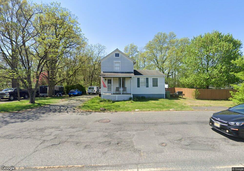
67 N Locust Ave Marlton, NJ 08053
Estimated Value: $393,000 - $446,114
--
Bed
--
Bath
1,568
Sq Ft
$266/Sq Ft
Est. Value
About This Home
This home is located at 67 N Locust Ave, Marlton, NJ 08053 and is currently estimated at $416,779, approximately $265 per square foot. 67 N Locust Ave is a home located in Burlington County with nearby schools including Frances Demasi Middle School, Cherokee High School, and Lenape High School.
Ownership History
Date
Name
Owned For
Owner Type
Purchase Details
Closed on
Jun 10, 2005
Sold by
Ehrhart Dorothy S
Bought by
Bass William and Bass Renee A
Current Estimated Value
Home Financials for this Owner
Home Financials are based on the most recent Mortgage that was taken out on this home.
Original Mortgage
$170,000
Outstanding Balance
$88,236
Interest Rate
5.67%
Mortgage Type
Fannie Mae Freddie Mac
Estimated Equity
$328,544
Purchase Details
Closed on
Jul 16, 2003
Sold by
Higginbotham David L and Higginbotham Diana E
Bought by
Ehrhart Dorothy S
Home Financials for this Owner
Home Financials are based on the most recent Mortgage that was taken out on this home.
Original Mortgage
$144,000
Interest Rate
5.46%
Mortgage Type
Purchase Money Mortgage
Create a Home Valuation Report for This Property
The Home Valuation Report is an in-depth analysis detailing your home's value as well as a comparison with similar homes in the area
Home Values in the Area
Average Home Value in this Area
Purchase History
| Date | Buyer | Sale Price | Title Company |
|---|---|---|---|
| Bass William | $220,000 | Congress Title Corp | |
| Ehrhart Dorothy S | $180,000 | Security First Title Partner |
Source: Public Records
Mortgage History
| Date | Status | Borrower | Loan Amount |
|---|---|---|---|
| Open | Bass William | $170,000 | |
| Previous Owner | Ehrhart Dorothy S | $144,000 |
Source: Public Records
Tax History Compared to Growth
Tax History
| Year | Tax Paid | Tax Assessment Tax Assessment Total Assessment is a certain percentage of the fair market value that is determined by local assessors to be the total taxable value of land and additions on the property. | Land | Improvement |
|---|---|---|---|---|
| 2025 | $7,342 | $215,000 | $116,500 | $98,500 |
| 2024 | $6,908 | $215,000 | $116,500 | $98,500 |
| 2023 | $6,908 | $215,000 | $116,500 | $98,500 |
| 2022 | $6,598 | $215,000 | $116,500 | $98,500 |
| 2021 | $6,271 | $215,000 | $116,500 | $98,500 |
| 2020 | $6,360 | $215,000 | $116,500 | $98,500 |
| 2019 | $6,308 | $215,000 | $116,500 | $98,500 |
| 2018 | $6,220 | $215,000 | $116,500 | $98,500 |
| 2017 | $6,030 | $210,900 | $116,500 | $94,400 |
| 2016 | $5,882 | $210,900 | $116,500 | $94,400 |
| 2015 | $5,779 | $210,900 | $116,500 | $94,400 |
| 2014 | $5,614 | $210,900 | $116,500 | $94,400 |
Source: Public Records
Map
Nearby Homes
- 30 Cooper Ave
- 100 Cambridge Ave
- 501 Stillhouse Ln Unit 501
- 118 Cambridge Ave
- 15 W Main St
- 63 Baker Blvd
- 42 S Locust Ave
- 128 Cambridge Ave
- 5 Marlborough Ave
- 39 Duchess Ave
- 78 Kent Ave
- 29 Marlborough Ave
- 161 Carlton Ave
- 61 S Maple Ave
- 21 Olympia Dr
- 22 Bettlewood Rd
- 12 Princess Ave
- 47 Bon Air Dr
- 31 Ashley Ct
- 38 Ashley Ct Unit 38