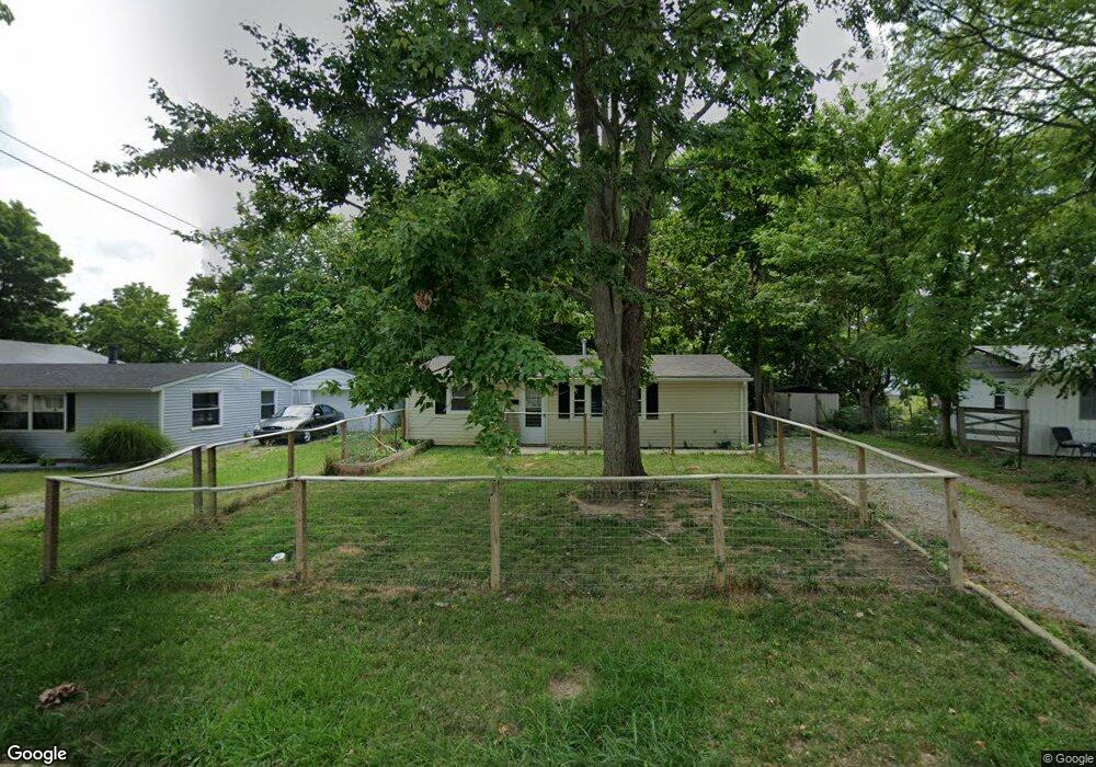
67 Orchard Cir Blanchester, OH 45107
Estimated Value: $127,571 - $200,000
3
Beds
1
Bath
864
Sq Ft
$192/Sq Ft
Est. Value
About This Home
This home is located at 67 Orchard Cir, Blanchester, OH 45107 and is currently estimated at $165,643, approximately $191 per square foot. 67 Orchard Cir is a home located in Clinton County with nearby schools including Cross Roads Elementary School, Putman Elementary School, and Blanchester Middle School.
Ownership History
Date
Name
Owned For
Owner Type
Purchase Details
Closed on
Oct 18, 2021
Sold by
Brown Troy D and Brown Veronica R
Bought by
Maxfield Shane W and Maxfield Serenity P
Current Estimated Value
Home Financials for this Owner
Home Financials are based on the most recent Mortgage that was taken out on this home.
Original Mortgage
$145,515
Outstanding Balance
$132,696
Interest Rate
2.8%
Mortgage Type
FHA
Estimated Equity
$32,947
Purchase Details
Closed on
Oct 18, 2006
Sold by
Hall Ray
Bought by
Brown Troy D and Brown Veronica R
Purchase Details
Closed on
Jul 6, 1999
Sold by
Foster David L
Bought by
Hall Ray
Home Financials for this Owner
Home Financials are based on the most recent Mortgage that was taken out on this home.
Original Mortgage
$20,000
Interest Rate
7.29%
Mortgage Type
New Conventional
Purchase Details
Closed on
Jan 1, 1990
Bought by
Foster David L and Foster Tina L
Create a Home Valuation Report for This Property
The Home Valuation Report is an in-depth analysis detailing your home's value as well as a comparison with similar homes in the area
Home Values in the Area
Average Home Value in this Area
Purchase History
| Date | Buyer | Sale Price | Title Company |
|---|---|---|---|
| Maxfield Shane W | $166 | None Listed On Document | |
| Maxfield Shane W | $166 | None Listed On Document | |
| Brown Troy D | $54,250 | -- | |
| Hall Ray | $45,000 | -- | |
| Foster David L | -- | -- |
Source: Public Records
Mortgage History
| Date | Status | Borrower | Loan Amount |
|---|---|---|---|
| Open | Maxfield Shane W | $145,515 | |
| Closed | Maxfield Shane W | $145,515 | |
| Previous Owner | Hall Ray | $20,000 |
Source: Public Records
Tax History Compared to Growth
Tax History
| Year | Tax Paid | Tax Assessment Tax Assessment Total Assessment is a certain percentage of the fair market value that is determined by local assessors to be the total taxable value of land and additions on the property. | Land | Improvement |
|---|---|---|---|---|
| 2024 | $958 | $25,590 | $3,360 | $22,230 |
| 2023 | $958 | $25,590 | $3,360 | $22,230 |
| 2022 | $823 | $19,910 | $2,910 | $17,000 |
| 2021 | $1,367 | $19,910 | $2,910 | $17,000 |
| 2020 | $880 | $19,910 | $2,910 | $17,000 |
| 2019 | $1,771 | $15,930 | $2,910 | $13,020 |
| 2018 | $1,408 | $15,930 | $2,910 | $13,020 |
| 2017 | $1,367 | $15,930 | $2,910 | $13,020 |
| 2016 | $590 | $13,730 | $2,950 | $10,780 |
| 2015 | $1,583 | $13,730 | $2,950 | $10,780 |
| 2013 | $922 | $13,210 | $2,950 | $10,260 |
Source: Public Records
Map
Nearby Homes
- 401 N Wright St
- 157 Pansy Pike
- 409 N Broadway St
- 112 Willow Place
- 477 N Columbus St
- 213 N Broadway St
- 169 Pansy Pike
- 9 Pansy Pike
- 217 Pansy Pike
- 11 Pansy Pike
- 12 Pansy Pike
- 10 Pansy Pike
- 301 W Main St
- 504 Cherry St
- 502 Railroad St
- 305 W Main St
- 221 S Vine St
- 107 Central Ave
- 1432 State Route 28
- 503 S Broadway St
- 67 S Orchard Cir
- 75 S Orchard Cir
- 75 Orchard Cir
- 57 S Orchard Cir
- 57 Orchard Cir
- 83 Orchard Cir
- 45 Orchard Cir
- 68 Orchard Cir
- 89 Orchard Cir
- 60 Orchard Cir
- 92 S Orchard Cir
- 92 Orchard Cir
- 35 Orchard Cir
- 526 N Broadway St
- 48 Orchard Cir
- 97 S Orchard Cir
- 97 Orchard Cir
- 518 N Broadway St
- 38 Orchard Cir
- 25 Orchard Cir