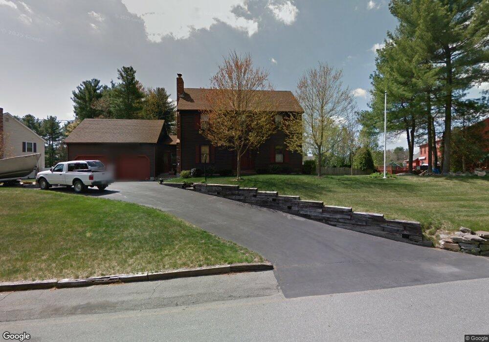
67 Partridge Cir Taunton, MA 02780
Whittenton NeighborhoodEstimated Value: $623,609 - $673,000
4
Beds
3
Baths
1,872
Sq Ft
$343/Sq Ft
Est. Value
About This Home
This home is located at 67 Partridge Cir, Taunton, MA 02780 and is currently estimated at $642,902, approximately $343 per square foot. 67 Partridge Cir is a home located in Bristol County with nearby schools including Benjamin Friedman Middle School, Joseph C. Chamberlain Elementary School, and Taunton High School.
Ownership History
Date
Name
Owned For
Owner Type
Purchase Details
Closed on
Feb 26, 2022
Sold by
Margaret L Kotak Lt
Bought by
Kotak Ft
Current Estimated Value
Purchase Details
Closed on
Sep 1, 2016
Sold by
Kotak Francis P and Kotak Margaret L
Bought by
Margaret L Kotak Lt
Purchase Details
Closed on
Oct 20, 1988
Sold by
Northbay Constr Cor
Bought by
Kolak Francis
Create a Home Valuation Report for This Property
The Home Valuation Report is an in-depth analysis detailing your home's value as well as a comparison with similar homes in the area
Home Values in the Area
Average Home Value in this Area
Purchase History
| Date | Buyer | Sale Price | Title Company |
|---|---|---|---|
| Kotak Ft | -- | None Available | |
| Margaret L Kotak Lt | -- | -- | |
| Kolak Francis | $183,000 | -- |
Source: Public Records
Mortgage History
| Date | Status | Borrower | Loan Amount |
|---|---|---|---|
| Previous Owner | Kolak Francis | $25,000 | |
| Previous Owner | Kolak Francis | $70,000 | |
| Previous Owner | Kolak Francis | $114,000 | |
| Previous Owner | Kolak Francis | $115,000 |
Source: Public Records
Tax History Compared to Growth
Tax History
| Year | Tax Paid | Tax Assessment Tax Assessment Total Assessment is a certain percentage of the fair market value that is determined by local assessors to be the total taxable value of land and additions on the property. | Land | Improvement |
|---|---|---|---|---|
| 2025 | $5,853 | $535,000 | $135,600 | $399,400 |
| 2024 | $5,230 | $467,400 | $135,600 | $331,800 |
| 2023 | $5,137 | $426,300 | $129,400 | $296,900 |
| 2022 | $5,037 | $382,200 | $118,100 | $264,100 |
| 2021 | $5,035 | $354,600 | $107,400 | $247,200 |
| 2020 | $4,868 | $327,600 | $107,400 | $220,200 |
| 2019 | $4,950 | $314,100 | $107,400 | $206,700 |
| 2018 | $4,788 | $304,600 | $108,500 | $196,100 |
| 2017 | $4,589 | $292,100 | $102,800 | $189,300 |
| 2016 | $4,431 | $282,600 | $99,800 | $182,800 |
| 2015 | $4,257 | $283,600 | $98,800 | $184,800 |
| 2014 | $4,233 | $289,700 | $98,800 | $190,900 |
Source: Public Records
Map
Nearby Homes
- 750 Whittenton St Unit 523
- 750 Whittenton St Unit 1021
- 59 Edgehill Rd
- 169 Powderhorn Dr
- 0 Montclair Ave Unit 72130752
- 86 Lakeview Ave
- 68 Sabbatia Ln
- 16 Hunter St Unit A
- 193 Fremont St
- 8 Spinnaker Ln Unit B
- 1559 Bay St Unit 53
- 115 Ice House Rd
- 15 Alcott Cir Unit D3
- 0 Whittenton St
- 113 Scadding St
- 3 4th Ave
- 3 4th Ave Unit 1
- 3 4th Ave Unit 2
- Lot 8 Joel Harvey Way
- 22 Garfield St
- 83 Partridge Cir
- 51 Quail Dr
- 39 Partridge Cir
- 37 Quail Dr
- 76 Partridge Cir
- 91 Partridge Cir
- 42 Partridge Cir
- 88 Partridge Cir
- 27 Quail Dr
- 56 Quail Dr
- 34 Partridge Cir
- 44 Quail Dr
- 96 Partridge Cir
- 109 Partridge Cir
- 22 Partridge Cir
- 129 Partridge Cir
- 32 Quail Dr
- 249 Fremont St
- 247 Fremont St
- 15 Quail Dr