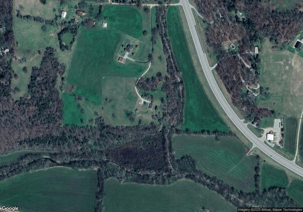
67 Pelican Ln Green Forest, AR 72638
Estimated Value: $252,000 - $315,000
--
Bed
2
Baths
2,432
Sq Ft
$116/Sq Ft
Est. Value
About This Home
This home is located at 67 Pelican Ln, Green Forest, AR 72638 and is currently estimated at $282,899, approximately $116 per square foot. 67 Pelican Ln is a home located in Carroll County with nearby schools including Green Forest Elementary School, Green Forest Intermed School, and Green Forest High School.
Ownership History
Date
Name
Owned For
Owner Type
Purchase Details
Closed on
Jan 13, 2023
Sold by
Adams Jeffrey and Adams Ashton
Bought by
Adams Jeffrey and Adams Ashton
Current Estimated Value
Purchase Details
Closed on
Feb 24, 2020
Sold by
Adams Julie Ann
Bought by
Adams Jeffrey T
Purchase Details
Closed on
May 6, 2008
Sold by
Not Provided
Bought by
Adams Julie Ann
Purchase Details
Closed on
Jan 7, 2000
Sold by
Stafford
Bought by
Adams
Purchase Details
Closed on
Jul 6, 1999
Sold by
Hester
Bought by
Adams
Purchase Details
Closed on
Nov 1, 1989
Bought by
Stafford To Hester
Create a Home Valuation Report for This Property
The Home Valuation Report is an in-depth analysis detailing your home's value as well as a comparison with similar homes in the area
Home Values in the Area
Average Home Value in this Area
Purchase History
| Date | Buyer | Sale Price | Title Company |
|---|---|---|---|
| Adams Jeffrey | -- | -- | |
| Adams Jeffrey T | -- | None Available | |
| Adams Jeffrey T | $145,000 | Kings River Title | |
| Adams Julie Ann | -- | -- | |
| Adams | $11,000 | -- | |
| Adams | $120,000 | -- | |
| Stafford To Hester | -- | -- | |
| Bryant To Stafford | -- | -- |
Source: Public Records
Tax History Compared to Growth
Tax History
| Year | Tax Paid | Tax Assessment Tax Assessment Total Assessment is a certain percentage of the fair market value that is determined by local assessors to be the total taxable value of land and additions on the property. | Land | Improvement |
|---|---|---|---|---|
| 2024 | $2,073 | $42,740 | $1,780 | $40,960 |
| 2023 | $2,073 | $42,740 | $1,780 | $40,960 |
| 2022 | $2,073 | $42,740 | $1,780 | $40,960 |
| 2021 | $1,303 | $26,850 | $1,680 | $25,170 |
| 2020 | $928 | $26,850 | $1,680 | $25,170 |
| 2019 | $946 | $26,850 | $1,680 | $25,170 |
| 2018 | $931 | $26,030 | $1,680 | $24,350 |
| 2017 | $931 | $26,030 | $1,680 | $24,350 |
| 2016 | $908 | $25,920 | $1,650 | $24,270 |
| 2014 | -- | $25,920 | $1,650 | $24,270 |
Source: Public Records
Map
Nearby Homes
- 144-00009-001 Cr 993
- TBD Cr 993
- 909 Enterprise Ave
- 906 Enterprise Ave
- 825-00623-021 (to be Forest Ave
- 11339 Highway 62 E
- 604 Rainbow Place
- 501 Rainbow Place
- 608 Apple St
- 14889 Arkansas 311
- 16078 (100 AC) Arkansas 311
- 709 Carroll Ave
- Lot 4 Cr-906
- 0 County Rd 8534 Unit 1085747
- 0 Co Rd 8534 Unit 146407
- 365 Cr 993
- 504 W 6th St
- 201 County Road 632
- Hwy 310 Cudney Orchard Rd
- 68 County Road 8492
