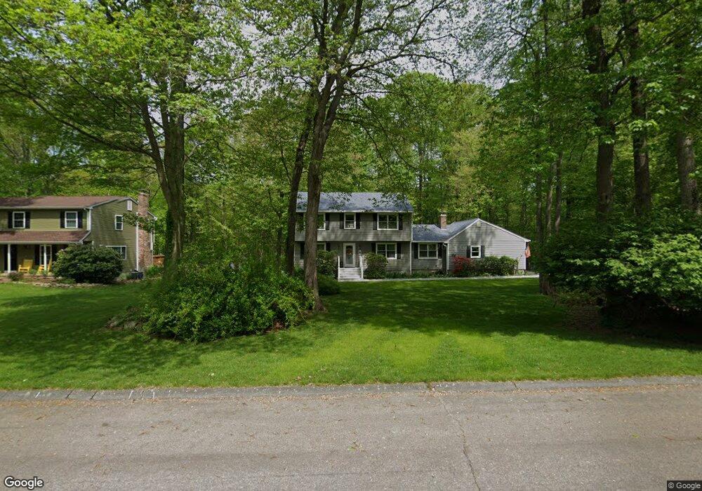
67 Pheasant Run Dr Gales Ferry, CT 06335
Estimated Value: $462,918 - $504,000
4
Beds
3
Baths
1,940
Sq Ft
$251/Sq Ft
Est. Value
About This Home
This home is located at 67 Pheasant Run Dr, Gales Ferry, CT 06335 and is currently estimated at $486,730, approximately $250 per square foot. 67 Pheasant Run Dr is a home located in New London County with nearby schools including Ledyard Middle School, Ledyard High School, and Academy Of St Therese.
Ownership History
Date
Name
Owned For
Owner Type
Purchase Details
Closed on
Nov 24, 1998
Sold by
Knight Richard T and Knight Paula C
Bought by
Krug Paul F and Krug Lynne J
Current Estimated Value
Home Financials for this Owner
Home Financials are based on the most recent Mortgage that was taken out on this home.
Original Mortgage
$141,750
Outstanding Balance
$30,669
Interest Rate
6.49%
Estimated Equity
$456,061
Purchase Details
Closed on
Jun 26, 1992
Sold by
Sullivan Paul and Sullivan Marie
Bought by
Knight Richard and Knight Paula
Home Financials for this Owner
Home Financials are based on the most recent Mortgage that was taken out on this home.
Original Mortgage
$132,000
Interest Rate
8.57%
Mortgage Type
Unknown
Create a Home Valuation Report for This Property
The Home Valuation Report is an in-depth analysis detailing your home's value as well as a comparison with similar homes in the area
Home Values in the Area
Average Home Value in this Area
Purchase History
| Date | Buyer | Sale Price | Title Company |
|---|---|---|---|
| Krug Paul F | $165,000 | -- | |
| Knight Richard | $165,000 | -- |
Source: Public Records
Mortgage History
| Date | Status | Borrower | Loan Amount |
|---|---|---|---|
| Open | Knight Richard | $141,750 | |
| Previous Owner | Knight Richard | $132,000 |
Source: Public Records
Tax History Compared to Growth
Tax History
| Year | Tax Paid | Tax Assessment Tax Assessment Total Assessment is a certain percentage of the fair market value that is determined by local assessors to be the total taxable value of land and additions on the property. | Land | Improvement |
|---|---|---|---|---|
| 2025 | $7,305 | $196,700 | $52,220 | $144,480 |
| 2024 | $6,904 | $196,070 | $52,220 | $143,850 |
| 2023 | $6,776 | $196,070 | $52,220 | $143,850 |
| 2022 | $6,631 | $196,070 | $52,220 | $143,850 |
| 2021 | $6,588 | $196,070 | $52,220 | $143,850 |
| 2020 | $6,205 | $177,450 | $54,740 | $122,710 |
| 2019 | $6,221 | $177,450 | $54,740 | $122,710 |
| 2018 | $6,085 | $177,450 | $54,740 | $122,710 |
| 2017 | $5,774 | $177,450 | $54,740 | $122,710 |
| 2016 | $5,661 | $177,450 | $54,740 | $122,710 |
| 2015 | $5,394 | $177,450 | $54,740 | $122,710 |
| 2014 | $5,475 | $183,120 | $54,740 | $128,380 |
Source: Public Records
Map
Nearby Homes
- 932 Long Cove Rd Unit TRLR 4
- 1010 Long Cove Rd
- 1513 Connecticut 12
- 17 Inchcliffe Dr
- 5 Ledgewood Dr
- 11 Marty's Way
- 25 Marty's Way
- 27 Marty's Way
- 16 Marty's Way
- 18 Marty's Way
- 31 Richard Rd
- 39 Ash Dr Unit 9
- 14 Woodland Ln
- 95 Murphys Dr Unit 95
- 47 Norman Dr
- 7 Briarwood Ct
- 9 Reservoir View
- 7 Harvard Rd
- 2 Garden Ct
- 9 West Dr
- 69 Pheasant Run Dr
- 65 Pheasant Run Dr
- 63 Pheasant Run Dr
- 71 Pheasant Run Dr
- 68 Pheasant Run Dr
- 10 Osprey Dr
- 66 Pheasant Run Dr
- 8 Osprey Dr
- 12 Osprey Dr
- 64 Pheasant Run Dr
- 14 Osprey Dr
- 61 Pheasant Run Dr
- 6 Osprey Dr
- 6 Whippoorwill Dr
- 4 Whippoorwill Dr
- 2 Whippoorwill Dr
- 10 Warbler Way
- 59 Pheasant Run Dr
- 67 Partridge Hollow Rd
- 65 Partridge Hollow Rd