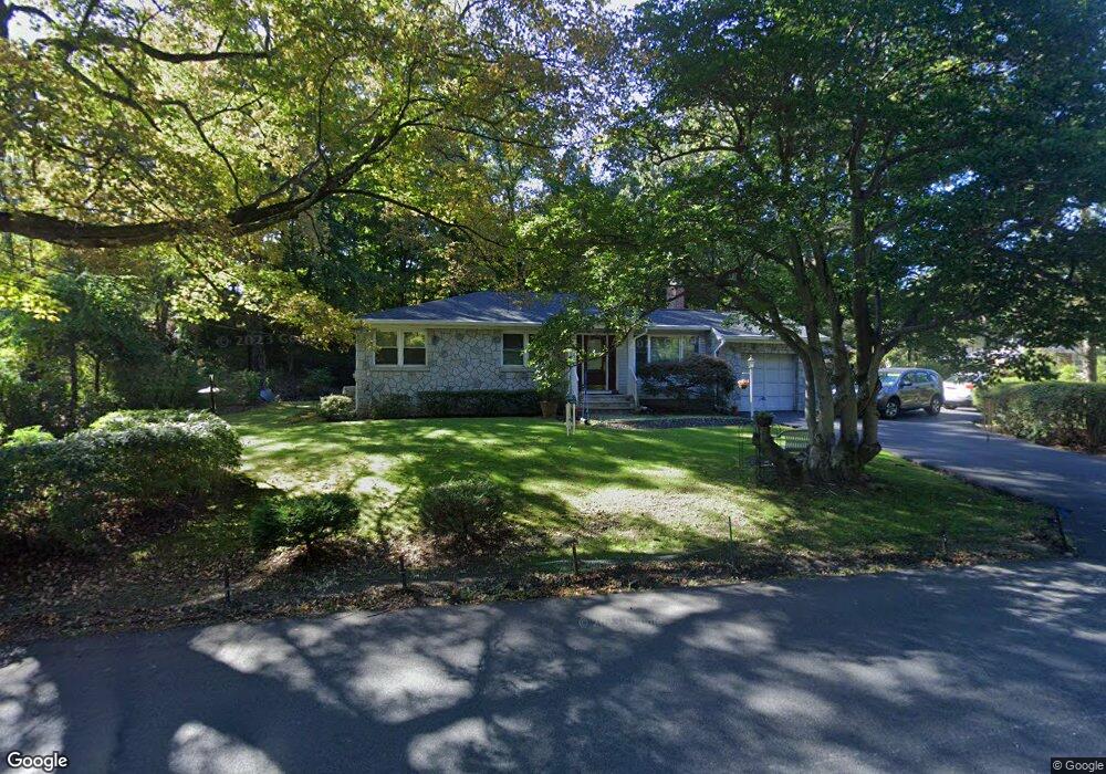
67 Pine Brook Rd Towaco, NJ 07082
Estimated Value: $702,000 - $857,000
Studio
--
Bath
1,980
Sq Ft
$390/Sq Ft
Est. Value
About This Home
This home is located at 67 Pine Brook Rd, Towaco, NJ 07082 and is currently estimated at $772,627, approximately $390 per square foot. 67 Pine Brook Rd is a home located in Morris County with nearby schools including Montville Township High School, Apple Montessori School of Towaco, and Chapel Hill Academy.
Ownership History
Date
Name
Owned For
Owner Type
Purchase Details
Closed on
Jul 8, 2009
Sold by
Pellington Donald and Pellington Paula J
Bought by
Pruksa Peter and Pruksa Paula
Current Estimated Value
Home Financials for this Owner
Home Financials are based on the most recent Mortgage that was taken out on this home.
Original Mortgage
$175,000
Outstanding Balance
$111,044
Interest Rate
4.93%
Mortgage Type
Purchase Money Mortgage
Estimated Equity
$661,583
Purchase Details
Closed on
Aug 29, 1998
Sold by
Pellington Donald
Bought by
Pellington Donald and Pellington Paula J
Create a Home Valuation Report for This Property
The Home Valuation Report is an in-depth analysis detailing your home's value as well as a comparison with similar homes in the area
Home Values in the Area
Average Home Value in this Area
Purchase History
| Date | Buyer | Sale Price | Title Company |
|---|---|---|---|
| Pruksa Peter | $472,000 | None Available | |
| Pellington Donald | -- | -- |
Source: Public Records
Mortgage History
| Date | Status | Borrower | Loan Amount |
|---|---|---|---|
| Open | Pruksa Peter | $175,000 |
Source: Public Records
Tax History
| Year | Tax Paid | Tax Assessment Tax Assessment Total Assessment is a certain percentage of the fair market value that is determined by local assessors to be the total taxable value of land and additions on the property. | Land | Improvement |
|---|---|---|---|---|
| 2025 | $11,239 | $421,100 | $190,000 | $231,100 |
| 2024 | $11,003 | $421,100 | $190,000 | $231,100 |
Source: Public Records
Map
Nearby Homes
- 85 Pine Brook Rd
- 19 Woodshire Terrace
- 45 Cobblestone Terrace
- 27 Cobblestone Terrace Unit 242
- 41 Lakeview Terrace Unit 222
- 201 Encampment Ct
- 2 Lafayette Ln
- 4 Lafayette Ln
- 6 Rathbun Rd
- 206 Encampment Ct
- 203 Encampment Ct
- 107 Encampment Ct
- 310 Encampment Ct
- 204 Encampment Ct
- 6 Lafayette Ln
- 33 Whitehall Rd
- 18 Rathbun Rd
- 63 Passaic Valley Rd
- 104 Encampment Ct
- 301 Encampment Ct
Your Personal Tour Guide
Ask me questions while you tour the home.