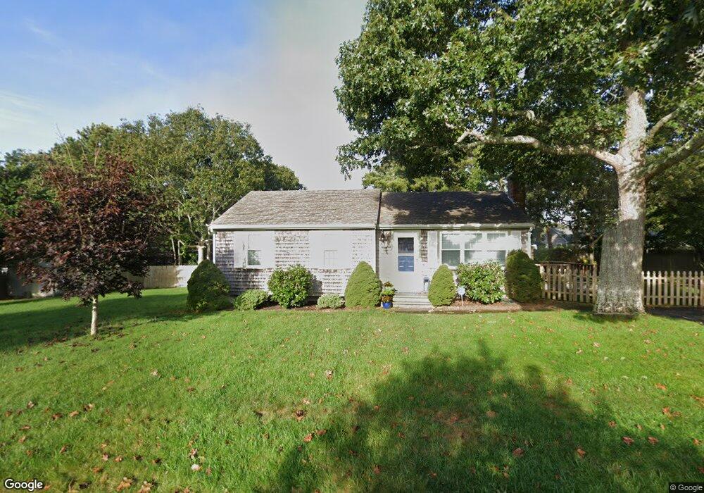
67 Polly Fisk Ln Dennis Port, MA 02639
Dennis Port NeighborhoodEstimated Value: $509,000 - $616,000
3
Beds
2
Baths
1,002
Sq Ft
$574/Sq Ft
Est. Value
About This Home
This home is located at 67 Polly Fisk Ln, Dennis Port, MA 02639 and is currently estimated at $574,733, approximately $573 per square foot. 67 Polly Fisk Ln is a home located in Barnstable County with nearby schools including Dennis-Yarmouth Regional High School and St. Pius X. School.
Ownership History
Date
Name
Owned For
Owner Type
Purchase Details
Closed on
Oct 29, 2014
Sold by
Pergamo James M and Pergamo Susan A
Bought by
James & Susan Pergamo Ft
Current Estimated Value
Purchase Details
Closed on
Dec 27, 1991
Sold by
Goldberg Marc L and Goldberg Maxine I
Bought by
Pergamo James M and Pergamo Susan
Create a Home Valuation Report for This Property
The Home Valuation Report is an in-depth analysis detailing your home's value as well as a comparison with similar homes in the area
Home Values in the Area
Average Home Value in this Area
Purchase History
| Date | Buyer | Sale Price | Title Company |
|---|---|---|---|
| James & Susan Pergamo Ft | -- | -- | |
| Pergamo James M | $112,000 | -- |
Source: Public Records
Tax History Compared to Growth
Tax History
| Year | Tax Paid | Tax Assessment Tax Assessment Total Assessment is a certain percentage of the fair market value that is determined by local assessors to be the total taxable value of land and additions on the property. | Land | Improvement |
|---|---|---|---|---|
| 2025 | $2,321 | $536,100 | $204,000 | $332,100 |
| 2024 | $2,221 | $505,900 | $196,100 | $309,800 |
| 2023 | $2,148 | $460,000 | $178,300 | $281,700 |
| 2022 | $2,074 | $370,400 | $160,600 | $209,800 |
| 2021 | $2,132 | $353,500 | $180,000 | $173,500 |
| 2020 | $1,923 | $315,200 | $157,500 | $157,700 |
| 2019 | $1,831 | $296,800 | $154,400 | $142,400 |
| 2018 | $3,857 | $276,700 | $147,000 | $129,700 |
| 2017 | $1,612 | $262,100 | $136,500 | $125,600 |
| 2016 | $1,644 | $251,700 | $147,000 | $104,700 |
| 2015 | $1,611 | $251,700 | $147,000 | $104,700 |
| 2014 | $1,465 | $230,700 | $126,000 | $104,700 |
Source: Public Records
Map
Nearby Homes
- 80 Michaels Ave
- 31 Easy St
- 19 Standish Way
- 37 Ocean Dr Unit 2
- 22 Wixon Rd
- 64 Beaten Rd
- 4 Coffey Ln
- 71 Main St
- 12 Spoonbill Rd
- 125 Main St Unit 3
- 112 Old Wharf Rd Unit E4
- 112 Old Wharf Rd Unit E1
- 154 Old Wharf Rd Unit 26
- 154 Old Wharf Rd Unit 14
- 120 Old Wharf Rd Unit 11
- 15 Woodside Park Rd
- 72 Bassett Ln
- 61 Trotters Ln
- 217 Old Wharf Rd Unit 64
- 268 Main St
- 70 Polly Fisk Ln
- 73 Polly Fisk Ln
- 61 Polly Fisk Ln
- 78 Lawrence Rd
- 64 Polly Fisk Ln
- 82 Lawrence Rd
- 76 Polly Fisk Ln
- 65 Cornell Dr
- 61 Cornell Dr
- 70 Lawrence Rd
- 69 Cornell Dr
- 57 Cornell Dr
- 56 Polly Fisk Ln
- 79 Polly Fisk Ln
- 55 Polly Fisk Ln
- 73 Cornell Dr
- 90 Lawrence Rd
- 79 Lawrence Rd
- 75 Lawrence Rd
- 81 Lawrence Rd