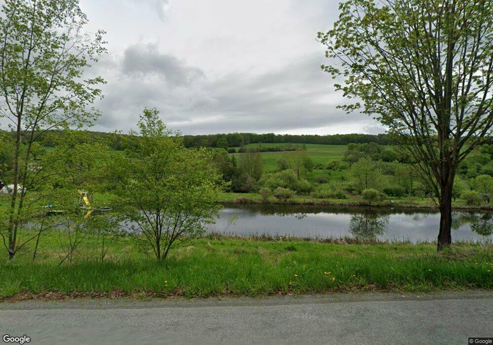
67 Price Rd Honesdale, PA 18431
Estimated Value: $341,000 - $572,000
6
Beds
1
Bath
3,295
Sq Ft
$129/Sq Ft
Est. Value
About This Home
This home is located at 67 Price Rd, Honesdale, PA 18431 and is currently estimated at $426,333, approximately $129 per square foot. 67 Price Rd is a home with nearby schools including Honesdale High School and Brookside School.
Ownership History
Date
Name
Owned For
Owner Type
Purchase Details
Closed on
Oct 8, 2020
Sold by
Ambrosio Pascale J and Ambrosio Jane C
Bought by
Smith Gordon M and Smith Patrice M
Current Estimated Value
Home Financials for this Owner
Home Financials are based on the most recent Mortgage that was taken out on this home.
Original Mortgage
$325,000
Outstanding Balance
$261,618
Interest Rate
2.9%
Mortgage Type
Future Advance Clause Open End Mortgage
Estimated Equity
$164,715
Purchase Details
Closed on
Aug 7, 2013
Sold by
Chu Anne and Jacquet Philippe
Bought by
Smith Gordon M and Smith Patrice K
Home Financials for this Owner
Home Financials are based on the most recent Mortgage that was taken out on this home.
Original Mortgage
$318,000
Interest Rate
3.87%
Mortgage Type
Construction
Create a Home Valuation Report for This Property
The Home Valuation Report is an in-depth analysis detailing your home's value as well as a comparison with similar homes in the area
Home Values in the Area
Average Home Value in this Area
Purchase History
| Date | Buyer | Sale Price | Title Company |
|---|---|---|---|
| Smith Gordon M | $225,000 | None Available | |
| Smith Gordon M | $200,000 | None Available |
Source: Public Records
Mortgage History
| Date | Status | Borrower | Loan Amount |
|---|---|---|---|
| Open | Smith Gordon M | $325,000 | |
| Previous Owner | Smith Gordon M | $318,000 |
Source: Public Records
Tax History Compared to Growth
Tax History
| Year | Tax Paid | Tax Assessment Tax Assessment Total Assessment is a certain percentage of the fair market value that is determined by local assessors to be the total taxable value of land and additions on the property. | Land | Improvement |
|---|---|---|---|---|
| 2025 | $9,222 | $549,500 | $119,600 | $429,900 |
| 2024 | $8,767 | $547,300 | $117,400 | $429,900 |
| 2023 | $12,388 | $547,300 | $117,400 | $429,900 |
| 2022 | $7,208 | $295,000 | $66,800 | $228,200 |
| 2021 | $7,137 | $295,000 | $66,800 | $228,200 |
| 2020 | $7,137 | $295,000 | $66,800 | $228,200 |
| 2019 | $6,668 | $295,000 | $66,800 | $228,200 |
| 2018 | $6,493 | $295,000 | $66,800 | $228,200 |
| 2017 | $6,051 | $267,500 | $66,800 | $200,700 |
| 2016 | $5,562 | $267,500 | $66,800 | $200,700 |
| 2014 | -- | $267,500 | $66,800 | $200,700 |
Source: Public Records
Map
Nearby Homes
- 0 Bryn Mawr Rd
- 406 Bryn Mawr Rd
- 19 Oregon Turnpike
- 191 Kratz Rd
- 479 Ash St
- 401 Wayne St
- 105 Grimms Rd
- 154 Slish Rd
- 19 Bethany Turnpike
- 15 Rose Land Dr
- 1797 N Main St
- Lot 23 Edna Ln
- 1729 N Main St
- 1727 N Main St
- 1403 N Main St
- 1223 Dyberry Place
- 1226 Dyberry Place
- 1322 N Main St
- 1205 Dyberry Place
- 1318 N Main St
- 7 Runoff Ln
- 11 Runoff Ln
- 448 Carley Brook Rd
- 2 Cherokee Dr
- Lot 22 Horseshoe Dr
- 105 Texas Palmyra Hwy
- Lot 27 Hill Top Dr
- 457 Carley Brook Rd
- 17 Price Ln
- 29 Price Ln
- 24 Price Ln
- 46 Price Ln
- 491 Carley Brook Rd
- 290 Bryn Mawr Rd
- 361 Carley Brook Rd
- 267 Bryn Mawr Rd
- 45 Riefler Rd
- 245 Bryn Mawr Rd
- 533 Carley Brook Rd
- 394 Bryn Mawr Rd
