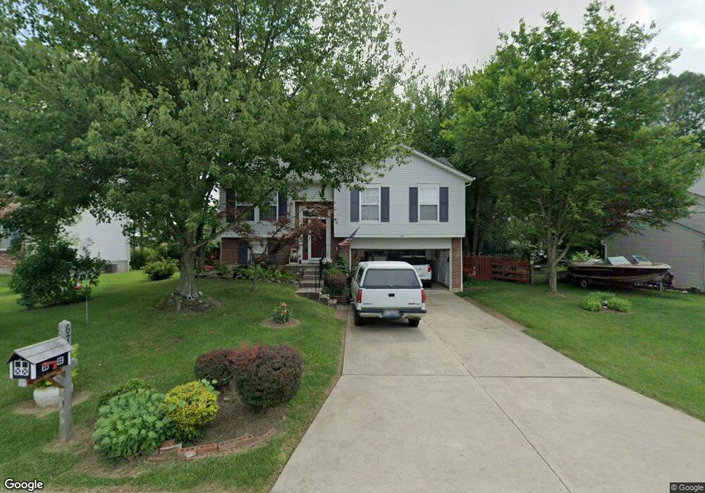
67 Red Bud Cir Amelia, OH 45102
Estimated Value: $240,280 - $258,000
3
Beds
3
Baths
1,352
Sq Ft
$186/Sq Ft
Est. Value
About This Home
This home is located at 67 Red Bud Cir, Amelia, OH 45102 and is currently estimated at $250,820, approximately $185 per square foot. 67 Red Bud Cir is a home located in Clermont County with nearby schools including Amelia Elementary School, West Clermont Middle School, and West Clermont High School.
Ownership History
Date
Name
Owned For
Owner Type
Purchase Details
Closed on
Jun 5, 2006
Sold by
Woodside Park Development Co Llc
Bought by
Perry Joseph and Perry Donna K
Current Estimated Value
Purchase Details
Closed on
Jun 5, 1995
Sold by
Ryland Group Inc
Bought by
Perry Joseph and Perry Donna K
Home Financials for this Owner
Home Financials are based on the most recent Mortgage that was taken out on this home.
Original Mortgage
$49,900
Interest Rate
7.84%
Mortgage Type
New Conventional
Purchase Details
Closed on
Jun 30, 1994
Create a Home Valuation Report for This Property
The Home Valuation Report is an in-depth analysis detailing your home's value as well as a comparison with similar homes in the area
Home Values in the Area
Average Home Value in this Area
Purchase History
| Date | Buyer | Sale Price | Title Company |
|---|---|---|---|
| Perry Joseph | -- | None Available | |
| Perry Joseph | $89,900 | -- | |
| -- | $15,000 | -- |
Source: Public Records
Mortgage History
| Date | Status | Borrower | Loan Amount |
|---|---|---|---|
| Previous Owner | Perry Joseph | $49,900 |
Source: Public Records
Tax History
| Year | Tax Paid | Tax Assessment Tax Assessment Total Assessment is a certain percentage of the fair market value that is determined by local assessors to be the total taxable value of land and additions on the property. | Land | Improvement |
|---|---|---|---|---|
| 2024 | $2,762 | $63,880 | $16,070 | $47,810 |
| 2023 | $2,798 | $63,880 | $16,070 | $47,810 |
| 2022 | $2,185 | $45,890 | $11,550 | $34,340 |
| 2021 | $2,160 | $45,890 | $11,550 | $34,340 |
| 2020 | $2,161 | $45,890 | $11,550 | $34,340 |
| 2019 | $1,833 | $43,200 | $10,750 | $32,450 |
| 2018 | $1,851 | $43,200 | $10,750 | $32,450 |
| 2017 | $1,878 | $43,200 | $10,750 | $32,450 |
| 2016 | $1,658 | $36,610 | $9,100 | $27,510 |
| 2015 | $1,548 | $36,610 | $9,100 | $27,510 |
| 2014 | $1,548 | $36,610 | $9,100 | $27,510 |
| 2013 | $1,593 | $37,140 | $9,100 | $28,040 |
Source: Public Records
Map
Nearby Homes
- 27 Locustwood Ct
- 21 Mallard Dr
- 288 Samplewood Ln
- 3330 Huntsman Trace Unit 803C
- 253 Deer Creek Dr
- 11 Finch Ct
- 263 Deer Creek Dr
- 185 Woodside Park Dr
- 9 Woodside Park Dr
- 27 Heron Dr
- 1554 Denny Dr
- 1700 White Birch
- 1969 Ohio 125
- 52 Huntington Ave
- 212 Wooded Ridge Dr
- 1336 Dee Ln
- 1770 Ohio 125
- 65 Wooded Ridge Dr
- 9 Letitia Ave
- 52 Charmalee Dr
- 65 Red Bud Cir
- 69 Red Bud Cir
- 63 Red Bud Cir
- 71 Red Bud Cir
- 58 Red Bud Cir
- 60 Red Bud Cir
- 56 Red Bud Cir
- 62 Red Bud Cir
- 61 Red Bud Cir
- 73 Red Bud Cir
- 54 Red Bud Cir
- 4 Arrowhead Dr
- 6 Arrowhead Dr
- 10 Arrowhead Dr
- 2 Arrowhead Dr
- 75 Red Bud Cir
- 8 Arrowhead Dr
- 52 Red Bud Cir
- 16 Arrowhead Dr
- 57 Red Bud Cir
Your Personal Tour Guide
Ask me questions while you tour the home.