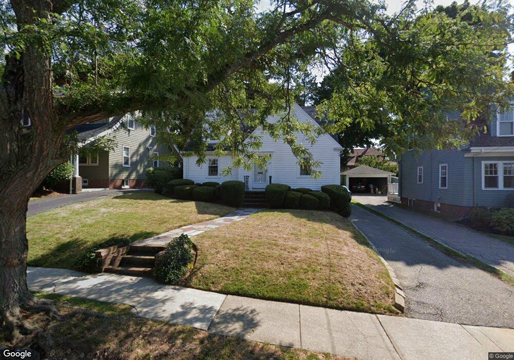
67 Robbins Rd Watertown, MA 02472
East Watertown NeighborhoodEstimated Value: $918,562 - $1,090,000
4
Beds
2
Baths
1,398
Sq Ft
$709/Sq Ft
Est. Value
About This Home
This home is located at 67 Robbins Rd, Watertown, MA 02472 and is currently estimated at $991,641, approximately $709 per square foot. 67 Robbins Rd is a home located in Middlesex County with nearby schools including The Kendall School and Beacon High School.
Ownership History
Date
Name
Owned For
Owner Type
Purchase Details
Closed on
Jun 22, 2023
Sold by
Igoe Eleanor M
Bought by
Igoe Eleanor M and Igoe James M
Current Estimated Value
Purchase Details
Closed on
Apr 4, 1979
Bought by
Igoe Esther M and Igoe Eleanor M
Create a Home Valuation Report for This Property
The Home Valuation Report is an in-depth analysis detailing your home's value as well as a comparison with similar homes in the area
Home Values in the Area
Average Home Value in this Area
Purchase History
| Date | Buyer | Sale Price | Title Company |
|---|---|---|---|
| Igoe Eleanor M | -- | None Available | |
| Igoe Eleanor M | -- | None Available | |
| Igoe Eleanor M | -- | None Available | |
| Igoe Esther M | -- | -- |
Source: Public Records
Tax History Compared to Growth
Tax History
| Year | Tax Paid | Tax Assessment Tax Assessment Total Assessment is a certain percentage of the fair market value that is determined by local assessors to be the total taxable value of land and additions on the property. | Land | Improvement |
|---|---|---|---|---|
| 2025 | $9,233 | $790,500 | $486,700 | $303,800 |
| 2024 | $8,101 | $692,400 | $464,600 | $227,800 |
| 2023 | $8,963 | $660,000 | $442,800 | $217,200 |
| 2022 | $8,703 | $656,800 | $435,500 | $221,300 |
| 2021 | $7,958 | $649,600 | $428,300 | $221,300 |
| 2020 | $7,621 | $627,800 | $406,500 | $221,300 |
| 2019 | $7,069 | $548,800 | $392,000 | $156,800 |
| 2018 | $6,669 | $495,100 | $348,400 | $146,700 |
| 2017 | $6,877 | $495,100 | $348,400 | $146,700 |
| 2016 | $6,302 | $460,700 | $314,000 | $146,700 |
| 2015 | $6,924 | $460,700 | $314,000 | $146,700 |
| 2014 | $6,892 | $460,700 | $314,000 | $146,700 |
Source: Public Records
Map
Nearby Homes
- 68 Barnard Ave
- 25 Barnard Ave
- 152 Bellevue Rd
- 68 Lovell Rd
- 11 Broadway Unit 11
- 235 Mount Auburn St
- 5 Mason Rd
- 118 Spring St Unit 118
- 456 Belmont St Unit 10
- 456 Belmont St Unit 21
- 93 Spring St Unit 29
- 20 Oakley Rd
- 21 Fayette St Unit 1
- 30 Merrill Rd
- 46 Hall Ave Unit 2
- 61-63 Church St
- 67 Walnut St
- 55 Phillips St
- 532 Belmont St
- 121 Channing Rd
- 65 Robbins Rd
- 71 Robbins Rd
- 59 Robbins Rd
- 75 Robbins Rd
- 84 Barnard Ave
- 80 Barnard Ave
- 81 Robbins Rd
- 70 Robbins Rd
- 66 Robbins Rd
- 66 Robbins Rd Unit 66
- 55 Robbins Rd
- 92 Barnard Ave
- 92 Barnard Ave Unit 1
- 92 Barnard Ave Unit 92
- 92 Barnard Ave Unit 2
- 72 Robbins Rd
- 74 Barnard Ave
- 74 Barnard Ave Unit 2
- 74 Barnard Ave Unit 74
- 62 Robbins Rd