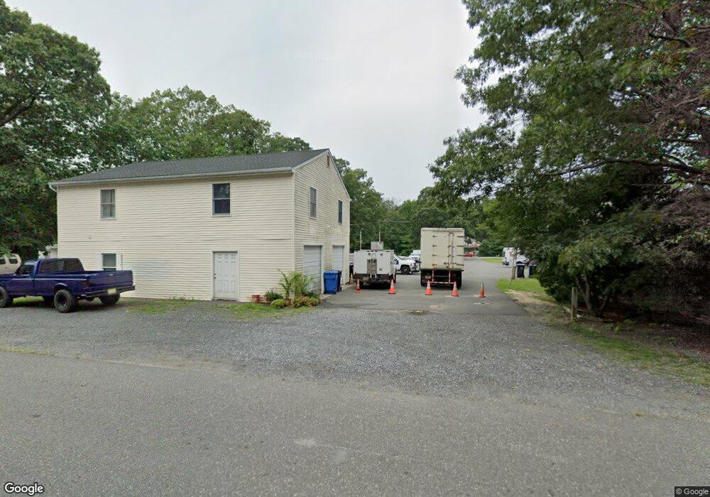
67 Route 50 Ocean View, NJ 08230
--
Bed
--
Bath
6,300
Sq Ft
0.63
Acres
About This Home
This home is located at 67 Route 50, Ocean View, NJ 08230. 67 Route 50 is a home located in Cape May County with nearby schools including Upper Township Primary School, Upper Township Elementary School, and Upper Township Middle School.
Ownership History
Date
Name
Owned For
Owner Type
Purchase Details
Closed on
Mar 15, 2021
Sold by
Fsb Enterprise Llc
Bought by
Dande Llc and Route50re Llc
Purchase Details
Closed on
Jul 18, 2018
Sold by
Fsb Enterprise Llc
Bought by
Fsb Enterprise Llc
Purchase Details
Closed on
Jul 7, 2017
Sold by
Inserra Vincenzo and Inserra Anthony
Bought by
Fsb Enterprises Llc
Purchase Details
Closed on
Feb 23, 1989
Sold by
Inserra Vincent and Inserra Maria
Bought by
Atlantic City Electric Co
Purchase Details
Closed on
Jul 11, 1988
Sold by
Arone & King & Woodstock Assoc
Bought by
Inserra Vincenzo
Create a Home Valuation Report for This Property
The Home Valuation Report is an in-depth analysis detailing your home's value as well as a comparison with similar homes in the area
Home Values in the Area
Average Home Value in this Area
Purchase History
| Date | Buyer | Sale Price | Title Company |
|---|---|---|---|
| Dande Llc | $225,000 | Foundation Title | |
| Fsb Enterprise Llc | -- | -- | |
| Fsb Enterprises Llc | $350,000 | None Available | |
| Atlantic City Electric Co | -- | -- | |
| Inserra Vincenzo | $220,000 | -- | |
| Inserra Vincenzo | $220,000 | -- |
Source: Public Records
Tax History Compared to Growth
Tax History
| Year | Tax Paid | Tax Assessment Tax Assessment Total Assessment is a certain percentage of the fair market value that is determined by local assessors to be the total taxable value of land and additions on the property. | Land | Improvement |
|---|---|---|---|---|
| 2025 | $5,083 | $221,500 | $139,400 | $82,100 |
| 2024 | $5,083 | $221,500 | $139,400 | $82,100 |
| 2023 | $4,833 | $221,500 | $139,400 | $82,100 |
| 2022 | $4,671 | $221,500 | $139,400 | $82,100 |
| 2021 | $7,790 | $382,800 | $139,400 | $243,400 |
| 2020 | $7,495 | $382,800 | $139,400 | $243,400 |
| 2019 | $7,315 | $382,800 | $139,400 | $243,400 |
| 2018 | $7,128 | $382,800 | $139,400 | $243,400 |
| 2017 | $7,047 | $382,800 | $139,400 | $243,400 |
| 2016 | $7,158 | $382,800 | $139,400 | $243,400 |
| 2015 | $6,971 | $382,800 | $139,400 | $243,400 |
| 2014 | $6,860 | $461,300 | $144,100 | $317,200 |
Source: Public Records
Map
Nearby Homes
- 86 Route 50
- 81 Flounder
- 16 Winchester Ct
- 3 Kruk Terrace
- 5 Kruk Terrace
- 14 Winchester Ct
- 2058 U S 9
- 49 Hope Corson Rd
- 2058 Shore Rd
- 4 W Katherine Ave
- 11 Laurel Ridge Rd
- 13 Mooring Cir
- 1 New Jersey 50
- 1431 Stagecoach Rd
- 2 New Jersey 50
- 127 Route 50
- 12 Ashcroft Ave
- 2058 S Shore Rd
- 3 Sandcastle Dr
- 4 Sandcastle Dr
- 65 Route 50
- 63 Route 50
- 71 Route 50
- 72 Route 50
- 2 Peach Orchard Rd
- 59 Route 50
- 1495 Stagecoach Rd
- 54 W Katherine Ave
- 2 Preswyck Ln
- 70 Route 50
- 1481 Stagecoach Rd
- 75 Route 50
- 1497 Stagecoach Rd
- 66 Route 50
- 4 Peach Orchard Rd
- 1 Peach Orchard Rd
- 52 W Katherine Ave
- 50 W Katherine Ave
- 57 Route 50
- 221 Sandberg Place