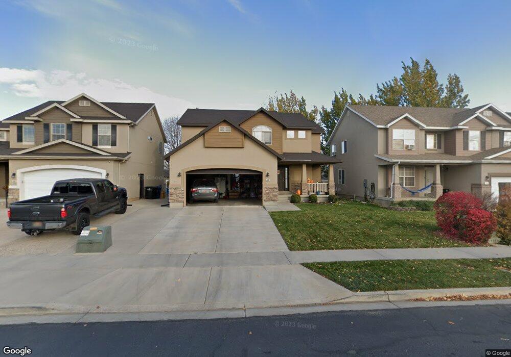
67 S 475 W Spanish Fork, UT 84660
Estimated Value: $530,000 - $632,000
4
Beds
3
Baths
2,633
Sq Ft
$216/Sq Ft
Est. Value
About This Home
This home is located at 67 S 475 W, Spanish Fork, UT 84660 and is currently estimated at $568,471, approximately $215 per square foot. 67 S 475 W is a home located in Utah County with nearby schools including Brockbank Elementary School, Spanish Fork Jr High School, and Spanish Fork High School.
Ownership History
Date
Name
Owned For
Owner Type
Purchase Details
Closed on
Oct 4, 2021
Sold by
Wing Paxton
Bought by
Madsen Taylor and Madsen Rachel
Current Estimated Value
Home Financials for this Owner
Home Financials are based on the most recent Mortgage that was taken out on this home.
Original Mortgage
$355,000
Outstanding Balance
$323,727
Interest Rate
2.8%
Mortgage Type
New Conventional
Estimated Equity
$244,744
Purchase Details
Closed on
Aug 22, 2019
Sold by
Wing Karleen M
Bought by
Wing Paxton
Home Financials for this Owner
Home Financials are based on the most recent Mortgage that was taken out on this home.
Original Mortgage
$249,269
Interest Rate
3.7%
Mortgage Type
New Conventional
Purchase Details
Closed on
Aug 31, 2018
Sold by
Wing Paxton
Bought by
Wing Paxton and Wing Karleen M
Home Financials for this Owner
Home Financials are based on the most recent Mortgage that was taken out on this home.
Original Mortgage
$243,000
Interest Rate
4.5%
Mortgage Type
New Conventional
Purchase Details
Closed on
Nov 19, 2015
Sold by
Vanausdal Brad and Vanausdal Brooke
Bought by
Cutler Chase N
Home Financials for this Owner
Home Financials are based on the most recent Mortgage that was taken out on this home.
Original Mortgage
$237,500
Interest Rate
3.71%
Mortgage Type
New Conventional
Purchase Details
Closed on
Mar 29, 2006
Sold by
Salisbury Development Lc
Bought by
Vanausdal Brad and Vanausdal Brooke
Home Financials for this Owner
Home Financials are based on the most recent Mortgage that was taken out on this home.
Original Mortgage
$31,350
Interest Rate
6.2%
Mortgage Type
Stand Alone Second
Purchase Details
Closed on
Mar 9, 2005
Sold by
Red Cedar Properties Lc
Bought by
Salisbury Development Lc
Home Financials for this Owner
Home Financials are based on the most recent Mortgage that was taken out on this home.
Original Mortgage
$467,500
Interest Rate
5.65%
Mortgage Type
Construction
Purchase Details
Closed on
Sep 5, 1997
Sold by
Highland Properties L C
Bought by
Salsbury Patricia Mary
Create a Home Valuation Report for This Property
The Home Valuation Report is an in-depth analysis detailing your home's value as well as a comparison with similar homes in the area
Home Values in the Area
Average Home Value in this Area
Purchase History
| Date | Buyer | Sale Price | Title Company |
|---|---|---|---|
| Madsen Taylor | -- | Inwest Title | |
| Wing Paxton | -- | Highland Title | |
| Wing Paxton | -- | Accommodation | |
| Wing Paxton | -- | Highland Title | |
| Cutler Chase N | -- | Provo Land Title Co | |
| Vanausdal Brad | -- | Provo Land Title Company | |
| Salisbury Development Lc | -- | Provo Land Title Co | |
| Salsbury Patricia Mary | -- | -- |
Source: Public Records
Mortgage History
| Date | Status | Borrower | Loan Amount |
|---|---|---|---|
| Open | Madsen Taylor | $355,000 | |
| Previous Owner | Wing Paxton | $249,269 | |
| Previous Owner | Wing Paxton | $243,000 | |
| Previous Owner | Cutler Chase N | $237,500 | |
| Previous Owner | Vanausdal Brad | $31,350 | |
| Previous Owner | Vanausdal Brad | $167,200 | |
| Previous Owner | Salisbury Development Lc | $467,500 |
Source: Public Records
Tax History
| Year | Tax Paid | Tax Assessment Tax Assessment Total Assessment is a certain percentage of the fair market value that is determined by local assessors to be the total taxable value of land and additions on the property. | Land | Improvement |
|---|---|---|---|---|
| 2025 | $2,268 | $253,990 | -- | -- |
| 2024 | $2,268 | $233,805 | $0 | $0 |
| 2023 | $2,355 | $242,990 | $0 | $0 |
| 2022 | $2,515 | $254,540 | $0 | $0 |
| 2021 | $2,141 | $346,700 | $103,700 | $243,000 |
| 2020 | $2,042 | $321,400 | $94,300 | $227,100 |
| 2019 | $1,891 | $313,100 | $86,000 | $227,100 |
| 2018 | $1,773 | $283,900 | $79,100 | $204,800 |
| 2017 | $1,671 | $143,770 | $0 | $0 |
| 2016 | $1,520 | $129,030 | $0 | $0 |
| 2015 | $1,353 | $113,465 | $0 | $0 |
| 2014 | $1,267 | $106,645 | $0 | $0 |
Source: Public Records
Map
Nearby Homes
Your Personal Tour Guide
Ask me questions while you tour the home.