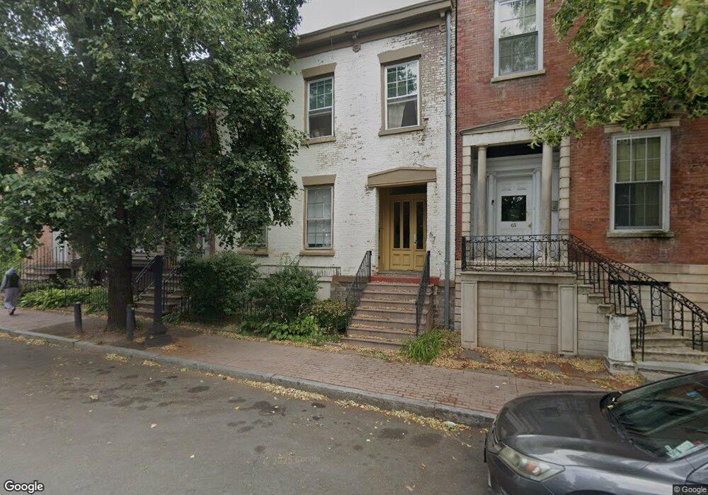
67 S Ferry St Albany, NY 12202
Downtown Albany NeighborhoodEstimated Value: $100,000 - $168,000
2
Beds
1
Bath
878
Sq Ft
$151/Sq Ft
Est. Value
About This Home
This home is located at 67 S Ferry St, Albany, NY 12202 and is currently estimated at $132,768, approximately $151 per square foot. 67 S Ferry St is a home located in Albany County with nearby schools including Giffen Memorial Elementary School, Stephen And Harriet Myers Middle School, and Albany High School.
Ownership History
Date
Name
Owned For
Owner Type
Purchase Details
Closed on
Oct 25, 2024
Sold by
Weinberg Chauna E
Bought by
Benchmark Properties Of Albany Llc
Current Estimated Value
Purchase Details
Closed on
Jun 20, 2014
Sold by
Kluska Jennifer Lynn
Bought by
Weinberg Chauna
Purchase Details
Closed on
Nov 1, 2005
Sold by
Rv Complete Property Crp
Bought by
Kluska Jennifer Betsy
Home Financials for this Owner
Home Financials are based on the most recent Mortgage that was taken out on this home.
Original Mortgage
$35,000
Interest Rate
6.07%
Mortgage Type
New Conventional
Purchase Details
Closed on
Sep 17, 2001
Create a Home Valuation Report for This Property
The Home Valuation Report is an in-depth analysis detailing your home's value as well as a comparison with similar homes in the area
Home Values in the Area
Average Home Value in this Area
Purchase History
| Date | Buyer | Sale Price | Title Company |
|---|---|---|---|
| Benchmark Properties Of Albany Llc | $39,500 | None Listed On Document | |
| Benchmark Properties Of Albany Llc | $39,500 | None Listed On Document | |
| Weinberg Chauna | $35,000 | None Available | |
| Kluska Jennifer Betsy | $35,000 | -- | |
| -- | -- | -- |
Source: Public Records
Mortgage History
| Date | Status | Borrower | Loan Amount |
|---|---|---|---|
| Previous Owner | Kluska Jennifer Betsy | $35,000 |
Source: Public Records
Tax History Compared to Growth
Tax History
| Year | Tax Paid | Tax Assessment Tax Assessment Total Assessment is a certain percentage of the fair market value that is determined by local assessors to be the total taxable value of land and additions on the property. | Land | Improvement |
|---|---|---|---|---|
| 2024 | $1,837 | $72,000 | $14,400 | $57,600 |
| 2023 | $2,207 | $56,000 | $12,000 | $44,000 |
| 2022 | $2,158 | $56,000 | $12,000 | $44,000 |
| 2021 | $2,154 | $56,000 | $12,000 | $44,000 |
| 2020 | $2,361 | $56,000 | $12,000 | $44,000 |
| 2019 | $2,205 | $56,000 | $12,000 | $44,000 |
| 2018 | $2,486 | $56,000 | $12,000 | $44,000 |
| 2017 | $1,054 | $56,000 | $12,000 | $44,000 |
| 2016 | $2,306 | $56,000 | $12,000 | $44,000 |
| 2015 | $2,228 | $57,100 | $7,600 | $49,500 |
| 2014 | -- | $57,100 | $7,600 | $49,500 |
Source: Public Records
Map
Nearby Homes
- 67 S Ferry St Unit 36
- 128 S Pearl St
- 84 Grand St
- 329 S Pearl St
- 7 Wilbur St
- 15 Wilbur St
- 68 Bassett St
- 64 Clinton St
- 128 Hamilton St
- 3 Elizabeth St Unit 2
- 51 Elm St
- 3 Osborne St
- 4 Osborne St
- 137 4th Ave
- 0 State Route 26 Unit S1611788
- 64 Alexander St
- 113 Clinton St
- 46 Osborne St
- 79 2nd Ave
- 37 Sloan St
- 67 S Ferry St Unit 2
- 69 S Ferry St
- 69 S Ferry St Unit 38
- 53 S Ferry St
- 51 S Ferry St
- 149 Green St
- 151 Green St
- 68 Westerlo St
- 51 Westerlo St
- 51 Westerlo St
- 69 Westerlo St
- 47 Westerlo St
- 49 Westerlo St
- 49 Westerlo St
- 49 Westerlo St
- 137 Green St
- 217 S Pearl St
- 213 S Pearl St
- 135 Green St
- 60 Westerlo St