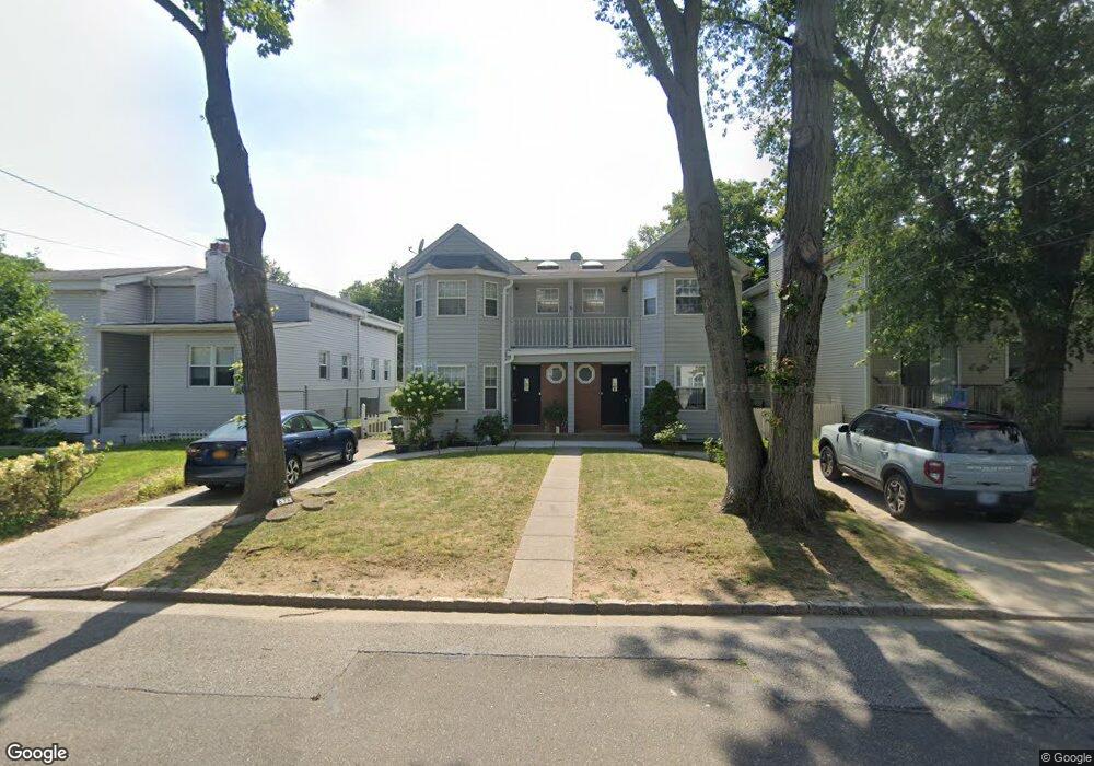
67 Sagamore Hill Dr Unit A Left Port Washington, NY 11050
Estimated Value: $1,260,000 - $1,320,624
3
Beds
3
Baths
2,804
Sq Ft
$460/Sq Ft
Est. Value
About This Home
This home is located at 67 Sagamore Hill Dr Unit A Left, Port Washington, NY 11050 and is currently estimated at $1,290,312, approximately $460 per square foot. 67 Sagamore Hill Dr Unit A Left is a home located in Nassau County with nearby schools including Carrie Palmer Weber Middle School, Paul D. Schreiber Senior High School, and Happy Montessori School.
Ownership History
Date
Name
Owned For
Owner Type
Purchase Details
Closed on
Jul 23, 1996
Sold by
Oakland Developers Corp
Bought by
Mayourian Edmond
Current Estimated Value
Home Financials for this Owner
Home Financials are based on the most recent Mortgage that was taken out on this home.
Original Mortgage
$245,000
Outstanding Balance
$17,618
Interest Rate
8.18%
Mortgage Type
Purchase Money Mortgage
Estimated Equity
$1,272,694
Create a Home Valuation Report for This Property
The Home Valuation Report is an in-depth analysis detailing your home's value as well as a comparison with similar homes in the area
Home Values in the Area
Average Home Value in this Area
Purchase History
| Date | Buyer | Sale Price | Title Company |
|---|---|---|---|
| Mayourian Edmond | -- | -- |
Source: Public Records
Mortgage History
| Date | Status | Borrower | Loan Amount |
|---|---|---|---|
| Open | Mayourian Edmond | $245,000 |
Source: Public Records
Tax History Compared to Growth
Tax History
| Year | Tax Paid | Tax Assessment Tax Assessment Total Assessment is a certain percentage of the fair market value that is determined by local assessors to be the total taxable value of land and additions on the property. | Land | Improvement |
|---|---|---|---|---|
| 2025 | $18,522 | $923 | $366 | $557 |
| 2024 | $3,342 | $921 | $365 | $556 |
| 2023 | $15,627 | $958 | $380 | $578 |
| 2022 | $15,627 | $958 | $380 | $578 |
| 2021 | $13,742 | $912 | $371 | $541 |
| 2020 | $10,919 | $861 | $547 | $314 |
| 2019 | $9,989 | $922 | $549 | $373 |
| 2018 | $10,054 | $984 | $0 | $0 |
| 2017 | $8,002 | $1,045 | $553 | $492 |
| 2016 | $10,324 | $1,107 | $528 | $579 |
| 2015 | $2,790 | $1,168 | $557 | $611 |
| 2014 | $2,790 | $1,168 | $557 | $611 |
| 2013 | $2,490 | $1,229 | $586 | $643 |
Source: Public Records
Map
Nearby Homes
- 24 Hickory Rd
- 42 Firwood Rd Unit A
- 44 Firwood Rd
- 11 Fishermans Dr
- 1 Toms Point Ln Unit 2A
- 1 Toms Point Ln Unit Bldg.2, Apt.4A
- 1 Orchard Beach Blvd
- 59 Edgewood Rd
- 27 Juniper Rd
- 68 Graywood Rd
- 13 Linwood Rd S
- 14 Marwood Rd S
- 78 Edgewood Rd
- 36 Fishermans Dr
- 46 Linwood Rd N Unit A and B
- 46 Linwood Rd N
- 10 Oldwood Rd
- 13 Dunes Ln Unit A and B
- 13 Dunes Ln
- 43 Miro Place
- 67B Sagamore Hill Dr Unit Right
- 67 Sagamore Hill Dr Unit A
- 67 Sagamore Hill Dr Unit B
- 65 Sagamore Hill Dr
- 26 Pequot Ave
- 26 Pequot Ave Unit B
- 26 Pequot Ave Unit A
- 69 Sagamore Hill Dr
- 26A Pequot Ave Unit A
- 26A Pequot Ave
- 28 Pequot Ave Unit A
- 28 Pequot Ave Unit B
- 28 Pequot Ave
- 21 Mohegan Ave
- 23 Mohegan Ave
- 30 Pequot Ave
- 25 Mohegan Ave
- 66 Sagamore Hill Dr
- 66 Sagamore Hill Dr
- 66 Sagamore Hill Dr Unit A