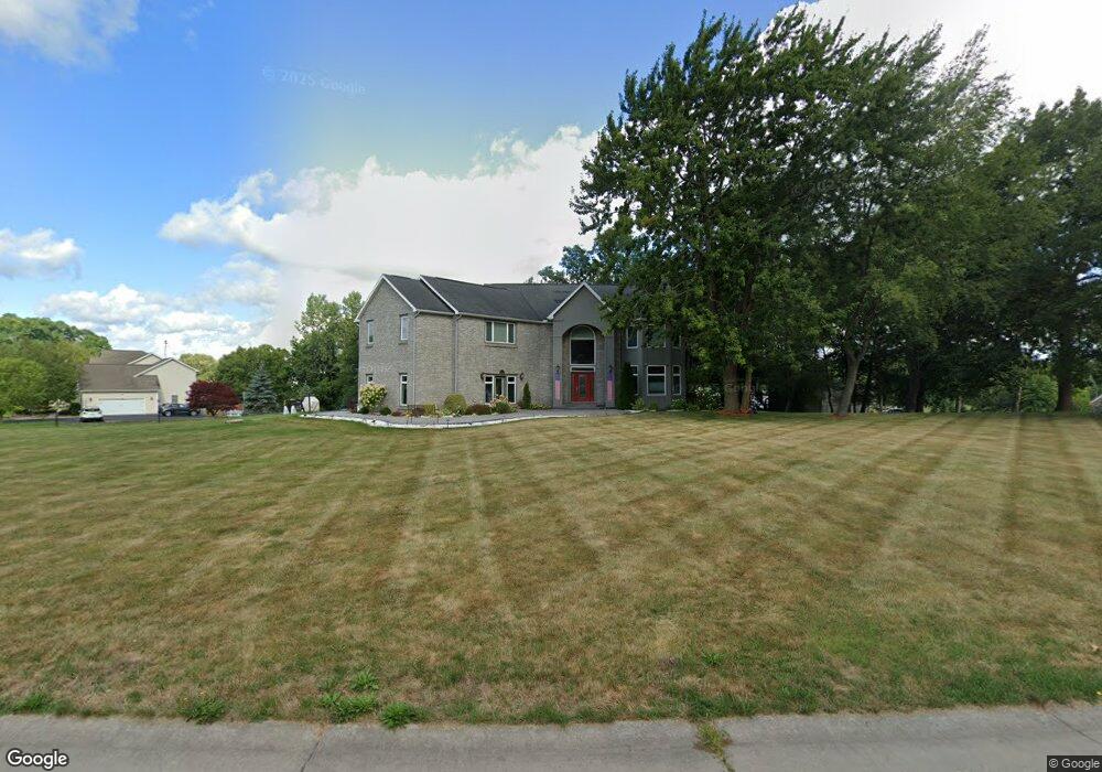
67 Sarah Cir Spencerport, NY 14559
Estimated Value: $514,000 - $834,000
5
Beds
5
Baths
3,455
Sq Ft
$194/Sq Ft
Est. Value
About This Home
This home is located at 67 Sarah Cir, Spencerport, NY 14559 and is currently estimated at $671,272, approximately $194 per square foot. 67 Sarah Cir is a home located in Monroe County with nearby schools including A M Cosgrove Middle School and Spencerport High School.
Ownership History
Date
Name
Owned For
Owner Type
Purchase Details
Closed on
Jul 29, 2008
Sold by
Caruso Giuseppe
Bought by
Fahoury Alex
Current Estimated Value
Home Financials for this Owner
Home Financials are based on the most recent Mortgage that was taken out on this home.
Original Mortgage
$275,200
Interest Rate
5.98%
Mortgage Type
New Conventional
Purchase Details
Closed on
Aug 21, 2007
Sold by
Gallelli Antonio
Bought by
Caruso Giuseppe
Purchase Details
Closed on
Mar 7, 2003
Sold by
Giuseppe Caruso
Bought by
Antonio Gallelli
Purchase Details
Closed on
Aug 20, 1999
Sold by
Stoney Point Development Corp.
Bought by
Caruso Giuseppee
Create a Home Valuation Report for This Property
The Home Valuation Report is an in-depth analysis detailing your home's value as well as a comparison with similar homes in the area
Home Values in the Area
Average Home Value in this Area
Purchase History
| Date | Buyer | Sale Price | Title Company |
|---|---|---|---|
| Fahoury Alex | $344,000 | -- | |
| Caruso Giuseppe | -- | -- | |
| Antonio Gallelli | -- | -- | |
| Caruso Giuseppee | $73,500 | Enzo A Faga |
Source: Public Records
Mortgage History
| Date | Status | Borrower | Loan Amount |
|---|---|---|---|
| Closed | Fahoury Alex | $275,200 |
Source: Public Records
Tax History Compared to Growth
Tax History
| Year | Tax Paid | Tax Assessment Tax Assessment Total Assessment is a certain percentage of the fair market value that is determined by local assessors to be the total taxable value of land and additions on the property. | Land | Improvement |
|---|---|---|---|---|
| 2024 | $15,409 | $638,000 | $113,400 | $524,600 |
| 2023 | $15,409 | $360,000 | $60,600 | $299,400 |
| 2022 | $14,507 | $360,000 | $60,600 | $299,400 |
| 2021 | $14,188 | $360,000 | $60,600 | $299,400 |
| 2020 | $14,038 | $360,000 | $60,600 | $299,400 |
| 2019 | $12,939 | $360,000 | $60,600 | $299,400 |
| 2018 | $13,316 | $360,000 | $60,600 | $299,400 |
| 2017 | $7,639 | $344,000 | $60,600 | $283,400 |
| 2016 | $12,939 | $344,000 | $60,600 | $283,400 |
| 2015 | -- | $344,000 | $60,600 | $283,400 |
| 2014 | -- | $344,000 | $60,600 | $283,400 |
Source: Public Records
Map
Nearby Homes
- 4028 Canal Rd
- 3375 Brockport Spencerport Rd
- 24 Birdsong Terrace
- vl Canal Rd
- 76 Hawthorne Dr
- 0000 Bay Leaf Cir Lot#119
- 000
- 00 Bay Leaf Circle Lot#117
- 0 Unit R1620030
- 326 Village Walk Cir
- 607 Trimmer Rd
- 154 Amity St
- 87 Highview Dr
- 78 Clark St
- 389 Washington St
- 4310 Canal Rd
- 2283 S Union St
- 6 Walnut Hill Dr
- 49 Hillcrest Dr
- 911 Washington St