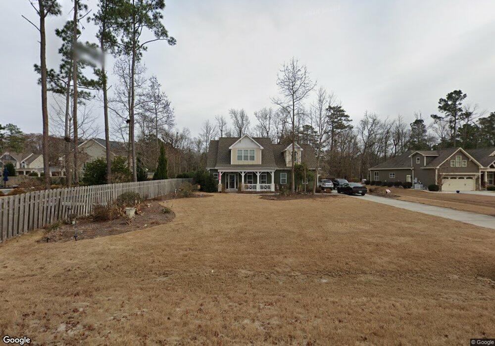
67 Sourwood Cove Hampstead, NC 28443
Estimated Value: $563,678 - $638,000
3
Beds
3
Baths
2,422
Sq Ft
$248/Sq Ft
Est. Value
About This Home
This home is located at 67 Sourwood Cove, Hampstead, NC 28443 and is currently estimated at $600,920, approximately $248 per square foot. 67 Sourwood Cove is a home with nearby schools including South Topsail Elementary School, Topsail Middle School, and Topsail High School.
Ownership History
Date
Name
Owned For
Owner Type
Purchase Details
Closed on
Feb 22, 2016
Sold by
Bill Clark Homes Of Wilmington Llc
Bought by
Laplante David Jonathan and Steinberg Elizabeth Ann
Current Estimated Value
Home Financials for this Owner
Home Financials are based on the most recent Mortgage that was taken out on this home.
Original Mortgage
$281,081
Outstanding Balance
$224,218
Interest Rate
3.97%
Mortgage Type
New Conventional
Estimated Equity
$376,702
Create a Home Valuation Report for This Property
The Home Valuation Report is an in-depth analysis detailing your home's value as well as a comparison with similar homes in the area
Home Values in the Area
Average Home Value in this Area
Purchase History
| Date | Buyer | Sale Price | Title Company |
|---|---|---|---|
| Laplante David Jonathan | $296,000 | None Available |
Source: Public Records
Mortgage History
| Date | Status | Borrower | Loan Amount |
|---|---|---|---|
| Open | Laplante David Jonathan | $281,081 |
Source: Public Records
Tax History Compared to Growth
Tax History
| Year | Tax Paid | Tax Assessment Tax Assessment Total Assessment is a certain percentage of the fair market value that is determined by local assessors to be the total taxable value of land and additions on the property. | Land | Improvement |
|---|---|---|---|---|
| 2024 | $3,119 | $315,578 | $51,811 | $263,767 |
| 2023 | $3,119 | $315,578 | $51,811 | $263,767 |
| 2022 | $2,651 | $305,198 | $51,811 | $253,387 |
| 2021 | $2,651 | $305,198 | $51,811 | $253,387 |
| 2020 | $2,651 | $305,198 | $51,811 | $253,387 |
| 2019 | $2,761 | $305,198 | $51,811 | $253,387 |
| 2018 | $2,455 | $256,181 | $40,000 | $216,181 |
| 2017 | $2,455 | $256,181 | $40,000 | $216,181 |
| 2016 | $1,457 | $168,972 | $40,000 | $128,972 |
| 2015 | $276 | $168,972 | $40,000 | $128,972 |
| 2014 | -- | $300,480 | $300,480 | $0 |
Source: Public Records
Map
Nearby Homes
- 80 Rice Flat Bay St
- 33 Medina Ct
- 75 Twisted Oak Ct
- 47 Thomas Ln
- 131 Turner Way
- 1031 Washington Acres Rd
- 613 Hughes Rd
- 76 Hughes Rd
- 648 Hughes Rd
- 13271 Us Highway 17 N
- 509 Center Dr
- 239 Seneca Reef Dr
- 522 Hughes Rd
- 655 Hughes Rd
- 84 Capital Dr
- Tract 1 Christian Chapel
- 60 Bluenose Ln
- 10 Abaco Way
- 2 Christian Chapel Rd
- 802 Sound View Dr
- 87 Sourwood Cove
- 162 Estuary
- 148 Estuary Dr
- 50 Sourwood Cove
- 68 Sourwood Ct
- 32 Sourwood Ct
- 105 Sourwood Cove
- 172 Estuary Dr
- 84 Sourwood Cove
- 104 Sourwood Ct
- 104 Sourwood Ct
- 16 Sourwood Cove
- 16 Sourwood Cove
- 147 Estuary Dr
- 61 Mangrove Ct
- 61 Mangrove Ct
- 20 Rice Flat Bay St
- 167 Estuary Dr
- 41 Mangrove Ct
- 17 Mangrove Ct