Estimated Value: $630,000 - $764,000
2
Beds
1
Bath
1,322
Sq Ft
$545/Sq Ft
Est. Value
About This Home
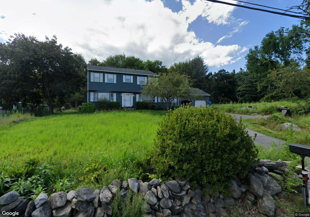
This home is located at 67 Taylor Rd, Acton, MA 01720 and is currently estimated at $720,591, approximately $545 per square foot. 67 Taylor Rd is a home located in Middlesex County with nearby schools including Acton-Boxborough Regional High School and Nashoba Brooks School.
Ownership History
Date
Name
Owned For
Owner Type
Purchase Details
Closed on
Jun 11, 2013
Sold by
Melon Francisco and Melon Linda S
Bought by
Melon Francisco
Current Estimated Value
Purchase Details
Closed on
Jun 1, 2009
Sold by
Argento-Perkins Maria
Bought by
Melon Francisco and Melon Linda S
Purchase Details
Closed on
Oct 11, 2006
Sold by
Int Dorothy M Dicicco and Dicicco Dorothy M
Bought by
Perkins Mark Argento
Home Financials for this Owner
Home Financials are based on the most recent Mortgage that was taken out on this home.
Original Mortgage
$245,000
Interest Rate
6.47%
Mortgage Type
Purchase Money Mortgage
Create a Home Valuation Report for This Property
The Home Valuation Report is an in-depth analysis detailing your home's value as well as a comparison with similar homes in the area
Home Values in the Area
Average Home Value in this Area
Purchase History
| Date | Buyer | Sale Price | Title Company |
|---|---|---|---|
| Melon Francisco | -- | -- | |
| Melon Francisco | $335,000 | -- | |
| Perkins Mark Argento | $325,000 | -- |
Source: Public Records
Mortgage History
| Date | Status | Borrower | Loan Amount |
|---|---|---|---|
| Previous Owner | Perkins Mark Argento | $245,000 |
Source: Public Records
Tax History
| Year | Tax Paid | Tax Assessment Tax Assessment Total Assessment is a certain percentage of the fair market value that is determined by local assessors to be the total taxable value of land and additions on the property. | Land | Improvement |
|---|---|---|---|---|
| 2025 | $11,115 | $648,100 | $313,700 | $334,400 |
| 2024 | $10,547 | $632,700 | $313,700 | $319,000 |
| 2023 | $10,067 | $573,300 | $285,100 | $288,200 |
| 2022 | $10,184 | $523,600 | $247,800 | $275,800 |
| 2021 | $9,725 | $480,700 | $229,600 | $251,100 |
| 2020 | $9,112 | $473,600 | $229,600 | $244,000 |
| 2019 | $8,684 | $448,300 | $229,600 | $218,700 |
| 2018 | $7,868 | $406,000 | $229,600 | $176,400 |
| 2017 | $7,738 | $406,000 | $229,600 | $176,400 |
| 2016 | $7,375 | $383,500 | $229,600 | $153,900 |
| 2015 | $6,911 | $362,800 | $229,600 | $133,200 |
| 2014 | $6,942 | $356,900 | $229,600 | $127,300 |
Source: Public Records
Map
Nearby Homes
- 67 Taylor Rd Unit 67
- 65 Taylor Rd
- 68 Taylor Rd
- 69 Taylor Rd
- 66 Taylor Rd
- 70 Taylor Rd
- 70 Taylor Rd Unit 70
- 2 Partridge Pond Rd
- 2 Partridge Pond Rd Unit 2
- 73 Taylor Rd
- 4 Partridge Pond Rd
- 74 Taylor Rd
- 75 Taylor Rd
- 62 Taylor Rd
- 41 Minot Ave
- 43 Minot Ave
- 49 Taylor Rd
- 81 Taylor Rd
- 52 Taylor Rd
- 52 Taylor Rd Unit 52
Your Personal Tour Guide
Ask me questions while you tour the home.