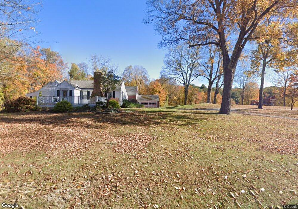
67 Todd Rd Wolcott, CT 06716
Estimated Value: $367,000 - $495,000
3
Beds
2
Baths
2,468
Sq Ft
$181/Sq Ft
Est. Value
About This Home
This home is located at 67 Todd Rd, Wolcott, CT 06716 and is currently estimated at $445,619, approximately $180 per square foot. 67 Todd Rd is a home located in New Haven County with nearby schools including Tyrrell Middle School and Wolcott High School.
Ownership History
Date
Name
Owned For
Owner Type
Purchase Details
Closed on
Apr 14, 2025
Sold by
Emanuel Thomas
Bought by
Thomas J Emanuel Jr Irt and Emanual
Current Estimated Value
Purchase Details
Closed on
Feb 4, 2015
Sold by
Mancinone Alan
Bought by
Hauslaib Alexis L
Purchase Details
Closed on
Aug 27, 1962
Bought by
Emanuel Lorraine M
Create a Home Valuation Report for This Property
The Home Valuation Report is an in-depth analysis detailing your home's value as well as a comparison with similar homes in the area
Home Values in the Area
Average Home Value in this Area
Purchase History
| Date | Buyer | Sale Price | Title Company |
|---|---|---|---|
| Thomas J Emanuel Jr Irt | -- | None Available | |
| Emanuel Thomas | -- | None Available | |
| Emanuel Thomas | -- | None Available | |
| Hauslaib Alexis L | -- | -- | |
| Hauslaib Alexis L | -- | -- | |
| Emanuel Lorraine M | -- | -- |
Source: Public Records
Mortgage History
| Date | Status | Borrower | Loan Amount |
|---|---|---|---|
| Previous Owner | Emanuel Lorraine M | $250,000 |
Source: Public Records
Tax History
| Year | Tax Paid | Tax Assessment Tax Assessment Total Assessment is a certain percentage of the fair market value that is determined by local assessors to be the total taxable value of land and additions on the property. | Land | Improvement |
|---|---|---|---|---|
| 2025 | $7,906 | $220,040 | $56,820 | $163,220 |
| 2024 | $7,277 | $220,040 | $56,820 | $163,220 |
| 2023 | $7,013 | $220,040 | $56,820 | $163,220 |
| 2022 | $6,777 | $220,040 | $56,820 | $163,220 |
| 2021 | $6,593 | $198,950 | $54,300 | $144,650 |
| 2020 | $6,593 | $198,950 | $54,300 | $144,650 |
| 2019 | $6,593 | $198,950 | $54,300 | $144,650 |
| 2018 | $6,406 | $198,950 | $54,300 | $144,650 |
| 2017 | $6,221 | $198,950 | $54,300 | $144,650 |
| 2016 | $6,240 | $215,850 | $57,740 | $158,110 |
| 2015 | $6,061 | $215,850 | $57,740 | $158,110 |
| 2014 | $5,865 | $215,850 | $57,740 | $158,110 |
Source: Public Records
Map
Nearby Homes
- 0 Woodtick Rd Unit 24119429
- 00 Woodtick Rd
- 20 Wolf Hill Rd Unit 1A
- 3 Pimlico Rd
- 47 Arvida Rd
- 210 Munson Rd Unit 2-D
- 210 Munson Rd Unit 1-H
- 210 Munson Rd Unit 1-F
- 210 Munson Rd Unit 2-F
- 210 Munson Rd Unit 1B
- 210 Munson Rd Unit 1-E
- 210 Munson Rd Unit 1-G
- 210 Munson Rd Unit 1-A
- 210 Munson Rd Unit 1D
- 210 Munson Rd Unit 2-G
- 210 Munson Rd Unit 2-C
- 210 Munson Rd Unit 2-E
- 210 Munson Rd Unit 1-C
- 0 Arvida Rd Unit 24054898
- 143 Bound Line Rd
Your Personal Tour Guide
Ask me questions while you tour the home.