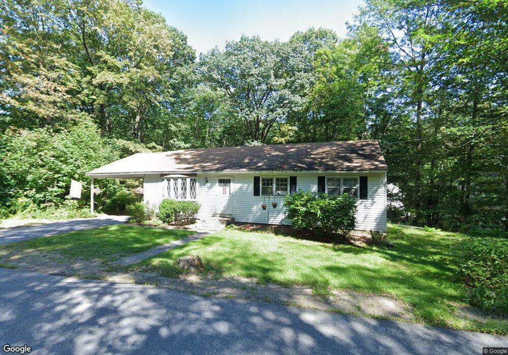
67 Town Farm Rd Westminster, MA 01473
Estimated Value: $408,000 - $546,000
About This Home
This home is located at 67 Town Farm Rd, Westminster, MA 01473 and is currently estimated at $458,897, approximately $356 per square foot. 67 Town Farm Rd is a home located in Worcester County with nearby schools including Oakmont Regional High School.
Ownership History
We collect this data history from publicly available records. To have your information removed, we recommend requesting removal directly through your county’s website.
Purchase Details
Home Values in the Area
Average Home Value in this Area
Purchase History
We collect this data history from publicly available records. To have your information removed, we recommend requesting removal directly through your county’s website.
| Date | Buyer | Sale Price | Title Company |
|---|---|---|---|
| $38,000 | -- |
Mortgage History
We collect this data history from publicly available records. To have your information removed, we recommend requesting removal directly through your county’s website.
| Date | Status | Borrower | Loan Amount |
|---|---|---|---|
| Open | $71,105 | ||
| Closed | $105,000 |
Tax History
We collect this data history from publicly available records. To have your information removed, we recommend requesting removal directly through your county’s website.
| Year | Tax Paid | Tax Assessment Tax Assessment Total Assessment is a certain percentage of the fair market value that is determined by local assessors to be the total taxable value of land and additions on the property. | Land | Improvement |
|---|---|---|---|---|
| 2025 | $3,910 | $317,900 | $121,600 | $196,300 |
| 2024 | $3,758 | $306,500 | $121,600 | $184,900 |
| 2023 | $3,752 | $287,300 | $112,300 | $175,000 |
| 2022 | $3,778 | $239,100 | $97,700 | $141,400 |
| 2021 | $3,707 | $221,200 | $86,400 | $134,800 |
| 2020 | $3,601 | $205,200 | $78,400 | $126,800 |
| 2019 | $3,497 | $191,600 | $64,800 | $126,800 |
| 2018 | $3,378 | $182,100 | $64,800 | $117,300 |
| 2017 | $3,312 | $182,100 | $64,800 | $117,300 |
| 2016 | $3,198 | $170,300 | $53,900 | $116,400 |
| 2015 | $3,079 | $162,500 | $53,900 | $108,600 |
| 2014 | $3,084 | $162,500 | $53,900 | $108,600 |
Map
- 18 N Common Rd
- 39 N Common Rd
- 2 Roberts Way
- 108 Town Farm Rd
- 1 Newcomb Rd
- 0 Syd Smith Rd Unit 73395578
- 0 Syd Smith Rd (Rear)
- 0 Syd Smith Rd Map 71 Lot 4-2
- 0
- 61 Newcomb Rd
- 9 Syd Smith Rd
- 17 Leominster St
- 7 Brooks Ave
- 5 Blueberry Hill Ln
- 0 Knower Rd
- 9 Knower Rd
- Lot 0 Narrows Rd
- 3 Linda Dr
- 5 Fenno Dr
- 0 Bean Porridge Hill Rd
- 53 Town Farm Rd
- 71 Town Farm Rd
- 49 Town Farm Rd
- 49 Town Farm Rd
- 50 Town Farm Rd Unit 60
- 47 Town Farm Rd
- 80 Town Farm Rd
- Lots 1-5 State Rd W
- L-101& 102 Route 140
- Lot 26 Rock Maple Ln
- Lot43 Kimberly Ln Unit Ashby
- Lot41 Kimberly Ln Unit Littleton
- Lot56 Heritage Ln Unit Harvard
- Lot 17 Rock Maple Ln
- Lot38 Kimberly Ln Unit Littleton
- Lot35 Old Mill Cir Unit Harvard
- Lot56 Heritage Ln Unit Ashby
- 51 Town Farm Rd
- 45 Town Farm Rd
- 46 Town Farm Rd
Ask me questions while you tour the home.