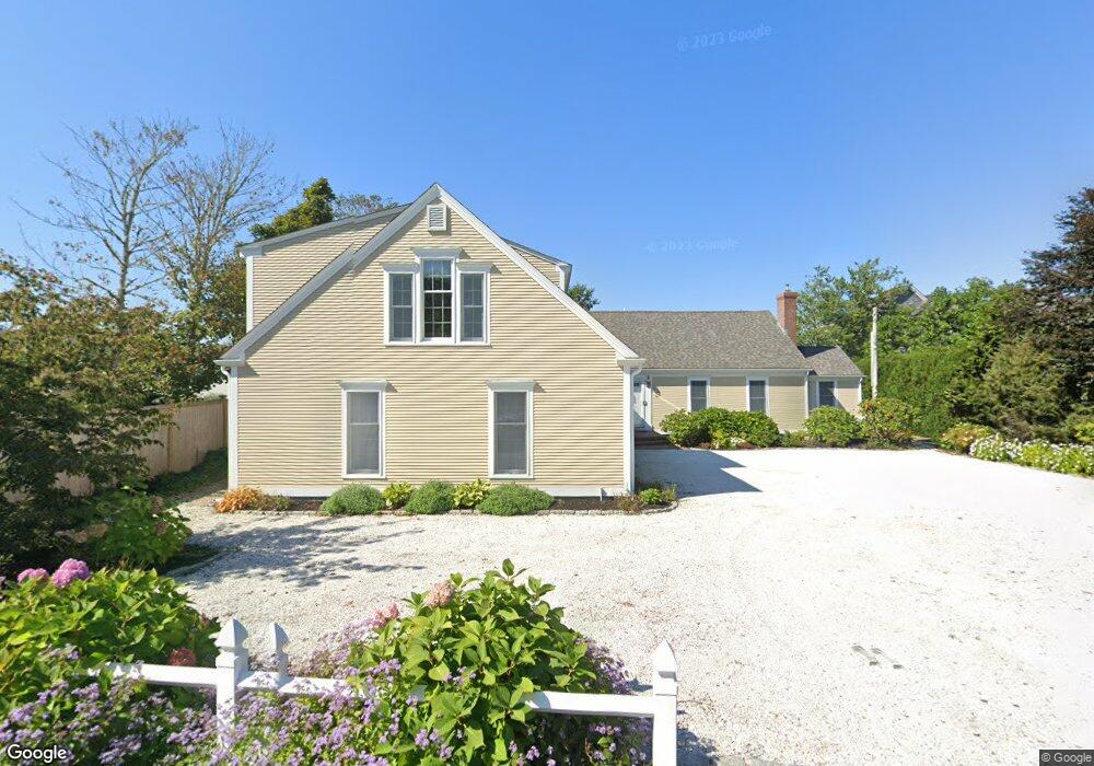
67 Uncle Barneys Rd West Dennis, MA 02670
West Dennis NeighborhoodEstimated Value: $2,661,000 - $3,384,441
4
Beds
4
Baths
3,979
Sq Ft
$760/Sq Ft
Est. Value
About This Home
This home is located at 67 Uncle Barneys Rd, West Dennis, MA 02670 and is currently estimated at $3,022,721, approximately $759 per square foot. 67 Uncle Barneys Rd is a home located in Barnstable County with nearby schools including Dennis-Yarmouth Regional High School and St. Pius X. School.
Ownership History
Date
Name
Owned For
Owner Type
Purchase Details
Closed on
Aug 27, 2018
Sold by
Malzone Louis F and Malzone Jeaninne I
Bought by
Uncle Barneys 2011 Rt
Current Estimated Value
Purchase Details
Closed on
Jun 13, 2018
Sold by
Uncle Barneys 2011 Rt
Bought by
Malzone Jeannine I and Malzone Louis F
Home Financials for this Owner
Home Financials are based on the most recent Mortgage that was taken out on this home.
Original Mortgage
$300,000
Interest Rate
4.5%
Mortgage Type
New Conventional
Purchase Details
Closed on
Jan 4, 2012
Sold by
Malzone Louis F and Malzone Jeannine I
Bought by
Uncle Barneys 2011 Rt
Create a Home Valuation Report for This Property
The Home Valuation Report is an in-depth analysis detailing your home's value as well as a comparison with similar homes in the area
Home Values in the Area
Average Home Value in this Area
Purchase History
| Date | Buyer | Sale Price | Title Company |
|---|---|---|---|
| Uncle Barneys 2011 Rt | -- | -- | |
| Malzone Jeannine I | -- | -- | |
| Uncle Barneys 2011 Rt | -- | -- |
Source: Public Records
Mortgage History
| Date | Status | Borrower | Loan Amount |
|---|---|---|---|
| Previous Owner | Malzone Jeannine I | $300,000 | |
| Previous Owner | Uncle Barneys 2011 Rt | $136,000 | |
| Previous Owner | Uncle Barneys 2011 Rt | $150,000 |
Source: Public Records
Tax History Compared to Growth
Tax History
| Year | Tax Paid | Tax Assessment Tax Assessment Total Assessment is a certain percentage of the fair market value that is determined by local assessors to be the total taxable value of land and additions on the property. | Land | Improvement |
|---|---|---|---|---|
| 2025 | $12,896 | $2,978,200 | $1,524,300 | $1,453,900 |
| 2024 | $12,611 | $2,872,700 | $1,465,900 | $1,406,800 |
| 2023 | $11,533 | $2,469,700 | $1,199,300 | $1,270,400 |
| 2022 | $10,609 | $1,894,400 | $926,100 | $968,300 |
| 2021 | $10,293 | $1,707,000 | $907,800 | $799,200 |
| 2020 | $9,744 | $1,597,400 | $823,100 | $774,300 |
| 2019 | $9,339 | $1,513,600 | $807,000 | $706,600 |
| 2018 | $9,216 | $1,453,600 | $768,200 | $685,400 |
| 2017 | $8,940 | $1,453,600 | $768,200 | $685,400 |
| 2016 | $9,453 | $1,447,600 | $853,000 | $594,600 |
| 2015 | $9,265 | $1,447,600 | $853,000 | $594,600 |
| 2014 | $9,089 | $1,431,400 | $853,000 | $578,400 |
Source: Public Records
Map
Nearby Homes
- 308 Old Main St
- 2 Rita Mary Way
- 14 Schoolhouse Ln
- 45 Seth Ln
- 209 Main St Unit 3
- 209 Main St Unit 6
- 209 Main St Unit 1
- 209 Main St Unit 2
- 209 Main St Unit 4
- 209 Main St Unit 5
- 40 Kelley Rd
- 29 Bass River Rd
- 23 Doric Ave
- 181 Pleasant St
- 18 Turner Ln
- 22 Powhatan Rd
- 116 N Main St
- 15 Sharon Rd
- 178 School St
- 401 Main St Unit 201
- 63 Uncle Barneys Rd
- 73 Uncle Barneys Rd
- 63 Uncle Barney's Rd
- 62 Uncle Barney's
- 68 Uncle Barneys Rd
- 62 Uncle Barneys Rd
- 60 Uncle Barneys Rd
- 74 Uncle Barneys Rd
- 57 Uncle Barneys Rd
- 56 Uncle Barneys Rd
- 81 Uncle Barneys Rd
- 82 Uncle Barneys Rd
- 28 Uncle Johns Rd
- 48 Uncle Barneys Rd
- 48 Uncle Stevens Rd
- 52 Uncle Barneys Rd
- 17 Home Acres
- 37 Uncle Johns Rd
- 11 Debra Way
- 45 Uncle Barneys Rd