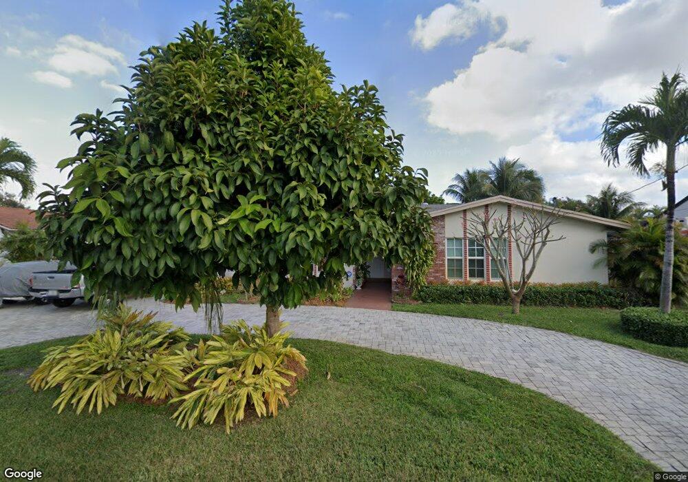
67 W Palm Dr Margate, FL 33063
Estimated Value: $567,000 - $604,000
3
Beds
2
Baths
2,353
Sq Ft
$249/Sq Ft
Est. Value
About This Home
This home is located at 67 W Palm Dr, Margate, FL 33063 and is currently estimated at $584,925, approximately $248 per square foot. 67 W Palm Dr is a home located in Broward County with nearby schools including Liberty Elementary School, Margate Middle School, and Coconut Creek High School.
Ownership History
Date
Name
Owned For
Owner Type
Purchase Details
Closed on
Dec 27, 2004
Sold by
Laxton Robert D and Laxton Cindy S
Bought by
Walters Clive A and Walters Fredericka R
Current Estimated Value
Home Financials for this Owner
Home Financials are based on the most recent Mortgage that was taken out on this home.
Original Mortgage
$216,000
Outstanding Balance
$101,547
Interest Rate
5.12%
Mortgage Type
Purchase Money Mortgage
Estimated Equity
$483,378
Purchase Details
Closed on
Jul 7, 2000
Sold by
Kirkegard Lars C and Kirkegard Irene C
Bought by
Laxton Robert D and Laxton Cindy S
Create a Home Valuation Report for This Property
The Home Valuation Report is an in-depth analysis detailing your home's value as well as a comparison with similar homes in the area
Purchase History
| Date | Buyer | Sale Price | Title Company |
|---|---|---|---|
| Walters Clive A | $270,000 | -- | |
| Laxton Robert D | $148,000 | -- |
Source: Public Records
Mortgage History
| Date | Status | Borrower | Loan Amount |
|---|---|---|---|
| Open | Walters Clive A | $216,000 | |
| Previous Owner | Laxton Robert D | $36,000 |
Source: Public Records
Tax History
| Year | Tax Paid | Tax Assessment Tax Assessment Total Assessment is a certain percentage of the fair market value that is determined by local assessors to be the total taxable value of land and additions on the property. | Land | Improvement |
|---|---|---|---|---|
| 2026 | $2,718 | $154,790 | -- | -- |
| 2025 | $2,645 | $154,790 | -- | -- |
| 2024 | $2,581 | $150,430 | -- | -- |
| 2023 | $2,581 | $146,050 | $0 | $0 |
| 2022 | $2,452 | $141,800 | $0 | $0 |
| 2021 | $2,380 | $137,670 | $0 | $0 |
| 2020 | $2,336 | $135,770 | $0 | $0 |
| 2019 | $2,289 | $132,720 | $0 | $0 |
| 2018 | $2,148 | $130,250 | $0 | $0 |
| 2017 | $2,120 | $127,580 | $0 | $0 |
| 2016 | $2,034 | $124,960 | $0 | $0 |
| 2015 | $2,083 | $124,100 | $0 | $0 |
| 2014 | $2,091 | $123,120 | $0 | $0 |
| 2013 | -- | $132,380 | $37,210 | $95,170 |
Source: Public Records
Map
Nearby Homes
- 65 W Palm Dr
- 137 E Palm Dr
- 5546 W Lakewood Cir
- 5515 Lakewood Cir N Unit 125
- 5550 Lakewood Cir S Unit A
- 160 NW 60th Ave Unit 63
- 5544 Lakewood Cir S Unit E
- 6006 NW 3rd St
- 6008 NW 3rd St
- 6014 NW 3rd St
- 6120 NW 2nd St
- 0 NW 4th St
- 6200 W Atlantic Blvd
- 5571 Lakeside Dr Unit 203
- 5641 SW 2nd Ct Unit 210
- 5661 SW 2nd Ct Unit 216
- 5661 SW 2nd Ct Unit 101
- 5681 SW 2nd Ct Unit 205
- 5681 SW 2nd Ct Unit 204
- 5681 SW 2nd Ct Unit 117
Your Personal Tour Guide
Ask me questions while you tour the home.