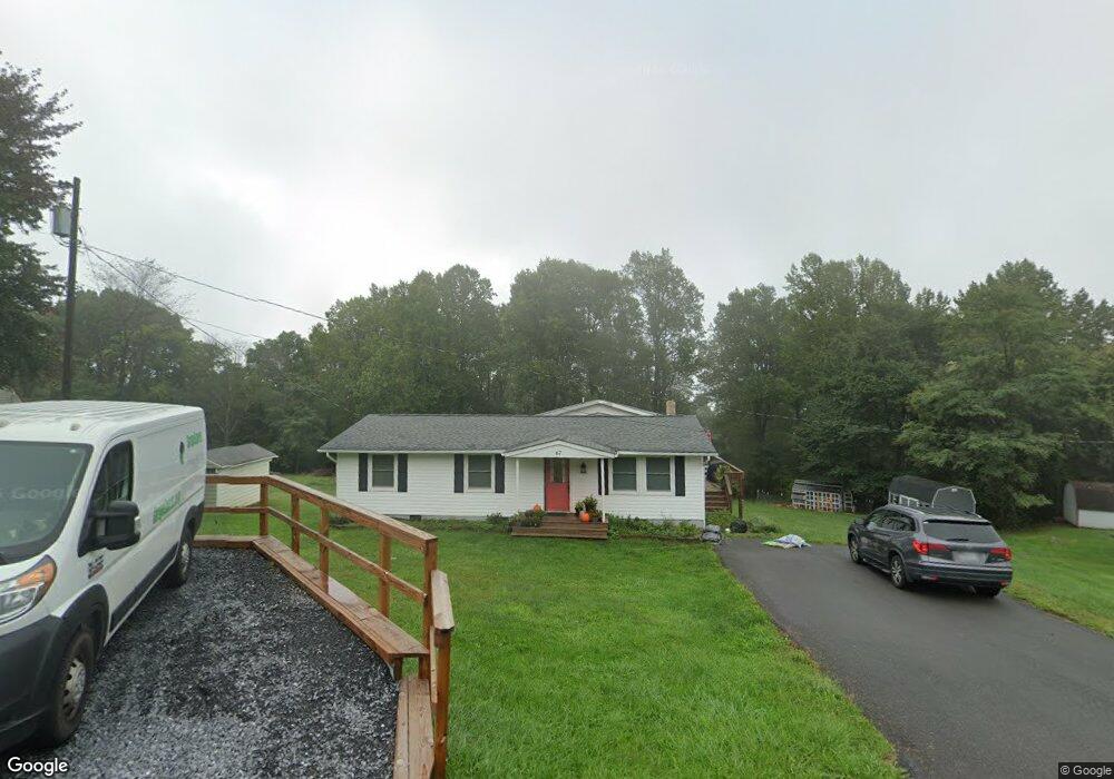
67 Waterfall Rd Chester Gap, VA 22623
Estimated Value: $334,000 - $397,000
4
Beds
3
Baths
1,632
Sq Ft
$223/Sq Ft
Est. Value
About This Home
This home is located at 67 Waterfall Rd, Chester Gap, VA 22623 and is currently estimated at $363,221, approximately $222 per square foot. 67 Waterfall Rd is a home located in Rappahannock County with nearby schools including Rappahannock County Elementary School and Rappahannock County High School.
Ownership History
Date
Name
Owned For
Owner Type
Purchase Details
Closed on
May 23, 2005
Sold by
Furlado Thomas J and Furlado Christina S
Bought by
Sladky Joseph F and Sladky Jeanette
Current Estimated Value
Home Financials for this Owner
Home Financials are based on the most recent Mortgage that was taken out on this home.
Original Mortgage
$118,000
Outstanding Balance
$65,540
Interest Rate
6.87%
Mortgage Type
New Conventional
Estimated Equity
$297,681
Create a Home Valuation Report for This Property
The Home Valuation Report is an in-depth analysis detailing your home's value as well as a comparison with similar homes in the area
Purchase History
| Date | Buyer | Sale Price | Title Company |
|---|---|---|---|
| Sladky Joseph F | $147,500 | None Available |
Source: Public Records
Mortgage History
| Date | Status | Borrower | Loan Amount |
|---|---|---|---|
| Open | Sladky Joseph F | $118,000 |
Source: Public Records
Tax History
| Year | Tax Paid | Tax Assessment Tax Assessment Total Assessment is a certain percentage of the fair market value that is determined by local assessors to be the total taxable value of land and additions on the property. | Land | Improvement |
|---|---|---|---|---|
| 2025 | $1,671 | $265,300 | $35,000 | $230,300 |
| 2024 | $1,618 | $265,300 | $35,000 | $230,300 |
| 2023 | $1,618 | $265,300 | $35,000 | $230,300 |
| 2022 | $1,592 | $265,300 | $35,000 | $230,300 |
| 2021 | $1,029 | $141,000 | $30,000 | $111,000 |
| 2020 | $1,029 | $141,000 | $30,000 | $111,000 |
| 2019 | $1,029 | $141,000 | $30,000 | $111,000 |
| 2018 | $987 | $141,000 | $30,000 | $111,000 |
| 2017 | $987 | $0 | $0 | $0 |
| 2016 | $987 | $141,000 | $0 | $0 |
| 2015 | -- | $171,100 | $36,700 | $134,400 |
| 2014 | -- | $171,100 | $36,700 | $134,400 |
Source: Public Records
Map
Nearby Homes
- 130 Highland Way
- 46 Rock Ridge Ln
- 0 0 Unit VARP2002068
- 139 Nez Perce Way
- 19 Highridge Rd
- 126 Locust Tree Ln
- Lot 22 Hickory Tree Rd
- 00 Hickory Tree Rd
- 14 Summit Point Dr
- Lot 33 Mountain Heights Rd
- 1170 Highridge Rd
- 0 Summit Point Dr
- 66 Bluejay Ct
- 400 Bluebird Way
- 402 Bluebird Way
- 83A Oriole Ct
- 0 High Top Rd Unit VAWR2012734
- 85 Oriole Way
- 83 Oriole Way
- 00 Corner of Brooklyn Road and Summit Point Dr
Your Personal Tour Guide
Ask me questions while you tour the home.