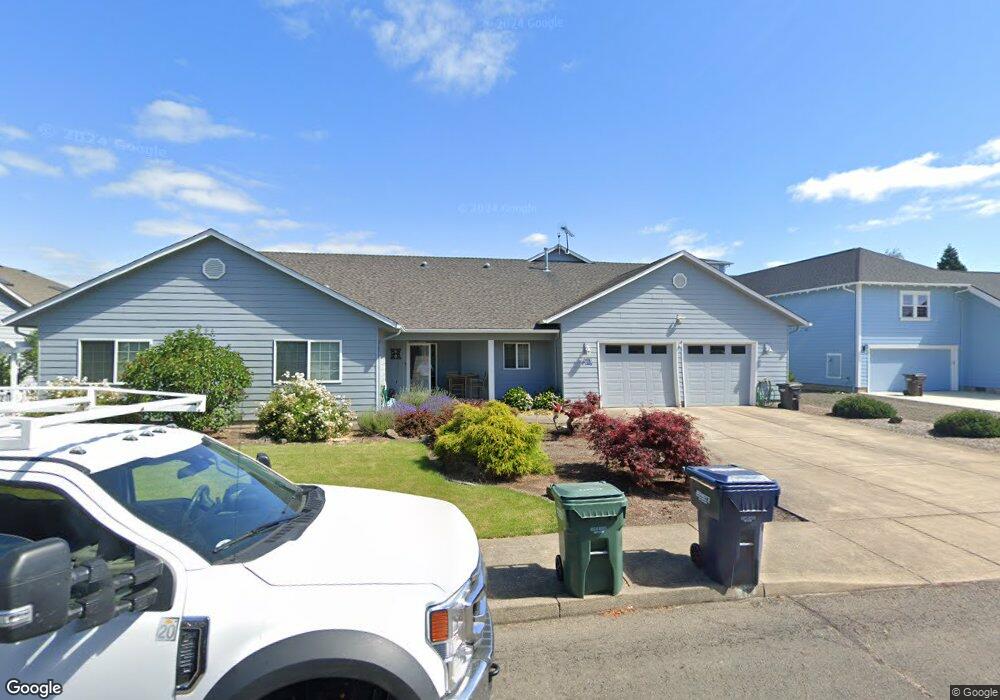
670 Airport Way Independence, OR 97351
Estimated Value: $617,000 - $683,000
2
Beds
3
Baths
1,806
Sq Ft
$358/Sq Ft
Est. Value
About This Home
This home is located at 670 Airport Way, Independence, OR 97351 and is currently estimated at $646,589, approximately $358 per square foot. 670 Airport Way is a home located in Polk County with nearby schools including Independence Elementary School, Talmadge Middle School, and Central High School.
Ownership History
Date
Name
Owned For
Owner Type
Purchase Details
Closed on
Sep 8, 2017
Sold by
Juve Richard G and Juve Deborah J
Bought by
Harrison Richard Bruce and Harrison Elizabeth
Current Estimated Value
Home Financials for this Owner
Home Financials are based on the most recent Mortgage that was taken out on this home.
Original Mortgage
$331,200
Outstanding Balance
$276,724
Interest Rate
3.92%
Mortgage Type
New Conventional
Estimated Equity
$369,865
Create a Home Valuation Report for This Property
The Home Valuation Report is an in-depth analysis detailing your home's value as well as a comparison with similar homes in the area
Home Values in the Area
Average Home Value in this Area
Purchase History
| Date | Buyer | Sale Price | Title Company |
|---|---|---|---|
| Harrison Richard Bruce | $414,000 | Ticor Title Company |
Source: Public Records
Mortgage History
| Date | Status | Borrower | Loan Amount |
|---|---|---|---|
| Open | Harrison Richard Bruce | $331,200 |
Source: Public Records
Tax History Compared to Growth
Tax History
| Year | Tax Paid | Tax Assessment Tax Assessment Total Assessment is a certain percentage of the fair market value that is determined by local assessors to be the total taxable value of land and additions on the property. | Land | Improvement |
|---|---|---|---|---|
| 2025 | $6,013 | $341,900 | $59,880 | $282,020 |
| 2024 | $6,013 | $331,950 | $58,130 | $273,820 |
| 2023 | $6,166 | $322,290 | $56,440 | $265,850 |
| 2022 | $5,661 | $312,910 | $54,800 | $258,110 |
| 2021 | $5,598 | $303,800 | $53,200 | $250,600 |
| 2020 | $5,452 | $294,960 | $51,650 | $243,310 |
| 2019 | $5,310 | $286,370 | $50,140 | $236,230 |
| 2018 | $5,141 | $278,030 | $48,680 | $229,350 |
| 2017 | $5,113 | $269,940 | $47,260 | $222,680 |
| 2016 | $5,207 | $262,080 | $45,880 | $216,200 |
| 2015 | $5,004 | $254,450 | $44,540 | $209,910 |
| 2014 | $4,897 | $247,040 | $43,240 | $203,800 |
Source: Public Records
Map
Nearby Homes
- 215 Polk St
- 1026 Sassafras St
- 212 Picture St
- 552 Log Cabin St
- 914 James St
- 941 Wild Rose Ct
- 8575 Hoffman Rd
- 1361 Marigold Dr
- 488 B St
- 470 N Gun Club Rd
- 320 N Gun Club Rd
- 544 C St
- 250 N Gun Club Rd
- 389 C St
- 144 S Main St
- 1555 Adams St
- 1220 Monmouth (Unit 12) St
- 275 Monmouth St
- 950 D St
- 89 S Gun Club Rd
- 710 Airport Way
- 650 Airport Way
- 730 Airport Way
- 630 Airport Way
- 663 Piper St
- 669 Airport Way
- 649 Airport Way
- 709 Airport Way
- 643 Piper St
- 629 Airport Way
- 623 Piper St
- 761 Piper St
- 610 Airport Way
- 729 Airport Way
- 750 Airport Way
- 613 Piper St
- 781 Piper St
- 749 Airport Way
- 609 Airport Way
- 780 Airport Way