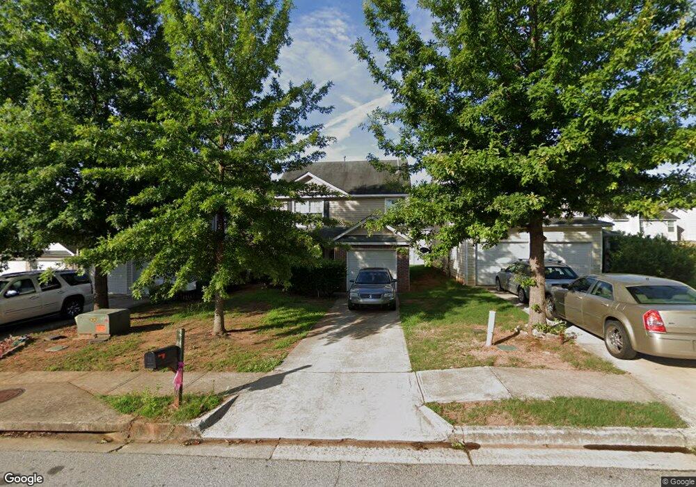
670 Barshay Dr Unit 1 Covington, GA 30016
Estimated Value: $224,490 - $251,000
--
Bed
2
Baths
1,660
Sq Ft
$145/Sq Ft
Est. Value
About This Home
This home is located at 670 Barshay Dr Unit 1, Covington, GA 30016 and is currently estimated at $241,123, approximately $145 per square foot. 670 Barshay Dr Unit 1 is a home located in Newton County with nearby schools including West Newton Elementary School, Clements Middle School, and Newton High School.
Ownership History
Date
Name
Owned For
Owner Type
Purchase Details
Closed on
May 7, 2007
Sold by
Legacy Cmntys Of Lakewood Est
Bought by
Bailey Dejanierra L
Current Estimated Value
Home Financials for this Owner
Home Financials are based on the most recent Mortgage that was taken out on this home.
Original Mortgage
$130,990
Outstanding Balance
$105,061
Interest Rate
6.11%
Mortgage Type
New Conventional
Estimated Equity
$136,062
Create a Home Valuation Report for This Property
The Home Valuation Report is an in-depth analysis detailing your home's value as well as a comparison with similar homes in the area
Home Values in the Area
Average Home Value in this Area
Purchase History
| Date | Buyer | Sale Price | Title Company |
|---|---|---|---|
| Bailey Dejanierra L | $131,000 | -- |
Source: Public Records
Mortgage History
| Date | Status | Borrower | Loan Amount |
|---|---|---|---|
| Open | Bailey Dejanierra L | $130,990 |
Source: Public Records
Tax History Compared to Growth
Tax History
| Year | Tax Paid | Tax Assessment Tax Assessment Total Assessment is a certain percentage of the fair market value that is determined by local assessors to be the total taxable value of land and additions on the property. | Land | Improvement |
|---|---|---|---|---|
| 2024 | $2,479 | $98,800 | $14,000 | $84,800 |
| 2023 | $2,345 | $87,560 | $4,800 | $82,760 |
| 2022 | $1,966 | $73,600 | $4,800 | $68,800 |
| 2021 | $1,932 | $65,160 | $4,800 | $60,360 |
| 2020 | $1,884 | $58,440 | $4,800 | $53,640 |
| 2019 | $1,566 | $48,280 | $4,800 | $43,480 |
| 2018 | $1,301 | $40,280 | $4,800 | $35,480 |
| 2017 | $1,152 | $35,960 | $4,800 | $31,160 |
| 2016 | $1,113 | $34,800 | $4,000 | $30,800 |
| 2015 | $848 | $26,880 | $4,000 | $22,880 |
| 2014 | $681 | $22,040 | $0 | $0 |
Source: Public Records
Map
Nearby Homes
- 675 Barshay Dr
- 3315 Salem Cove Trail SE
- 250 Lakeview Trail
- 165 Lakeside Point
- 80 Lakeview Trail
- 257 Pinewood Dr
- 30 Pinewood Dr
- 2177 E Chester Cir SE
- 1025 Lakeside Cir
- 3107 Salem Rd SE
- 2180 E Chester Cir SE
- 230 Forest Brook Dr
- 2075 Pinewood Dr
- 3380 Colony Dr SE
- 1052 Northfield Dr
- 6008 Pine Bluff Place
- 6009 Pine Bluff Place
- 660 Barshay Dr
- 690 Barshay Dr
- 650 Barshay Dr
- 730 Barshay Dr
- 170 Colser Dr Unit 1
- 180 Colser Dr
- 160 Colser Dr
- 190 Colser Dr Unit 1
- 150 Colser Dr
- 630 Barshay Dr
- 685 Barshay Dr
- 685 Barshay Dr
- 675 Barshay Dr Unit 1
- 140 Colser Dr Unit 1
- 665 Barshay Dr Unit 1
- 200 Colser Dr
- 620 Barshay Dr
- 655 Barshay Dr
- 210 Colser Dr
- 645 Barshay Dr