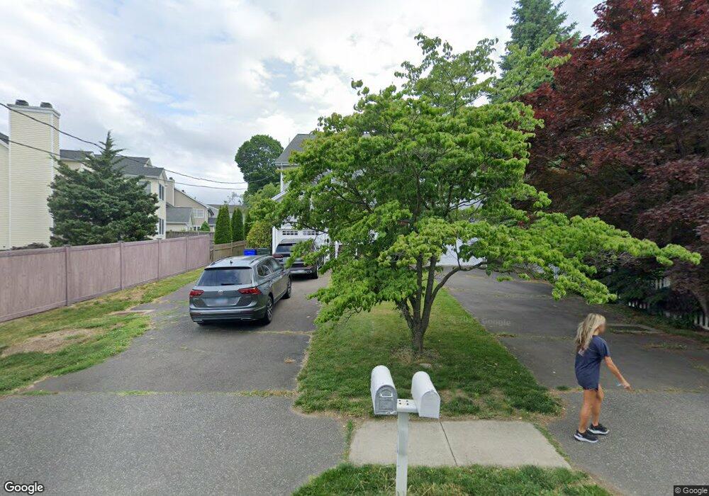
670 Kings Hwy W Southport, CT 06890
Southport NeighborhoodEstimated Value: $621,000 - $733,401
3
Beds
4
Baths
2,240
Sq Ft
$295/Sq Ft
Est. Value
About This Home
This home is located at 670 Kings Hwy W, Southport, CT 06890 and is currently estimated at $661,100, approximately $295 per square foot. 670 Kings Hwy W is a home located in Fairfield County with nearby schools including Mill Hill School, Roger Ludlowe Middle School, and Fairfield Ludlowe High School.
Ownership History
Date
Name
Owned For
Owner Type
Purchase Details
Closed on
Aug 2, 2022
Sold by
Stevens Lauren
Bought by
Evanko Donald J
Current Estimated Value
Purchase Details
Closed on
Oct 31, 2014
Sold by
Seymour Jeffrey
Bought by
Stevens Lauren
Purchase Details
Closed on
Sep 30, 2005
Sold by
Kardamis Constr
Bought by
Seymour Jeffrey
Home Financials for this Owner
Home Financials are based on the most recent Mortgage that was taken out on this home.
Original Mortgage
$488,000
Interest Rate
5.84%
Mortgage Type
Purchase Money Mortgage
Purchase Details
Closed on
Feb 11, 1997
Sold by
Krook K Christer
Bought by
Sabre Robert
Create a Home Valuation Report for This Property
The Home Valuation Report is an in-depth analysis detailing your home's value as well as a comparison with similar homes in the area
Home Values in the Area
Average Home Value in this Area
Purchase History
| Date | Buyer | Sale Price | Title Company |
|---|---|---|---|
| Evanko Donald J | $540,000 | None Available | |
| Evanko Donald J | $540,000 | None Available | |
| Evanko Donald J | $540,000 | None Available | |
| Stevens Lauren | $460,000 | -- | |
| Stevens Lauren | $460,000 | -- | |
| Seymour Jeffrey | $610,000 | -- | |
| Seymour Jeffrey | $610,000 | -- | |
| Sabre Robert | $30,000 | -- | |
| Sabre Robert | $30,000 | -- |
Source: Public Records
Mortgage History
| Date | Status | Borrower | Loan Amount |
|---|---|---|---|
| Previous Owner | Sabre Robert | $488,000 | |
| Previous Owner | Sabre Robert | $30,500 |
Source: Public Records
Tax History Compared to Growth
Tax History
| Year | Tax Paid | Tax Assessment Tax Assessment Total Assessment is a certain percentage of the fair market value that is determined by local assessors to be the total taxable value of land and additions on the property. | Land | Improvement |
|---|---|---|---|---|
| 2025 | $8,700 | $306,460 | $0 | $306,460 |
| 2024 | $8,550 | $306,460 | $0 | $306,460 |
| 2023 | $8,431 | $306,460 | $0 | $306,460 |
| 2022 | $8,348 | $306,460 | $0 | $306,460 |
| 2021 | $8,268 | $306,460 | $0 | $306,460 |
| 2020 | $8,263 | $308,420 | $0 | $308,420 |
| 2019 | $8,263 | $308,420 | $0 | $308,420 |
| 2018 | $8,130 | $308,420 | $0 | $308,420 |
| 2017 | $7,963 | $308,420 | $0 | $308,420 |
| 2016 | $7,849 | $308,420 | $0 | $308,420 |
| 2015 | $9,376 | $378,210 | $0 | $378,210 |
| 2014 | $9,228 | $378,210 | $0 | $378,210 |
Source: Public Records
Map
Nearby Homes
- 2 Elmwood Dr Unit 2
- 153 Pease Ave
- 305 S Gate Ln
- 944 Pequot Ave
- 844 Mill Hill Terrace
- 28 Mill Hill Rd Unit 28
- 260 Willow St
- 220 Lansdowne
- 125 Old Rd
- 53 Hilltop Dr
- 7 High Gate Rd
- 476 Mill Hill Terrace
- 342 Greens Farms Rd
- 1 Coastal Ct
- 107 Old Rd
- 36 Maple Ave S
- 100 Overhill Rd
- 1135 Mill Hill Rd
- 88 Overhill Rd
- 1213 Cedar Rd
- 670 Kings Hwy W
- 670 Kings Hwy W Unit 670
- 670 Kings Hwy W Unit 670
- 670 Kings Hwy W
- 670 Kings Hwy W Unit 670
- 10 Osborne Place
- 642 Kings Hwy W
- 20 Osborne Place
- 30 Osborne Place
- 56 Osborne Place
- 25 Taylor Place
- 26 Taylor Place
- 47 Taylor Place
- 63 Taylor Place
- 50 Osborne Place
- 3350 Post Rd
- 42 Osborne Place
- 15 Osborne Place
- 40 Taylor Place
- LOT 3C Kings Hwy W