Estimated Value: $286,000 - $373,921
3
Beds
2
Baths
2,968
Sq Ft
$111/Sq Ft
Est. Value
About This Home
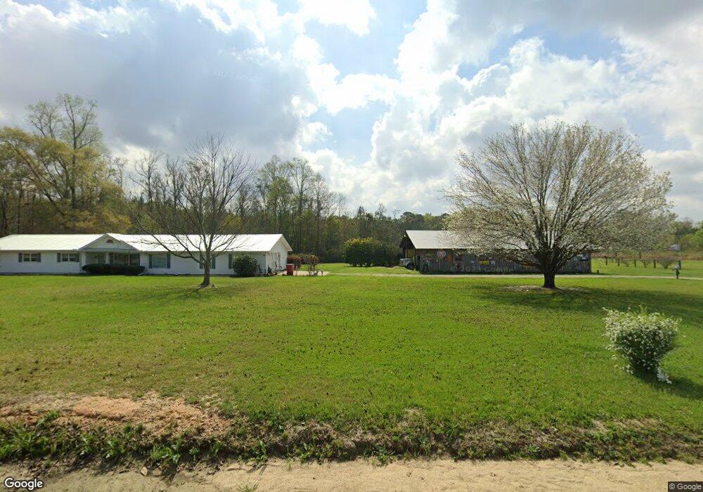
This home is located at 670 Stream Rd, Alma, GA 31510 and is currently estimated at $329,961, approximately $111 per square foot. 670 Stream Rd is a home located in Bacon County with nearby schools including Bacon County Primary School, Bacon County Elementary School, and Bacon County Middle School.
Ownership History
Date
Name
Owned For
Owner Type
Purchase Details
Closed on
Aug 28, 2013
Sold by
Southland Investment Co
Bought by
Hansley Robert B
Current Estimated Value
Home Financials for this Owner
Home Financials are based on the most recent Mortgage that was taken out on this home.
Original Mortgage
$92,381
Outstanding Balance
$22,466
Interest Rate
3.44%
Mortgage Type
New Conventional
Estimated Equity
$307,495
Purchase Details
Closed on
Aug 16, 2013
Sold by
Southland Investment Co
Bought by
Hensley Robert B
Home Financials for this Owner
Home Financials are based on the most recent Mortgage that was taken out on this home.
Original Mortgage
$92,381
Outstanding Balance
$22,466
Interest Rate
3.44%
Mortgage Type
New Conventional
Estimated Equity
$307,495
Purchase Details
Closed on
Jun 18, 2012
Sold by
Federal National Mortgage Association
Bought by
Southland Investment Co
Purchase Details
Closed on
Sep 6, 2011
Sold by
Lewis Roy B
Bought by
Federal National Mortgage Association
Create a Home Valuation Report for This Property
The Home Valuation Report is an in-depth analysis detailing your home's value as well as a comparison with similar homes in the area
Home Values in the Area
Average Home Value in this Area
Purchase History
| Date | Buyer | Sale Price | Title Company |
|---|---|---|---|
| Hansley Robert B | $61,200 | -- | |
| Hensley Robert B | $61,429 | -- | |
| Southland Investment Co | -- | -- | |
| Federal National Mortgage Association | $131,600 | -- |
Source: Public Records
Mortgage History
| Date | Status | Borrower | Loan Amount |
|---|---|---|---|
| Open | Hansley Robert B | $92,381 | |
| Closed | Hensley Robert B | $92,381 |
Source: Public Records
Tax History Compared to Growth
Tax History
| Year | Tax Paid | Tax Assessment Tax Assessment Total Assessment is a certain percentage of the fair market value that is determined by local assessors to be the total taxable value of land and additions on the property. | Land | Improvement |
|---|---|---|---|---|
| 2024 | $2,521 | $113,200 | $21,120 | $92,080 |
| 2023 | $2,412 | $105,280 | $21,120 | $84,160 |
| 2022 | $1,853 | $78,120 | $21,120 | $57,000 |
| 2021 | $1,745 | $73,920 | $21,120 | $52,800 |
| 2020 | $1,660 | $63,569 | $15,960 | $47,609 |
| 2019 | $1,659 | $63,569 | $15,960 | $47,609 |
| 2018 | $1,577 | $48,589 | $479 | $48,110 |
| 2017 | $1,462 | $50,893 | $479 | $50,414 |
| 2016 | $1,625 | $50,608 | $1,020 | $49,588 |
| 2015 | $1,509 | $51,012 | $1,020 | $49,991 |
| 2014 | $419 | $51,012 | $1,020 | $49,991 |
| 2013 | $419 | $34,842 | $930 | $33,912 |
Source: Public Records
Map
Nearby Homes
- 908 Bethel Freewill Rd
- T M Mims Rd
- 0 T M Mims Rd
- 0 Henry-Mimbs Rd Unit 10544748
- 00 Henry Mims Rd
- 151 Lake Gloria Ln
- 469 Dyal Rd
- Stewart Cemetery Rd
- 4th Street
- 00 Herrington Rd
- 0 Herrington Rd
- 0 Stewart Cemetery Rd
- 2648 Buck Head Rd
- 2612 Buck Head Rd
- W 4th St
- 4038 Lake Mayers Rd
- 235 S Fork Dr
- 0 Lake Mayers Rd Unit 23695
- 0 Lake Mayers Rd Unit 10628654
- 315 Crosby Chapel Rd