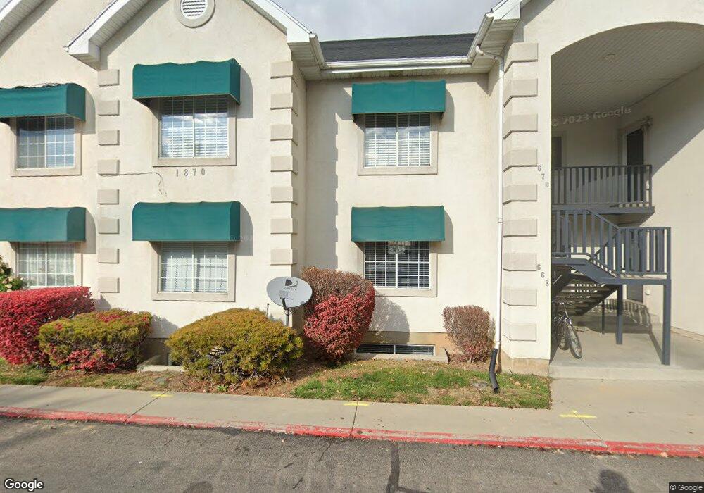
670 W 1870 N Orem, UT 84057
Aspen NeighborhoodEstimated Value: $330,000 - $380,000
2
Beds
1
Bath
1,575
Sq Ft
$226/Sq Ft
Est. Value
About This Home
This home is located at 670 W 1870 N, Orem, UT 84057 and is currently estimated at $355,733, approximately $225 per square foot. 670 W 1870 N is a home located in Utah County with nearby schools including Aspen Elementary School, Oak Canyon Junior High School, and Timpanogos High School.
Ownership History
Date
Name
Owned For
Owner Type
Purchase Details
Closed on
Apr 13, 2023
Sold by
Bataa Tushigsaikhan
Bought by
1870 North Orem Llc
Current Estimated Value
Purchase Details
Closed on
Jun 18, 2003
Sold by
Bataa Tushingsaikhan and Nurzed Bolorchimeg
Bought by
Bataa Tushigsaikhan and Nurzed Bolorchimeg
Home Financials for this Owner
Home Financials are based on the most recent Mortgage that was taken out on this home.
Original Mortgage
$113,854
Interest Rate
5.37%
Mortgage Type
FHA
Purchase Details
Closed on
Jan 25, 2002
Sold by
Tenney Ilene
Bought by
Bataa Tushings Aikhan and Nurzed Bolorchimeg
Home Financials for this Owner
Home Financials are based on the most recent Mortgage that was taken out on this home.
Original Mortgage
$113,878
Interest Rate
7.11%
Mortgage Type
FHA
Create a Home Valuation Report for This Property
The Home Valuation Report is an in-depth analysis detailing your home's value as well as a comparison with similar homes in the area
Home Values in the Area
Average Home Value in this Area
Purchase History
| Date | Buyer | Sale Price | Title Company |
|---|---|---|---|
| 1870 North Orem Llc | -- | None Listed On Document | |
| Bataa Tushigsaikhan | -- | First American Title Co | |
| Bataa Tushings Aikhan | -- | Access Title Company |
Source: Public Records
Mortgage History
| Date | Status | Borrower | Loan Amount |
|---|---|---|---|
| Previous Owner | Bataa Tushigsaikhan | $113,854 | |
| Previous Owner | Bataa Tushings Aikhan | $113,878 |
Source: Public Records
Tax History Compared to Growth
Tax History
| Year | Tax Paid | Tax Assessment Tax Assessment Total Assessment is a certain percentage of the fair market value that is determined by local assessors to be the total taxable value of land and additions on the property. | Land | Improvement |
|---|---|---|---|---|
| 2025 | $1,412 | $192,775 | $38,900 | $311,600 |
| 2024 | $1,461 | $172,645 | $0 | $0 |
| 2023 | $1,461 | $192,060 | $0 | $0 |
| 2022 | $1,434 | $182,545 | $0 | $0 |
| 2021 | $1,350 | $260,300 | $31,200 | $229,100 |
| 2020 | $1,226 | $232,400 | $27,900 | $204,500 |
| 2019 | $1,134 | $223,500 | $29,000 | $194,500 |
| 2018 | $1,089 | $205,000 | $25,000 | $180,000 |
| 2017 | $961 | $96,910 | $0 | $0 |
| 2016 | $440 | $88,110 | $0 | $0 |
| 2015 | $963 | $84,700 | $0 | $0 |
| 2014 | $886 | $77,550 | $0 | $0 |
Source: Public Records
Map
Nearby Homes
- 856 W 1840 N
- 1561 N 740 W
- 1991 N 920 W
- 613 W 1550 N
- 1545 N State St Unit 11
- 1482 N 550 St W Unit 18
- 1415 N 550 West St
- 697 W 1400 N
- 597 W 1400 N
- 1527 N 275 St W Unit 4
- 1543 N 275 St W Unit 2
- 1531 N 275 St W Unit 3
- 1570 N 275 St W
- 1557 N 275 St W Unit 1
- 1542 N 275 St W Unit 5
- 1556 N 275 St W Unit 5
- 1455 N Amiron Way Unit A
- 1438 N Amiron Way Unit B
- 1584 N 1150 W
- 582 W 1300 N
- 674 W 1870 N
- 672 W 1870 N Unit 3
- 674 W 1870 N Unit 9
- 668 W 1870 N
- 678 W 1870 N
- 676 W 1870 N
- 664 W 1870 N
- 662 W 1870 N
- 682 W 1870 N
- 680 W 1870 N
- 680 W 1870 N Unit 5
- 682 W 1870 N Unit 680
- 682 W 1870 N Unit 11
- 686 W 1870 N
- 684 W 1870 N
- 686 W 1870 N Unit 12
- 1846 N 680 W
- 1846 N 680 W Unit 9
- 1848 N 680 W
- 657 W 1870 N Unit 7