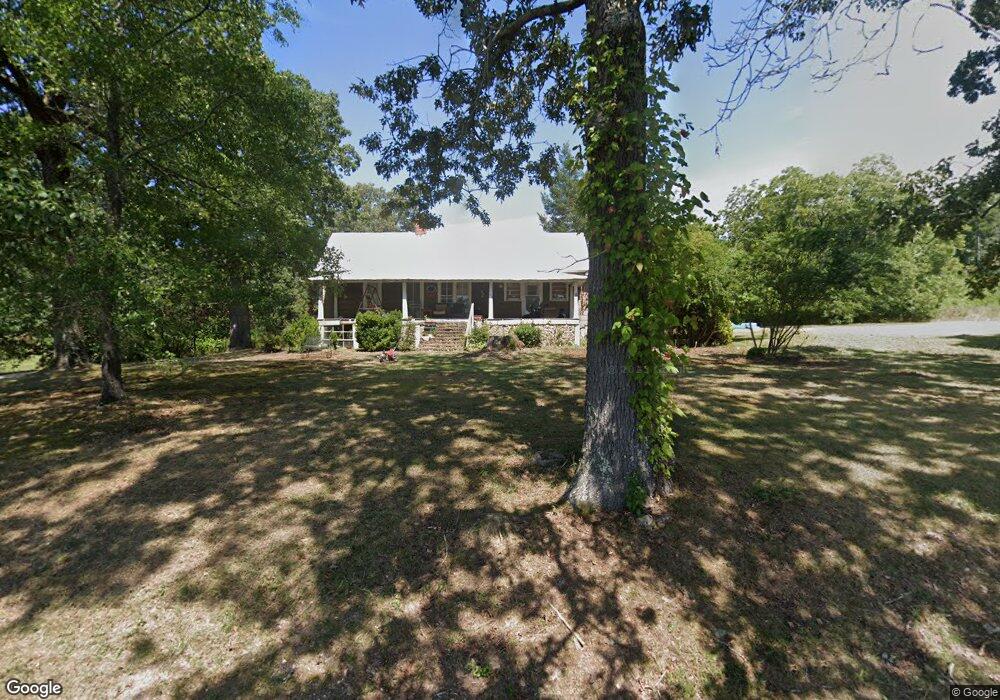
670 Worsham Rd Lyerly, GA 30730
Estimated Value: $399,000 - $567,899
--
Bed
1
Bath
1,958
Sq Ft
$241/Sq Ft
Est. Value
About This Home
This home is located at 670 Worsham Rd, Lyerly, GA 30730 and is currently estimated at $470,966, approximately $240 per square foot. 670 Worsham Rd is a home located in Chattooga County with nearby schools including Chattooga High School.
Ownership History
Date
Name
Owned For
Owner Type
Purchase Details
Closed on
Dec 31, 2011
Sold by
Worsham John Jerry
Bought by
Shelton Kenneth Joshua and Shelton April Worsham
Current Estimated Value
Purchase Details
Closed on
Feb 12, 2009
Sold by
Worsham John Jerry
Bought by
Worsham John Jerry
Home Financials for this Owner
Home Financials are based on the most recent Mortgage that was taken out on this home.
Original Mortgage
$174,000
Interest Rate
5.03%
Mortgage Type
New Conventional
Create a Home Valuation Report for This Property
The Home Valuation Report is an in-depth analysis detailing your home's value as well as a comparison with similar homes in the area
Home Values in the Area
Average Home Value in this Area
Purchase History
| Date | Buyer | Sale Price | Title Company |
|---|---|---|---|
| Shelton Kenneth Joshua | -- | -- | |
| Worsham John Jerry | -- | -- |
Source: Public Records
Mortgage History
| Date | Status | Borrower | Loan Amount |
|---|---|---|---|
| Previous Owner | Worsham John Jerry | $174,000 |
Source: Public Records
Tax History Compared to Growth
Tax History
| Year | Tax Paid | Tax Assessment Tax Assessment Total Assessment is a certain percentage of the fair market value that is determined by local assessors to be the total taxable value of land and additions on the property. | Land | Improvement |
|---|---|---|---|---|
| 2024 | $2,354 | $176,920 | $79,480 | $97,440 |
| 2023 | $2,854 | $176,920 | $79,480 | $97,440 |
| 2022 | $2,251 | $104,361 | $20,043 | $84,318 |
| 2021 | $1,791 | $77,944 | $16,070 | $61,874 |
| 2020 | $1,881 | $78,087 | $16,213 | $61,874 |
| 2019 | $1,927 | $78,087 | $16,213 | $61,874 |
| 2018 | $1,768 | $78,045 | $16,213 | $61,832 |
| 2017 | $1,858 | $78,045 | $16,213 | $61,832 |
| 2016 | $1,633 | $16,212 | $16,212 | $0 |
| 2015 | $1,352 | $78,812 | $16,212 | $62,600 |
| 2014 | $1,352 | $65,007 | $16,213 | $48,794 |
| 2013 | -- | $65,006 | $16,212 | $48,794 |
Source: Public Records
Map
Nearby Homes
- 8690 Silver Hill Rd
- 1217 Henderson Cir
- 2623 Big Texas Valley Rd NW
- 2077 Big Texas Valley Rd NW
- 1901 Big Texas Valley Rd NW
- 1825 Big Texas Valley Rd NW
- 664 Wiggins Rd
- 1638 Big Texas Valley Rd NW
- 1503 Taliaferro Springs Rd
- 2979 Big Texas Valley Rd NW
- 0 Tract 14 Unit 10476683
- 441 Lyerly Dam Rd
- 680 Fouche Gap Rd NW
- 0 Georgia 100
- 557 Acres On Taliaferro Springs Rd
- 0 Gaylor Rd Unit 22865068
- 0 Gaylor Rd Unit 10497505
- 0 Gaylor Rd Unit 10497539
- 386 Oak Grove Rd
- 0 Back Valley Rd Unit 25316915
- 94 Hughes Rd
- 192 Hughes Rd
- 805 Worsham Rd
- 160 Hughes Rd
- 876 Worsham Rd
- 1045 Lyerly Dam Rd
- 540 Worsham Rd
- 8675 Highway 100
- 56 Railroad St
- 78 Railroad St
- 9339 Highway 100
- 101 Holland Chattoogaville Rd
- 9355 Highway 100
- 9350 Georgia 100
- 9350 Highway 100
- 9350 Highway 100
- 9395 Georgia 100
- 9395 Highway 100
- 8641 Highway 100
- 312 Holland Chattoogaville Rd