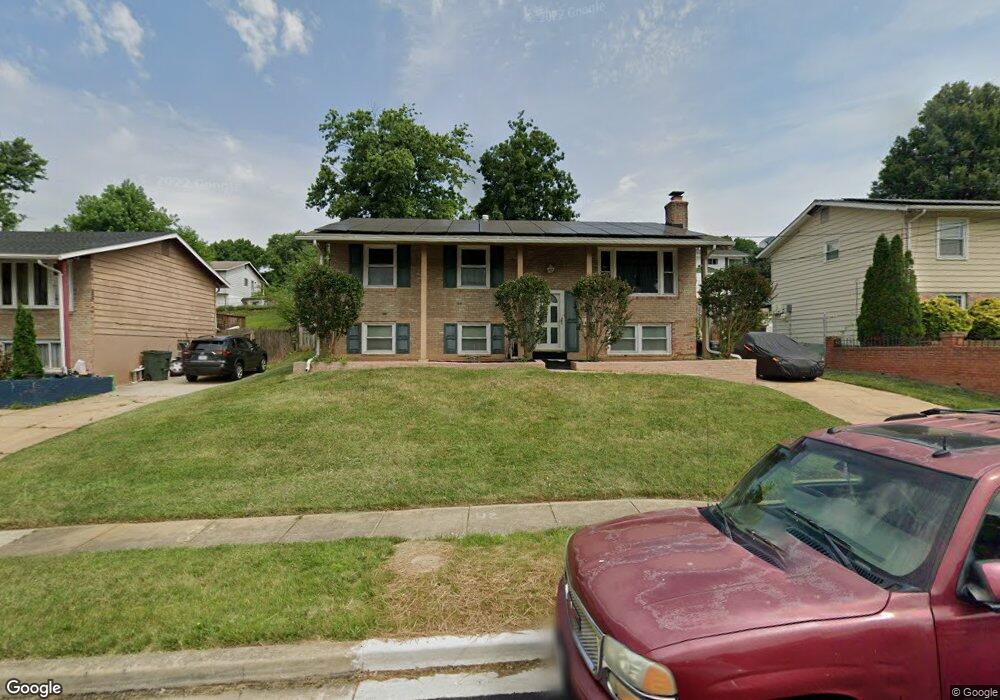
6700 Calmos St Capitol Heights, MD 20743
Estimated Value: $374,000 - $389,000
Studio
2
Baths
1,040
Sq Ft
$369/Sq Ft
Est. Value
About This Home
This home is located at 6700 Calmos St, Capitol Heights, MD 20743 and is currently estimated at $383,502, approximately $368 per square foot. 6700 Calmos St is a home located in Prince George's County with nearby schools including Carmody Hills Elementary School, G. James Gholson Middle School, and Central High School.
Ownership History
Date
Name
Owned For
Owner Type
Purchase Details
Closed on
Jun 16, 2003
Sold by
Hubbard Elsie M
Bought by
Brooks Robert L and Brooks Johnette L
Current Estimated Value
Purchase Details
Closed on
Jul 21, 1994
Sold by
Tiwari Muneshwar D
Bought by
Hubbard Elsie M
Home Financials for this Owner
Home Financials are based on the most recent Mortgage that was taken out on this home.
Original Mortgage
$125,665
Interest Rate
8.19%
Purchase Details
Closed on
Feb 16, 1990
Sold by
Blair Billy
Bought by
Tiwari Muneshwar D and Tiwari Karamdai
Create a Home Valuation Report for This Property
The Home Valuation Report is an in-depth analysis detailing your home's value as well as a comparison with similar homes in the area
Home Values in the Area
Average Home Value in this Area
Purchase History
| Date | Buyer | Sale Price | Title Company |
|---|---|---|---|
| Brooks Robert L | $169,500 | -- | |
| Hubbard Elsie M | $126,500 | -- | |
| Tiwari Muneshwar D | $105,000 | -- |
Source: Public Records
Mortgage History
| Date | Status | Borrower | Loan Amount |
|---|---|---|---|
| Previous Owner | Hubbard Elsie M | $125,665 |
Source: Public Records
Tax History
| Year | Tax Paid | Tax Assessment Tax Assessment Total Assessment is a certain percentage of the fair market value that is determined by local assessors to be the total taxable value of land and additions on the property. | Land | Improvement |
|---|---|---|---|---|
| 2025 | $4,068 | $341,533 | -- | -- |
| 2024 | $4,068 | $317,867 | -- | -- |
| 2023 | $3,890 | $294,200 | $60,600 | $233,600 |
| 2022 | $3,717 | $278,800 | $0 | $0 |
| 2021 | $3,548 | $263,400 | $0 | $0 |
| 2020 | $3,455 | $248,000 | $45,300 | $202,700 |
| 2019 | $3,384 | $240,933 | $0 | $0 |
| 2018 | $3,297 | $233,867 | $0 | $0 |
| 2017 | $3,228 | $226,800 | $0 | $0 |
| 2016 | -- | $213,167 | $0 | $0 |
| 2015 | $3,034 | $199,533 | $0 | $0 |
| 2014 | $3,034 | $185,900 | $0 | $0 |
Source: Public Records
Map
Nearby Homes
- 6610 Arlene Dr
- 30 Arenas Ct
- 6706 Central Ave
- 120 W Mill Ave
- 6515 Adak St
- 6415 Valley Park Rd
- 16 Daimler Dr Unit 62
- 6420 Valley Park Rd
- 304 Cedarleaf Ave
- 6915 Adel St
- 6615 Valley Park Rd
- 405 Birchleaf Ave
- 6902 Adel St
- 418 Cedarleaf Ave
- 600 Goldleaf Ave
- 510 Dateleaf Ave
- 209 Addison Rd S
- 310 70th Place
- 611 Fernleaf Ave
- 6509 Seat Pleasant Dr
Your Personal Tour Guide
Ask me questions while you tour the home.