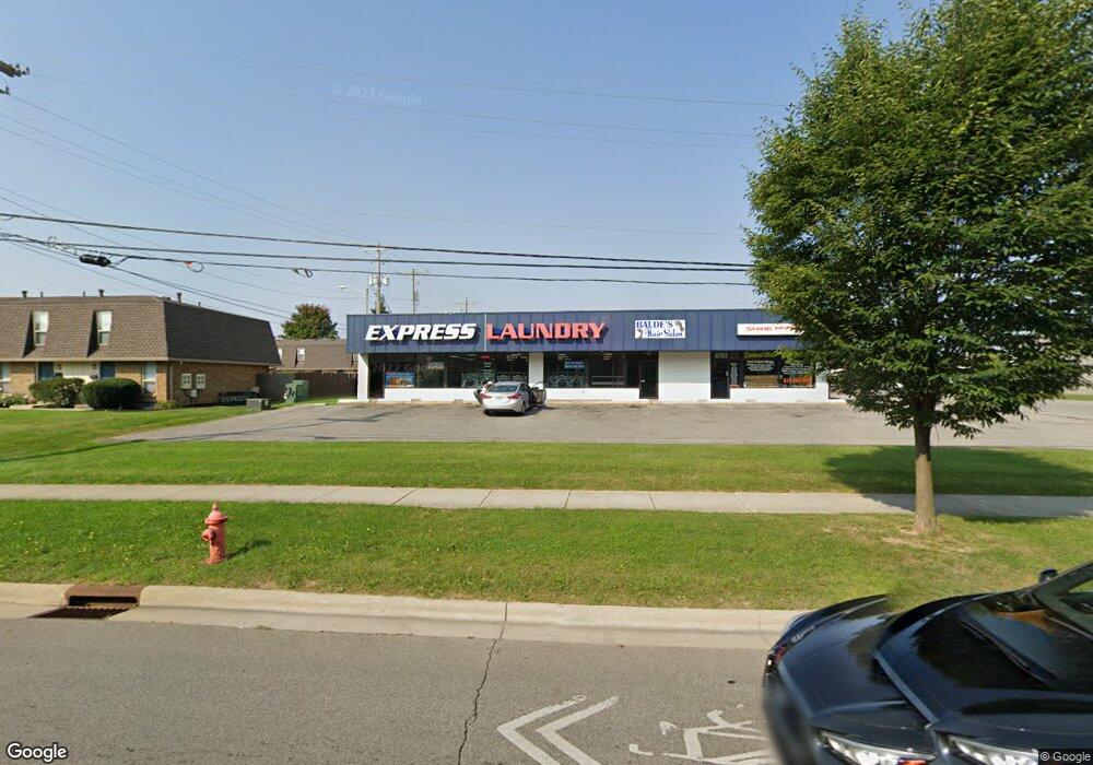
6701 Karl Rd Columbus, OH 43229
Devonshire NeighborhoodEstimated Value: $808,307
--
Bed
--
Bath
5,040
Sq Ft
$160/Sq Ft
Est. Value
About This Home
This home is located at 6701 Karl Rd, Columbus, OH 43229 and is currently estimated at $808,307, approximately $160 per square foot. 6701 Karl Rd is a home located in Franklin County with nearby schools including Colonial Hills Elementary School, Kilbourne Middle School, and Thomas Worthington High School.
Ownership History
Date
Name
Owned For
Owner Type
Purchase Details
Closed on
Oct 23, 2015
Sold by
Karl Road Properties Inc
Bought by
Srk Group Llc
Current Estimated Value
Home Financials for this Owner
Home Financials are based on the most recent Mortgage that was taken out on this home.
Original Mortgage
$280,000
Outstanding Balance
$223,820
Interest Rate
3.87%
Mortgage Type
Future Advance Clause Open End Mortgage
Estimated Equity
$566,840
Purchase Details
Closed on
Feb 12, 2015
Sold by
Karl Road Properties Inc
Bought by
Srk Group Llc
Home Financials for this Owner
Home Financials are based on the most recent Mortgage that was taken out on this home.
Original Mortgage
$288,000
Interest Rate
1%
Mortgage Type
Seller Take Back
Purchase Details
Closed on
May 4, 1994
Purchase Details
Closed on
Apr 1, 1986
Create a Home Valuation Report for This Property
The Home Valuation Report is an in-depth analysis detailing your home's value as well as a comparison with similar homes in the area
Home Values in the Area
Average Home Value in this Area
Purchase History
Date | Buyer | Sale Price | Title Company |
---|---|---|---|
Srk Group Llc | $320,000 | All Ohio Title Agency Llc | |
Srk Group Llc | $320,000 | Hayes Title | |
-- | -- | -- | |
-- | $77,000 | -- |
Source: Public Records
Mortgage History
Date | Status | Borrower | Loan Amount |
---|---|---|---|
Open | Srk Group Llc | $280,000 | |
Previous Owner | Srk Group Llc | $288,000 | |
Previous Owner | Karl Road Properties Inc | $125,000 |
Source: Public Records
Tax History Compared to Growth
Tax History
Year | Tax Paid | Tax Assessment Tax Assessment Total Assessment is a certain percentage of the fair market value that is determined by local assessors to be the total taxable value of land and additions on the property. | Land | Improvement |
---|---|---|---|---|
2024 | $13,837 | $146,060 | $54,290 | $91,770 |
2023 | $13,182 | $146,060 | $54,290 | $91,770 |
2022 | $13,338 | $125,060 | $44,770 | $80,290 |
2021 | $12,579 | $125,060 | $44,770 | $80,290 |
2020 | $12,196 | $125,060 | $44,770 | $80,290 |
2019 | $11,723 | $113,690 | $40,710 | $72,980 |
2018 | $10,490 | $113,690 | $40,710 | $72,980 |
2017 | $11,673 | $113,690 | $40,710 | $72,980 |
2016 | $11,255 | $112,010 | $40,710 | $71,300 |
2015 | $9,766 | $99,760 | $40,710 | $59,050 |
2014 | $10,012 | $99,760 | $40,710 | $59,050 |
2013 | $4,899 | $99,750 | $40,705 | $59,045 |
Source: Public Records
Map
Nearby Homes
- 1444 Bolenhill Ave
- 1677 Tendril Ct
- 6541 Skywae Dr
- 6416 Faircrest Rd
- 1795 Laylon Dr
- 1322 Cranwood Square S
- 6407 Skywae Dr
- 6273 Bellmeadow Dr
- 6376 Johnanne St
- 1410 Chelmsford Square S
- 2025 Willow Glen Ln Unit D
- 2089 Brookhurst Ave Unit D
- 6219 Ambleside Dr
- 2111 Brookhurst Ave Unit C
- 1288 Oakfield Dr N
- 7345 Oakmeadows Dr
- 6329 Birkewood St
- 0 Jewett Dr
- 7406 Murrayfield Dr
- 1732 Lynnhurst Rd
- 6701 Karl Rd
- 6707 Karl Rd
- 6733 Karl Rd
- 6721 Karl Rd
- 6725 Karl Rd
- 1541 Schrock Rd
- 1541 Barnes Dr E
- 1541 Barnes Dr E
- 0 Karl Rd Unit 2027475
- 0 Karl Rd Unit 211009284
- 6706 Karl Rd
- 1532 Bolenhill Ave
- 6677 Guinevere Dr
- 1516 Bolenhill Ave
- 1508 Bolenhill Ave
- 1487 Schrock Rd Unit 505
- 1487 Schrock Rd
- 1500 Bolenhill Ave
- 1485 Schrock Rd
- 1492 Bolenhill Ave