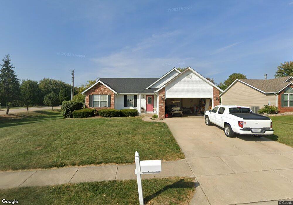
6701 Remington Ln Maryville, IL 62062
Estimated Value: $305,704 - $342,000
3
Beds
2
Baths
1,476
Sq Ft
$218/Sq Ft
Est. Value
About This Home
This home is located at 6701 Remington Ln, Maryville, IL 62062 and is currently estimated at $322,426, approximately $218 per square foot. 6701 Remington Ln is a home located in Madison County with nearby schools including Maryville Elementary School, Dorris Intermediate School, and Collinsville Middle School.
Ownership History
Date
Name
Owned For
Owner Type
Purchase Details
Closed on
Aug 16, 2024
Sold by
Newton Arthur W and Newton Brenda K
Bought by
Evans Tracey and Grometer Jodee
Current Estimated Value
Purchase Details
Closed on
Feb 3, 2003
Sold by
Osborn Homes Inc
Bought by
Newton Arthur W and Newton Brenda K
Home Financials for this Owner
Home Financials are based on the most recent Mortgage that was taken out on this home.
Original Mortgage
$157,629
Interest Rate
6%
Mortgage Type
FHA
Create a Home Valuation Report for This Property
The Home Valuation Report is an in-depth analysis detailing your home's value as well as a comparison with similar homes in the area
Home Values in the Area
Average Home Value in this Area
Purchase History
| Date | Buyer | Sale Price | Title Company |
|---|---|---|---|
| Evans Tracey | -- | None Available | |
| Newton Arthur W | $160,000 | Abstracts & Titles Inc | |
| Osborn Homes Inc | -- | Abstracts & Titles Inc |
Source: Public Records
Mortgage History
| Date | Status | Borrower | Loan Amount |
|---|---|---|---|
| Previous Owner | Newton Arthur W | $157,629 |
Source: Public Records
Tax History Compared to Growth
Tax History
| Year | Tax Paid | Tax Assessment Tax Assessment Total Assessment is a certain percentage of the fair market value that is determined by local assessors to be the total taxable value of land and additions on the property. | Land | Improvement |
|---|---|---|---|---|
| 2024 | $5,448 | $92,300 | $20,590 | $71,710 |
| 2023 | $5,448 | $84,180 | $18,740 | $65,440 |
| 2022 | $5,028 | $77,840 | $17,330 | $60,510 |
| 2021 | $4,473 | $73,130 | $16,280 | $56,850 |
| 2020 | $4,284 | $69,770 | $15,530 | $54,240 |
| 2019 | $4,212 | $68,330 | $16,430 | $51,900 |
| 2018 | $4,106 | $64,720 | $15,560 | $49,160 |
| 2017 | $4,062 | $63,430 | $15,250 | $48,180 |
| 2016 | $4,652 | $63,430 | $15,250 | $48,180 |
| 2015 | $4,326 | $61,780 | $14,850 | $46,930 |
| 2014 | $4,326 | $61,780 | $14,850 | $46,930 |
| 2013 | $4,326 | $61,780 | $14,850 | $46,930 |
Source: Public Records
Map
Nearby Homes
- 2009 Buttonwood Ct
- 1844 Crimson Oak Dr
- 1831 Crimson Oak Dr
- 1830 Robin Mills Ct
- 1826 Robin Mills Ct
- 1819 Robin Mills Ct
- 1815 Robins Mill Ct
- 963 Long Branch Rd
- 1 Heather Green
- 0 Homes of Liberty Place
- 6 Grant Ct
- 5 Grant Ct
- 919 Carla Dr
- Winchester A Plan at Homes of Liberty Place
- Winchester B Plan at Homes of Liberty Place
- Herndon Plan at Homes of Liberty Place
- Hannah Plan at Homes of Liberty Place
- Alexandria Plan at Homes of Liberty Place
- Culpepper Plan at Homes of Liberty Place
- Titan Plan at Homes of Liberty Place
- 6705 Remington Ln
- 22 Augusta Ct
- 6709 Remington Ln
- 1940 Wellington Ln
- 2003 Lakeview Acres Rd
- 2001 Lakeview Acres Rd
- 6715 Remington Ln
- 2006 Briarbend Ct
- 1931 Arlington Ct
- 1947 Wellington Ln
- 1936 Wellington Ln
- 2012 Briarbend Ct
- 2002 Briarbend Ct
- 2014 Briarbend Ct
- 1 Cider Crest Ct
- 1927 Arlington Ct
- 1943 Wellington Ln
- 1932 Wellington Ln
- 2000 Briarbend Ct
- 18 Augusta Ct