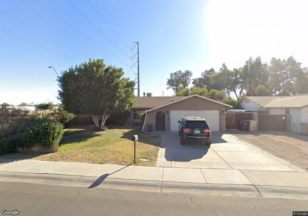
6701 W Carol Ave Peoria, AZ 85345
Estimated Value: $300,576 - $400,000
--
Bed
2
Baths
1,494
Sq Ft
$244/Sq Ft
Est. Value
About This Home
This home is located at 6701 W Carol Ave, Peoria, AZ 85345 and is currently estimated at $364,144, approximately $243 per square foot. 6701 W Carol Ave is a home located in Maricopa County with nearby schools including Ira A Murphy Elementary School and Centennial High School.
Ownership History
Date
Name
Owned For
Owner Type
Purchase Details
Closed on
May 21, 2019
Sold by
Jasobsen Sandra J
Bought by
Saari Michael D and Jacobsen Sandra J
Current Estimated Value
Home Financials for this Owner
Home Financials are based on the most recent Mortgage that was taken out on this home.
Original Mortgage
$212,798
Outstanding Balance
$186,713
Interest Rate
4.1%
Mortgage Type
VA
Estimated Equity
$177,432
Purchase Details
Closed on
Oct 20, 1999
Sold by
Hud
Bought by
Jacobsen Sandra J
Home Financials for this Owner
Home Financials are based on the most recent Mortgage that was taken out on this home.
Original Mortgage
$80,000
Interest Rate
7.95%
Purchase Details
Closed on
May 4, 1999
Sold by
Lloyd Robert S
Bought by
Ge Capital Mtg Services Inc
Create a Home Valuation Report for This Property
The Home Valuation Report is an in-depth analysis detailing your home's value as well as a comparison with similar homes in the area
Home Values in the Area
Average Home Value in this Area
Purchase History
| Date | Buyer | Sale Price | Title Company |
|---|---|---|---|
| Saari Michael D | -- | First American Title | |
| Jacobsen Sandra J | -- | First Southwestern Title | |
| Ge Capital Mtg Services Inc | -- | Security Title Agency |
Source: Public Records
Mortgage History
| Date | Status | Borrower | Loan Amount |
|---|---|---|---|
| Open | Saari Michael D | $212,798 | |
| Closed | Jacobsen Sandra J | $80,000 |
Source: Public Records
Tax History Compared to Growth
Tax History
| Year | Tax Paid | Tax Assessment Tax Assessment Total Assessment is a certain percentage of the fair market value that is determined by local assessors to be the total taxable value of land and additions on the property. | Land | Improvement |
|---|---|---|---|---|
| 2025 | $754 | $9,689 | -- | -- |
| 2024 | $743 | $9,228 | -- | -- |
| 2023 | $743 | $26,570 | $5,310 | $21,260 |
| 2022 | $727 | $20,200 | $4,040 | $16,160 |
| 2021 | $581 | $18,500 | $3,700 | $14,800 |
| 2020 | $616 | $17,050 | $3,410 | $13,640 |
| 2019 | $596 | $15,230 | $3,040 | $12,190 |
| 2018 | $508 | $9,460 | $1,890 | $7,570 |
| 2017 | $513 | $9,460 | $1,890 | $7,570 |
| 2016 | $526 | $9,930 | $1,980 | $7,950 |
| 2015 | $680 | $9,460 | $1,890 | $7,570 |
Source: Public Records
Map
Nearby Homes
- 9540 N 66th Dr
- 6604 W Vogel Ave
- 6601 W Eva St
- 6614 W Mountain View Rd
- 6942 W Olive Ave Unit 45
- 6942 W Olive Ave Unit 108
- 6942 W Olive Ave Unit 73
- 6942 W Olive Ave Unit 44
- 6942 W Olive Ave Unit 114
- 6942 W Olive Ave Unit 30
- 6942 W Olive Ave Unit 20
- 9459 N 64th Dr Unit 2
- 6404 W Sunnyslope Ln
- 8812 N 67th Dr
- 10002 N 66th Ln
- 6854 W Ironwood Dr
- 6351 W Mountain View Rd
- 10018 N 66th Ave
- 7040 W Olive Ave Unit 94
- 6626 W Cinnabar Ave
- 6707 W Carol Ave
- 9501 N 67th Dr
- 6713 W Carol Ave
- 9422 N 66th Dr
- 9426 N 66th Dr
- 6719 W Carol Ave
- 9511 N 67th Dr
- 9414 N 66th Dr
- 9502 N 67th Dr
- 9408 N 66th Dr
- 9512 N 67th Dr
- 6725 W Carol Ave
- 9521 N 67th Dr
- 9402 N 66th Dr
- 6622 W Hatcher Rd
- 9522 N 67th Dr
- 9501 N 67th Ln
- 6621 W Hatcher Rd
- 6625 W Carol Ave Unit 25
- 6625 W Carol Ave