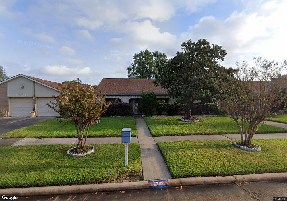
6702 Deer Ridge Ln Houston, TX 77086
North Houston NeighborhoodEstimated Value: $227,000 - $254,000
3
Beds
2
Baths
1,988
Sq Ft
$122/Sq Ft
Est. Value
About This Home
This home is located at 6702 Deer Ridge Ln, Houston, TX 77086 and is currently estimated at $242,156, approximately $121 per square foot. 6702 Deer Ridge Ln is a home located in Harris County with nearby schools including Kujawa EC/Pre-K/K School, Carmichael Elementary School, and Shotwell Middle School.
Ownership History
Date
Name
Owned For
Owner Type
Purchase Details
Closed on
Jul 28, 2011
Sold by
Fannie Mae
Bought by
Phillips Brenda G and Acosta Alfred T
Current Estimated Value
Purchase Details
Closed on
Apr 5, 2011
Sold by
Gonzalez Amanda L and Gonzalez Linda L
Bought by
Federal National Mortgage Association
Purchase Details
Closed on
Apr 28, 2006
Sold by
Minton Charles M and Minton Sharon A
Bought by
Gonzalez Amanda L and Gonzalez Linda L
Home Financials for this Owner
Home Financials are based on the most recent Mortgage that was taken out on this home.
Original Mortgage
$115,500
Interest Rate
6.32%
Mortgage Type
Fannie Mae Freddie Mac
Create a Home Valuation Report for This Property
The Home Valuation Report is an in-depth analysis detailing your home's value as well as a comparison with similar homes in the area
Home Values in the Area
Average Home Value in this Area
Purchase History
| Date | Buyer | Sale Price | Title Company |
|---|---|---|---|
| Phillips Brenda G | -- | Old Republic National Title | |
| Federal National Mortgage Association | $122,045 | None Available | |
| Gonzalez Amanda L | -- | Startex Title Company |
Source: Public Records
Mortgage History
| Date | Status | Borrower | Loan Amount |
|---|---|---|---|
| Previous Owner | Gonzalez Amanda L | $115,500 |
Source: Public Records
Tax History Compared to Growth
Tax History
| Year | Tax Paid | Tax Assessment Tax Assessment Total Assessment is a certain percentage of the fair market value that is determined by local assessors to be the total taxable value of land and additions on the property. | Land | Improvement |
|---|---|---|---|---|
| 2025 | $1,637 | $235,864 | $39,265 | $196,599 |
| 2024 | $1,637 | $235,864 | $39,265 | $196,599 |
| 2023 | $1,637 | $244,080 | $39,265 | $204,815 |
| 2022 | $4,007 | $205,219 | $33,275 | $171,944 |
| 2021 | $3,634 | $167,864 | $33,275 | $134,589 |
| 2020 | $3,673 | $158,762 | $33,275 | $125,487 |
| 2019 | $3,472 | $155,449 | $16,966 | $138,483 |
| 2018 | $654 | $147,049 | $16,966 | $130,083 |
| 2017 | $2,767 | $135,842 | $15,235 | $120,607 |
| 2016 | $2,515 | $122,998 | $15,235 | $107,763 |
| 2015 | $1,091 | $115,878 | $15,235 | $100,643 |
| 2014 | $1,091 | $86,875 | $15,235 | $71,640 |
Source: Public Records
Map
Nearby Homes
- 6703 Deer Ridge Ln
- 6606 Dusty Dawn Dr
- 10306 Jillana Kaye Dr
- 10214 Trade Winds Dr
- 6830 Desert Rose Ln
- 6822 Dusty Dawn Dr
- 6706 Redding Springs Ln
- 6911 Silver Star Dr
- 6502 Trail Valley Way
- 9815 Lonsford Dr
- 7011 Lower Arrow Dr
- 6615 Winding Trace Dr
- 6622 Sutton Meadows Dr
- 10522 Northview Dr
- 6722 Winding Trace Dr
- 10730 Antoine Dr
- 7002 Sandswept Ln
- 7023 Sandswept Ln
- 0 Tomball Pkwy
- 6411 Halstead Meadows Cir
- 6638 Deer Ridge Ln
- 6706 Deer Ridge Ln
- 6635 Dusty Dawn Dr
- 6710 Deer Ridge Ln
- 6634 Deer Ridge Ln
- 6639 Dusty Dawn Dr
- 6631 Dusty Dawn Dr
- 6643 Dusty Dawn Dr
- 6627 Dusty Dawn Dr
- 6707 Deer Ridge Ln
- 6714 Deer Ridge Ln
- 6630 Deer Ridge Ln
- 6635 Deer Ridge Ln
- 6711 Deer Ridge Ln
- 6703 Dusty Dawn Dr
- 6623 Dusty Dawn Dr
- 6631 Deer Ridge Ln
- 6715 Deer Ridge Ln
- 6718 Deer Ridge Ln
- 6626 Deer Ridge Ln