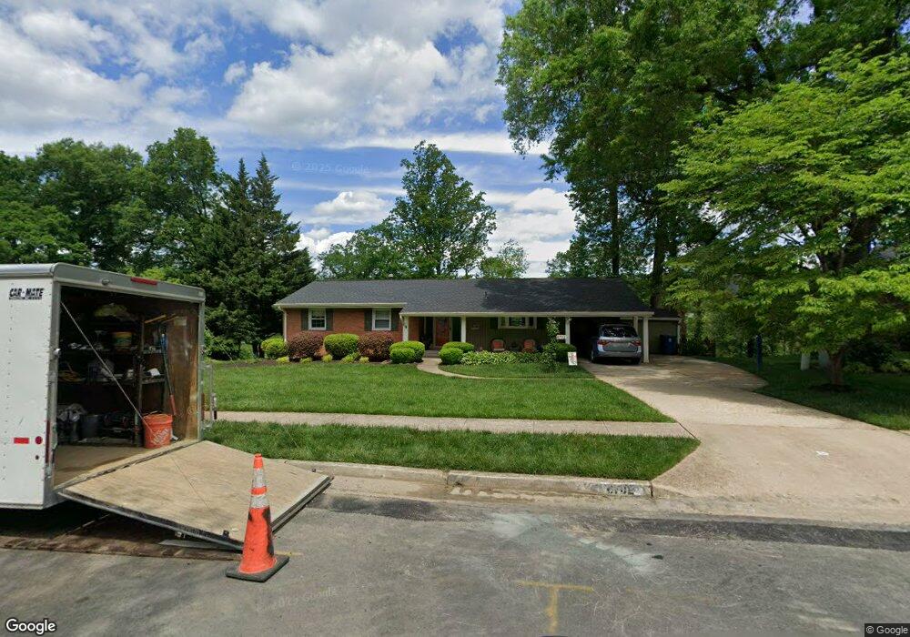
6702 Deland Dr Springfield, VA 22152
Estimated Value: $790,000 - $897,000
About This Home
This home is located at 6702 Deland Dr, Springfield, VA 22152 and is currently estimated at $849,559, approximately $495 per square foot. 6702 Deland Dr is a home located in Fairfax County with nearby schools including West Springfield Elementary School, Irving Middle School, and West Springfield High School.
Ownership History
We collect this data history from publicly available records. To have your information removed, we recommend requesting removal directly through your county’s website.
Purchase Details
Purchase Details
Home Financials for this Owner
Home Financials are based on the most recent Mortgage that was taken out on this home.Home Values in the Area
Average Home Value in this Area
Purchase History
We collect this data history from publicly available records. To have your information removed, we recommend requesting removal directly through your county’s website.
| Date | Buyer | Sale Price | Title Company |
|---|---|---|---|
| -- | None Listed On Document | ||
| $270,000 | -- |
Mortgage History
We collect this data history from publicly available records. To have your information removed, we recommend requesting removal directly through your county’s website.
| Date | Status | Borrower | Loan Amount |
|---|---|---|---|
| Previous Owner | $178,000 |
Tax History
We collect this data history from publicly available records. To have your information removed, we recommend requesting removal directly through your county’s website.
| Year | Tax Paid | Tax Assessment Tax Assessment Total Assessment is a certain percentage of the fair market value that is determined by local assessors to be the total taxable value of land and additions on the property. | Land | Improvement |
|---|---|---|---|---|
| 2025 | $9,413 | $839,970 | $324,000 | $515,970 |
| 2024 | $9,413 | $812,550 | $324,000 | $488,550 |
| 2023 | $9,054 | $802,290 | $324,000 | $478,290 |
| 2022 | $8,175 | $714,940 | $296,000 | $418,940 |
| 2021 | $7,722 | $658,020 | $261,000 | $397,020 |
| 2020 | $7,440 | $628,610 | $261,000 | $367,610 |
| 2019 | $7,312 | $617,860 | $255,000 | $362,860 |
| 2018 | $6,648 | $578,110 | $255,000 | $323,110 |
| 2017 | $6,580 | $566,790 | $255,000 | $311,790 |
| 2016 | $6,566 | $566,790 | $255,000 | $311,790 |
| 2015 | $5,970 | $534,910 | $255,000 | $279,910 |
| 2014 | $5,661 | $508,400 | $244,000 | $264,400 |
Map
- 6700 Norview Ct
- 7708 Jansen Dr
- 7941 Harwood Place
- 7027 Solomon Seal Ct
- 7033 Solomon Seal Ct
- 6303 Bardu Ave
- 7611 Tiverton Dr
- 6809 Rolling Rd
- 7674 Tiverton Dr
- 7664 Tiverton Dr
- 8137 Marcy Ave
- 8143 Edmonton Ct
- 7716 Shootingstar Dr
- 7705 Jewelweed Ct
- 7880 Rolling Woods Ct Unit 2103
- 6813 Landor Ln
- 6209 Fernleigh Blvd
- 8304 Harland Dr
- 7506 Oriole Ave
- 7265 Kousa Ln
Ask me questions while you tour the home.