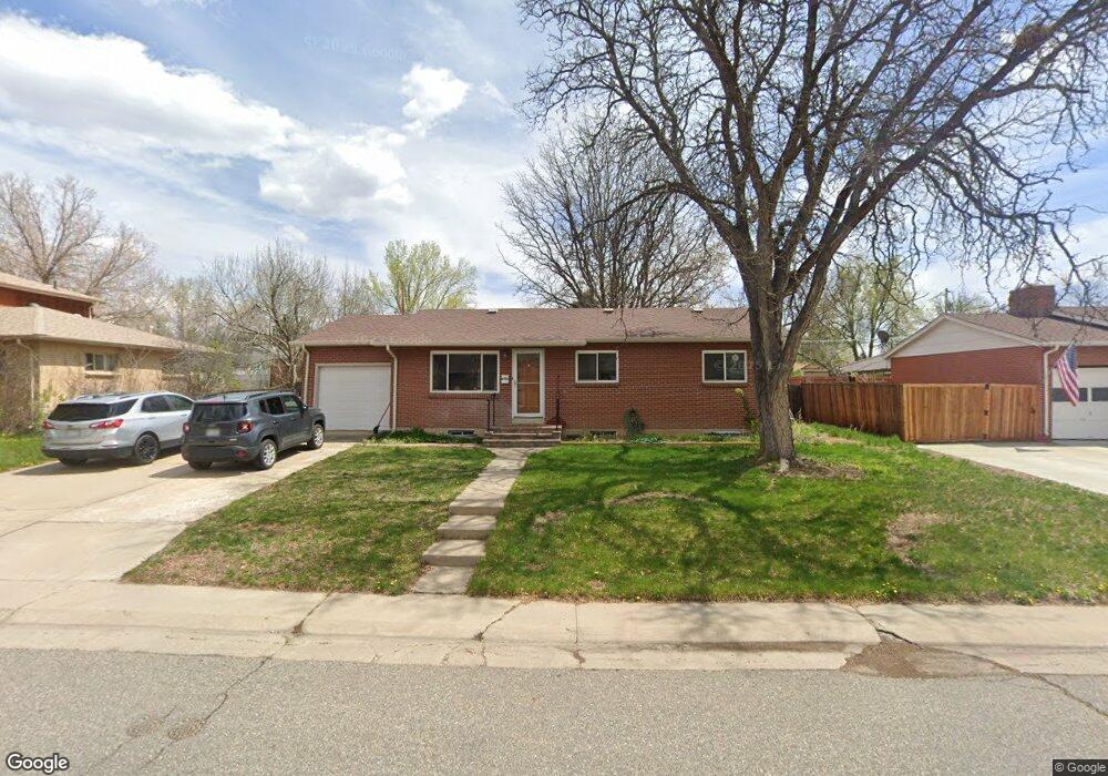
6702 Kipling St Arvada, CO 80004
Alta Vista NeighborhoodEstimated Value: $474,000 - $626,000
3
Beds
5
Baths
1,146
Sq Ft
$479/Sq Ft
Est. Value
About This Home
This home is located at 6702 Kipling St, Arvada, CO 80004 and is currently estimated at $549,080, approximately $479 per square foot. 6702 Kipling St is a home located in Jefferson County with nearby schools including Fremont Elementary School, Oberon Middle School, and Arvada West High School.
Ownership History
Date
Name
Owned For
Owner Type
Purchase Details
Closed on
Jun 26, 1998
Sold by
Branchaw Dora M
Bought by
Chea Leah L
Current Estimated Value
Home Financials for this Owner
Home Financials are based on the most recent Mortgage that was taken out on this home.
Original Mortgage
$130,577
Outstanding Balance
$26,908
Interest Rate
7.08%
Mortgage Type
FHA
Estimated Equity
$522,172
Purchase Details
Closed on
Jul 25, 1995
Sold by
Branchaw Joseph Richard
Bought by
Branchaw Dora M
Purchase Details
Closed on
May 21, 1994
Sold by
Branchaw Dora M
Bought by
Branchaw Joseph Richard
Create a Home Valuation Report for This Property
The Home Valuation Report is an in-depth analysis detailing your home's value as well as a comparison with similar homes in the area
Home Values in the Area
Average Home Value in this Area
Purchase History
| Date | Buyer | Sale Price | Title Company |
|---|---|---|---|
| Chea Leah L | $133,000 | -- | |
| Branchaw Dora M | -- | -- | |
| Branchaw Joseph Richard | -- | -- |
Source: Public Records
Mortgage History
| Date | Status | Borrower | Loan Amount |
|---|---|---|---|
| Open | Chea Leah L | $130,577 |
Source: Public Records
Tax History
| Year | Tax Paid | Tax Assessment Tax Assessment Total Assessment is a certain percentage of the fair market value that is determined by local assessors to be the total taxable value of land and additions on the property. | Land | Improvement |
|---|---|---|---|---|
| 2024 | $3,414 | $35,195 | $17,431 | $17,764 |
| 2023 | $3,414 | $35,195 | $17,431 | $17,764 |
| 2022 | $2,811 | $28,707 | $12,739 | $15,968 |
| 2021 | $2,858 | $29,533 | $13,106 | $16,427 |
| 2020 | $2,564 | $26,567 | $11,056 | $15,511 |
| 2019 | $2,529 | $26,567 | $11,056 | $15,511 |
| 2018 | $2,249 | $22,966 | $6,582 | $16,384 |
| 2017 | $2,059 | $22,966 | $6,582 | $16,384 |
| 2016 | $1,735 | $18,235 | $5,539 | $12,696 |
| 2015 | $1,491 | $18,235 | $5,539 | $12,696 |
| 2014 | $1,491 | $14,726 | $4,872 | $9,854 |
Source: Public Records
Map
Nearby Homes
- 6648 Lewis St
- 6572 Kipling St
- 10172 W 69th Ave
- 6836 Newcombe St
- 6371 Brooks Dr
- 6940 Independence St
- 6376 Brooks Dr
- 9909 W 70th Ave
- 9656 Rensselaer Dr
- 9303 W 66th Place
- 6396 Nelson Ct
- 10879 W 65th Way
- 6483 Newcombe Ct
- 9227 W 67th Ave
- 10785 W 63rd Place Unit 202
- 10785 W 63rd Place Unit 105
- 10693 W 63rd Dr Unit 101
- 10693 W 63rd Dr Unit 102
- 11023 W 67th Way
- 6943 Oak Way
- 6712 Kipling St
- 6692 Kipling St
- 9964 W 66th Cir
- 9954 W 66th Cir
- 6732 Kipling St
- 6682 Kipling St
- 6703 Kipling St
- 6713 Kipling St
- 6693 Kipling St
- 9949 W 66th Cir
- 9957 W 66th Place
- 6733 Kipling St
- 6683 Kipling St
- 6752 Kipling St
- 6662 Kipling St
- 9934 W 66th Cir
- 6704 Kline St
- 6694 Kline St
- 9929 W 66th Cir
- 6714 Kline St
Your Personal Tour Guide
Ask me questions while you tour the home.