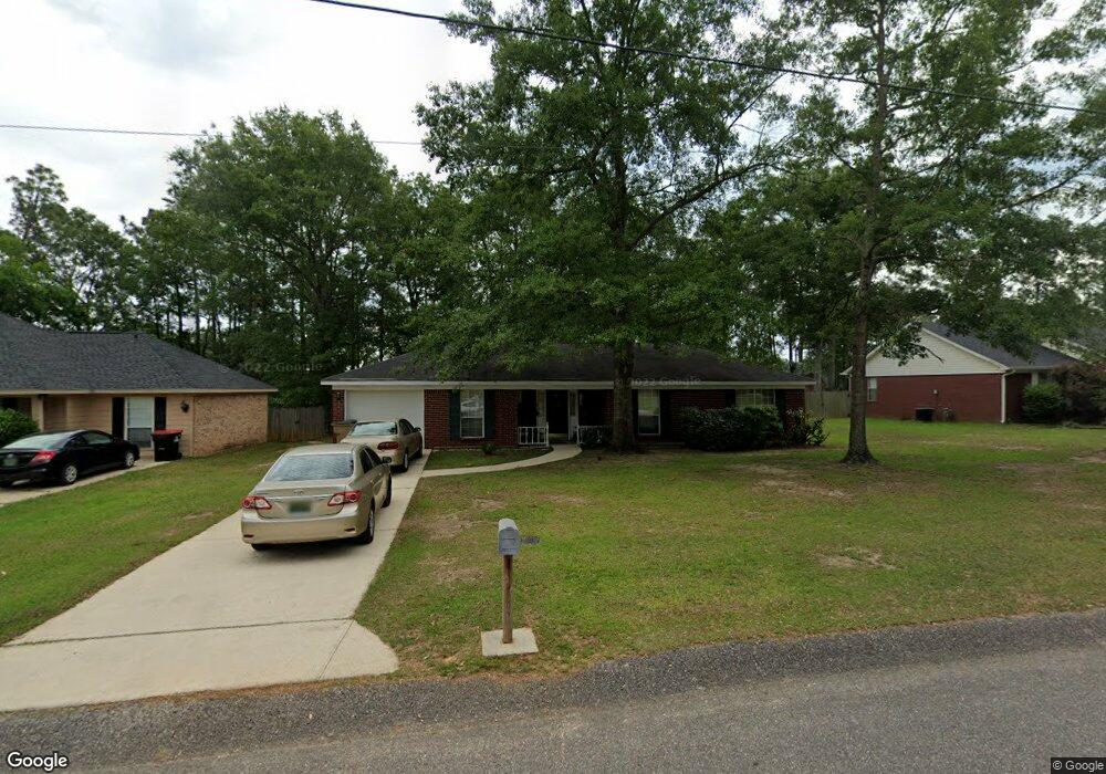
6705 Barnes Dr E Theodore, AL 36582
Westfield NeighborhoodEstimated Value: $157,286 - $227,000
3
Beds
2
Baths
1,205
Sq Ft
$170/Sq Ft
Est. Value
About This Home
This home is located at 6705 Barnes Dr E, Theodore, AL 36582 and is currently estimated at $204,572, approximately $169 per square foot. 6705 Barnes Dr E is a home located in Mobile County with nearby schools including Nan Gray Davis Elementary School, Katherine H Hankins Middle School, and Theodore High School.
Ownership History
Date
Name
Owned For
Owner Type
Purchase Details
Closed on
Mar 5, 2000
Sold by
Smith Lee A and Smith Tammy
Bought by
Ruggiero Sylvana Y
Current Estimated Value
Purchase Details
Closed on
Sep 18, 1998
Sold by
Benchmark Homes Inc
Bought by
Smith Lee A
Home Financials for this Owner
Home Financials are based on the most recent Mortgage that was taken out on this home.
Original Mortgage
$72,202
Interest Rate
6.92%
Mortgage Type
FHA
Create a Home Valuation Report for This Property
The Home Valuation Report is an in-depth analysis detailing your home's value as well as a comparison with similar homes in the area
Home Values in the Area
Average Home Value in this Area
Purchase History
| Date | Buyer | Sale Price | Title Company |
|---|---|---|---|
| Ruggiero Sylvana Y | -- | -- | |
| Smith Lee A | -- | -- |
Source: Public Records
Mortgage History
| Date | Status | Borrower | Loan Amount |
|---|---|---|---|
| Previous Owner | Smith Lee A | $72,202 |
Source: Public Records
Tax History
| Year | Tax Paid | Tax Assessment Tax Assessment Total Assessment is a certain percentage of the fair market value that is determined by local assessors to be the total taxable value of land and additions on the property. | Land | Improvement |
|---|---|---|---|---|
| 2025 | $756 | $14,840 | $3,000 | $11,840 |
| 2024 | $756 | $13,560 | $2,800 | $10,760 |
| 2023 | $711 | $13,200 | $2,800 | $10,400 |
| 2022 | $523 | $12,160 | $2,800 | $9,360 |
| 2021 | $467 | $11,020 | $2,800 | $8,220 |
| 2020 | $461 | $10,880 | $2,800 | $8,080 |
| 2019 | $476 | $11,200 | $0 | $0 |
| 2018 | $456 | $10,780 | $0 | $0 |
| 2017 | $456 | $10,780 | $0 | $0 |
| 2016 | $444 | $10,540 | $0 | $0 |
| 2013 | $470 | $10,980 | $0 | $0 |
Source: Public Records
Map
Nearby Homes
- 6241 Woodside Dr
- 6292 Woodside Dr S
- 6293 Woodside Dr S
- 0 Nan Gray Davis Rd
- 6157 Magnolia Trace N
- 6521 Barnes Rd
- 5950 Theodore Dawes Rd
- 7665 Oakmont Dr E
- 6611 Madison Arras Ct
- 6745 Carol Plantation Rd
- 6361 Rester Rd
- 7215 Broadview Dr E
- 6750 Barneswood Dr
- 6760 Barneswood Dr
- 6776 Barneswood Dr
- 7264 Broadview Dr W
- 0 Rester Rd
- 6561 Apache Run
- 6028 Creek Side Trail
- 0 Highway 90 Unit 7630566
- 6695 Barnes Dr E
- 6715 Barnes Dr E
- 6700 Barnes Dr E
- 6685 Barnes Dr E
- 6725 Barnes Dr E
- 6651 Nan Gray Davis Rd
- 6720 Barnes Dr E
- 6252 Woodside Dr S
- 6263 Woodside Dr S
- 6730 Barnes Dr E
- 6735 Barnes Dr E
- 6262 Woodside Dr S
- 6273 Woodside Dr S
- 6740 Barnes Dr E
- 6709 Barnes Dr W
- 6272 Woodside Dr S
- 6251 Woodside Dr
- 6745 Barnes Dr E
- 6719 Barnes Dr W
- 6283 Woodside Dr S
Your Personal Tour Guide
Ask me questions while you tour the home.