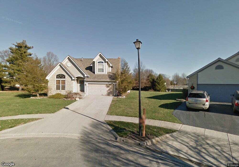
6705 Braeswick Ct Canal Winchester, OH 43110
Estimated Value: $404,000 - $432,000
3
Beds
3
Baths
2,045
Sq Ft
$203/Sq Ft
Est. Value
About This Home
This home is located at 6705 Braeswick Ct, Canal Winchester, OH 43110 and is currently estimated at $414,377, approximately $202 per square foot. 6705 Braeswick Ct is a home located in Franklin County with nearby schools including Winchester Trail Elementary School, Indian Trail Elementary School, and Canal Winchester Middle School.
Ownership History
Date
Name
Owned For
Owner Type
Purchase Details
Closed on
Nov 5, 2021
Sold by
Franklin County Treasurer
Bought by
Foss Sandra I
Current Estimated Value
Purchase Details
Closed on
Jun 23, 2006
Sold by
Byrd Robert J and Byrd Lisa M
Bought by
Foss Sandra L
Home Financials for this Owner
Home Financials are based on the most recent Mortgage that was taken out on this home.
Original Mortgage
$167,600
Outstanding Balance
$99,360
Interest Rate
6.72%
Mortgage Type
Purchase Money Mortgage
Estimated Equity
$315,017
Purchase Details
Closed on
Dec 26, 1995
Sold by
M/I Schottenstein Homes
Bought by
Byrd Robert J and Byrd Lisa M
Home Financials for this Owner
Home Financials are based on the most recent Mortgage that was taken out on this home.
Original Mortgage
$72,450
Interest Rate
7.43%
Mortgage Type
New Conventional
Purchase Details
Closed on
Aug 23, 1995
Sold by
Eastside Properties Ptns
Bought by
M/I Schottenstein Homes Inc
Create a Home Valuation Report for This Property
The Home Valuation Report is an in-depth analysis detailing your home's value as well as a comparison with similar homes in the area
Home Values in the Area
Average Home Value in this Area
Purchase History
| Date | Buyer | Sale Price | Title Company |
|---|---|---|---|
| Foss Sandra I | -- | -- | |
| Foss Sandra L | $209,500 | Talon Group | |
| Byrd Robert J | $173,930 | -- | |
| M/I Schottenstein Homes Inc | $55,000 | -- |
Source: Public Records
Mortgage History
| Date | Status | Borrower | Loan Amount |
|---|---|---|---|
| Open | Foss Sandra L | $167,600 | |
| Previous Owner | Byrd Robert J | $72,450 |
Source: Public Records
Tax History Compared to Growth
Tax History
| Year | Tax Paid | Tax Assessment Tax Assessment Total Assessment is a certain percentage of the fair market value that is determined by local assessors to be the total taxable value of land and additions on the property. | Land | Improvement |
|---|---|---|---|---|
| 2024 | $9,447 | $111,830 | $37,980 | $73,850 |
| 2023 | $6,198 | $111,825 | $37,975 | $73,850 |
| 2022 | $5,321 | $80,960 | $15,120 | $65,840 |
| 2021 | $5,378 | $80,960 | $15,120 | $65,840 |
| 2020 | $5,365 | $80,960 | $15,120 | $65,840 |
| 2019 | $5,185 | $66,820 | $12,600 | $54,220 |
| 2018 | $5,016 | $66,820 | $12,600 | $54,220 |
| 2017 | $5,091 | $66,820 | $12,600 | $54,220 |
| 2016 | $4,940 | $60,030 | $9,590 | $50,440 |
| 2015 | $4,954 | $60,030 | $9,590 | $50,440 |
| 2014 | $4,636 | $60,030 | $9,590 | $50,440 |
| 2013 | $2,411 | $63,175 | $10,080 | $53,095 |
Source: Public Records
Map
Nearby Homes
- 0 Groveport Rd
- 6535 Hemmingford Dr
- 6571 Hemmingford Dr
- 6558 Hemmingford Dr
- 6469 Tallman Ct
- 963 Groveport Rd
- 6430 Rossmore Ln
- 6910 Canal St
- 7412 Connor Ct
- 6185 Dietz Dr
- 6516 Lakeview Cir Unit 6516
- 6641 Steen St
- 7170 Seymour Ct
- 7362 Bromfield Dr
- 7288 Bromfield Dr
- 7191 Rosemount Way
- 369 W Waterloo St
- 359 W Waterloo St
- 7265 Bromfield Dr
- 6216 Meriden Ct
- 6710 Braeswick Ct
- 6476 Hemmingford Dr
- 6718 Braeswick Ct
- 6482 Hemmingford Dr
- 769 Groveport Pike
- 763 Groveport Pike
- 6470 Hemmingford Dr
- 6707 Braeswick Ct
- 789 Groveport Pike
- 6462 Hemmingford Dr
- 6711 Braeswick Ct
- 6732 Braeswick Ct
- 80 Gender Rd
- 6490 Hemmingford Dr
- 757 Groveport Pike
- 6727 Braeswick Ct
- 6737 Braeswick Ct
- 6477 Hemmingford Dr
- 6496 Hemmingford Dr
- 6441 Hemmingford Dr