Estimated Value: $222,688 - $268,000
2
Beds
1
Bath
1,252
Sq Ft
$193/Sq Ft
Est. Value
About This Home
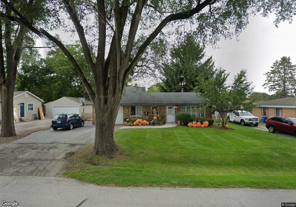
This home is located at 6705 Hawthorne Dr Unit 1, Cary, IL 60013 and is currently estimated at $241,172, approximately $192 per square foot. 6705 Hawthorne Dr Unit 1 is a home located in McHenry County with nearby schools including Deer Path Elementary School, Cary Jr High School, and Cary-Grove High School.
Ownership History
Date
Name
Owned For
Owner Type
Purchase Details
Closed on
May 17, 1996
Sold by
Banducci Richard J and Banducci Kelley L
Bought by
Gerard Julia J
Current Estimated Value
Home Financials for this Owner
Home Financials are based on the most recent Mortgage that was taken out on this home.
Original Mortgage
$111,200
Outstanding Balance
$6,394
Interest Rate
8.1%
Mortgage Type
FHA
Estimated Equity
$234,778
Purchase Details
Closed on
Jun 21, 1993
Sold by
Banducci Richard J
Bought by
Banducci Richard J and Banducci Kelley L
Home Financials for this Owner
Home Financials are based on the most recent Mortgage that was taken out on this home.
Original Mortgage
$87,700
Interest Rate
7%
Create a Home Valuation Report for This Property
The Home Valuation Report is an in-depth analysis detailing your home's value as well as a comparison with similar homes in the area
Home Values in the Area
Average Home Value in this Area
Purchase History
| Date | Buyer | Sale Price | Title Company |
|---|---|---|---|
| Gerard Julia J | $117,000 | -- | |
| Banducci Richard J | -- | Commonwealth Land Title |
Source: Public Records
Mortgage History
| Date | Status | Borrower | Loan Amount |
|---|---|---|---|
| Open | Gerard Julia J | $111,200 | |
| Previous Owner | Banducci Richard J | $87,700 |
Source: Public Records
Tax History
| Year | Tax Paid | Tax Assessment Tax Assessment Total Assessment is a certain percentage of the fair market value that is determined by local assessors to be the total taxable value of land and additions on the property. | Land | Improvement |
|---|---|---|---|---|
| 2024 | $4,476 | $69,274 | $10,011 | $59,263 |
| 2023 | $4,350 | $61,957 | $8,954 | $53,003 |
| 2022 | $3,655 | $50,673 | $10,359 | $40,314 |
| 2021 | $3,466 | $47,208 | $9,651 | $37,557 |
| 2020 | $3,352 | $45,536 | $9,309 | $36,227 |
| 2019 | $3,276 | $43,584 | $8,910 | $34,674 |
| 2018 | $2,607 | $35,171 | $8,231 | $26,940 |
| 2017 | $2,538 | $33,133 | $7,754 | $25,379 |
| 2016 | $2,500 | $31,076 | $7,273 | $23,803 |
| 2013 | -- | $38,130 | $6,784 | $31,346 |
Source: Public Records
Map
Nearby Homes
- 6606 Silver Lake Rd
- 317 Sterling Cir
- 6305 Robert Rd
- 2819 Sun Valley Dr
- 5 Echo Hill Rd
- 237 Foxford Dr
- 16 Ash Dr
- 331 Parkstone Dr
- Lot 10 Grove Ln
- Lot 11 Grove Ln
- LOT 02 Three Oaks Rd
- 203 Valley Dr
- 211 Woody Way
- 134 Bright Oaks Cir
- 3408 Royal Woods Dr
- 1141 Westlake Dr
- 717 Wellington Ln
- 392 W Margaret Terrace
- 1161 Amber Dr
- 12 Oak Valley Dr
- 6704 Hunters Path
- 6708 Hunters Path
- 6709 Hawthorne Dr
- 6703 Hawthorne Dr
- 6702 Hunters Path
- 6710 Hunters Path
- 6704 Hawthorne Dr
- 6706 Hawthorne Dr Unit 1
- 6711 Hawthorne Dr
- 6708 Hawthorne Dr
- 6702 Hawthorne Dr
- 6712 Hunters Path
- 6710 Hawthorne Dr
- 6609 Hawthorne Dr
- 6713 Hawthorne Dr
- 6608 Hunters Path
- 6705 Hunters Path Unit 1
- 6707 Hunters Path
- 6714 Hunters Path
- 6703 Hunters Path
Your Personal Tour Guide
Ask me questions while you tour the home.