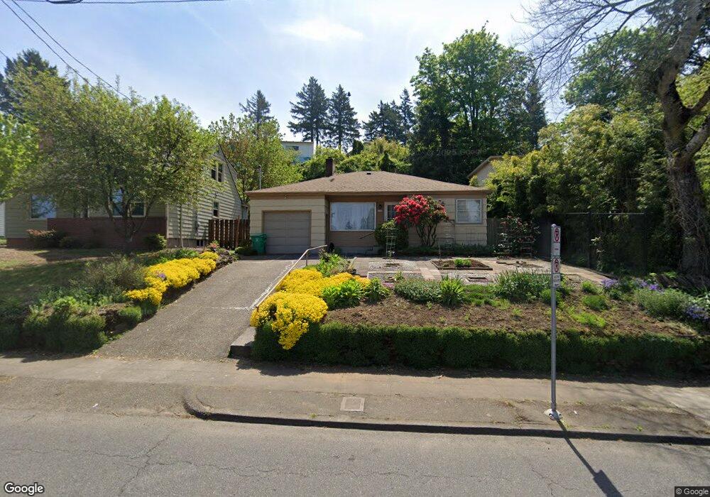
6706 E Burnside St Portland, OR 97215
Mount Tabor NeighborhoodEstimated Value: $411,000 - $638,000
2
Beds
1
Bath
1,047
Sq Ft
$489/Sq Ft
Est. Value
About This Home
This home is located at 6706 E Burnside St, Portland, OR 97215 and is currently estimated at $512,348, approximately $489 per square foot. 6706 E Burnside St is a home located in Multnomah County with nearby schools including Glencoe Elementary School, Mt Tabor Middle School, and Franklin High School.
Ownership History
Date
Name
Owned For
Owner Type
Purchase Details
Closed on
May 8, 2023
Sold by
Tran Chanh Cong and Cam Mong
Bought by
Chanh Cong Tran And Cam Mong Duong Revocable
Current Estimated Value
Purchase Details
Closed on
Feb 6, 1996
Sold by
Regula Fleta B
Bought by
Tran Chanh C and Duong Cam Mong
Home Financials for this Owner
Home Financials are based on the most recent Mortgage that was taken out on this home.
Original Mortgage
$85,500
Interest Rate
7.14%
Mortgage Type
Purchase Money Mortgage
Create a Home Valuation Report for This Property
The Home Valuation Report is an in-depth analysis detailing your home's value as well as a comparison with similar homes in the area
Home Values in the Area
Average Home Value in this Area
Purchase History
| Date | Buyer | Sale Price | Title Company |
|---|---|---|---|
| Chanh Cong Tran And Cam Mong Duong Revocable | -- | None Listed On Document | |
| Tran Chanh C | $95,000 | Fidelity National Title Co |
Source: Public Records
Mortgage History
| Date | Status | Borrower | Loan Amount |
|---|---|---|---|
| Previous Owner | Tran Chanh C | $85,500 |
Source: Public Records
Tax History
| Year | Tax Paid | Tax Assessment Tax Assessment Total Assessment is a certain percentage of the fair market value that is determined by local assessors to be the total taxable value of land and additions on the property. | Land | Improvement |
|---|---|---|---|---|
| 2025 | $5,770 | $214,140 | -- | -- |
| 2024 | $5,563 | $207,910 | -- | -- |
| 2023 | $5,349 | $201,860 | $0 | $0 |
| 2022 | $5,233 | $195,990 | $0 | $0 |
| 2021 | $5,145 | $190,290 | $0 | $0 |
| 2020 | $4,720 | $184,750 | $0 | $0 |
| 2019 | $4,546 | $179,370 | $0 | $0 |
| 2018 | $4,413 | $174,150 | $0 | $0 |
| 2017 | $4,229 | $169,080 | $0 | $0 |
| 2016 | $3,871 | $164,160 | $0 | $0 |
| 2015 | $3,769 | $159,380 | $0 | $0 |
| 2014 | $3,712 | $154,740 | $0 | $0 |
Source: Public Records
Map
Nearby Homes
- 6541 E Burnside St
- 6393 E Burnside St
- 0 E Burnside St Unit 508452690
- 7081 SE Thorburn St
- 6055 E Burnside St
- 232 NE 61st Ave
- 532 SE 69th Ave
- 7700 SE Stark St
- 365 NE 72nd Ave
- 235 NE 61st Ave Unit 36
- 350 NE 61st Ave
- 230 NE 60th Ave Unit 27
- 475 NE 72nd Ave Unit 7
- 255 NE 61st Ave Unit 12
- 481 NE 72nd Ave Unit 4
- 483 NE 72nd Ave Unit 3
- 227 NE 61st Ave Unit 1
- 7190 NE Glisan St
- 514 NE 71st Ave
- 7194 NE Glisan St Unit 1
- 6716 E Burnside St
- 6702 E Burnside St
- 6700 E Burnside St
- 6726 E Burnside St
- 6640 E Burnside St Unit 6652
- 6642 E Burnside St
- 6711 SE Thorburn St
- 6679 SE Thorburn St
- 6705 E Burnside St
- 6734 E Burnside St
- 6727 SE Thorburn St
- 6725 E Burnside St
- 6663 E Burnside St
- 6741 E Burnside St
- 6634 E Burnside St
- 6634 E Burnside St Unit A-N
- 6651 E Burnside St Unit 6653
- 6739 E Burnside St Unit 6741
- 24 NE 67th Ave
- 6657 SE Thorburn St
Your Personal Tour Guide
Ask me questions while you tour the home.