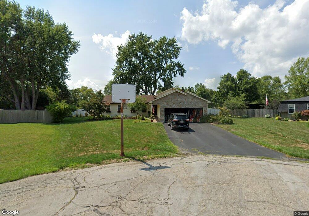
6707 Redwing Ct Orient, OH 43146
Estimated Value: $374,726 - $438,000
4
Beds
2
Baths
1,590
Sq Ft
$248/Sq Ft
Est. Value
About This Home
This home is located at 6707 Redwing Ct, Orient, OH 43146 and is currently estimated at $394,432, approximately $248 per square foot. 6707 Redwing Ct is a home located in Franklin County with nearby schools including Darbydale Elementary School, Hayes Intermediate School, and Pleasant View Middle School.
Ownership History
Date
Name
Owned For
Owner Type
Purchase Details
Closed on
Oct 23, 1996
Sold by
Six Gwenda L
Bought by
Capehart Dennis B and Capehart Trisha
Current Estimated Value
Home Financials for this Owner
Home Financials are based on the most recent Mortgage that was taken out on this home.
Original Mortgage
$115,000
Interest Rate
8.32%
Mortgage Type
Balloon
Purchase Details
Closed on
May 3, 1994
Purchase Details
Closed on
Sep 11, 1990
Create a Home Valuation Report for This Property
The Home Valuation Report is an in-depth analysis detailing your home's value as well as a comparison with similar homes in the area
Home Values in the Area
Average Home Value in this Area
Purchase History
| Date | Buyer | Sale Price | Title Company |
|---|---|---|---|
| Capehart Dennis B | $145,000 | -- | |
| -- | -- | -- | |
| -- | -- | -- |
Source: Public Records
Mortgage History
| Date | Status | Borrower | Loan Amount |
|---|---|---|---|
| Closed | Capehart Dennis B | $115,000 |
Source: Public Records
Tax History
| Year | Tax Paid | Tax Assessment Tax Assessment Total Assessment is a certain percentage of the fair market value that is determined by local assessors to be the total taxable value of land and additions on the property. | Land | Improvement |
|---|---|---|---|---|
| 2025 | $4,962 | $110,850 | $29,650 | $81,200 |
| 2024 | $4,962 | $110,850 | $29,650 | $81,200 |
| 2023 | $4,445 | $110,850 | $29,650 | $81,200 |
| 2022 | $4,344 | $78,090 | $16,100 | $61,990 |
| 2021 | $4,421 | $78,090 | $16,100 | $61,990 |
| 2020 | $4,400 | $78,090 | $16,100 | $61,990 |
| 2019 | $4,429 | $69,020 | $14,000 | $55,020 |
| 2018 | $4,060 | $68,640 | $14,000 | $54,640 |
| 2017 | $4,052 | $68,640 | $14,000 | $54,640 |
| 2016 | $3,733 | $53,560 | $11,800 | $41,760 |
| 2015 | $3,733 | $53,560 | $11,800 | $41,760 |
| 2014 | $3,681 | $53,560 | $11,800 | $41,760 |
| 2013 | $2,070 | $59,465 | $13,090 | $46,375 |
Source: Public Records
Map
Nearby Homes
- 5326 Sandpiper Dr
- 6446 Harrisburg Pike
- 0 London Groveport Rd
- 7879 Railroad St
- 1063 Springlawn Ave
- 6628 London Groveport Rd
- 5981 Main St
- 6106 London Groveport Rd Unit C9
- 6106 London Groveport Rd Unit C3
- 0 Gay Rd Unit Tract 5
- 6244 London Groveport Rd Unit 96
- 6244 London Groveport Rd Unit 8
- 6946 Harrisburg London Rd
- 6616 London Groveport Rd
- 6965 Gay Rd
- 5382 Kirkwood Dr
- 5600 Bellview Dr
- 6971 London Groveport Rd
- 5 Norton Rd
- 4950 Norton Rd
- 5414 Timberlake Cir
- 6704 Red Wing Ct
- 6732 Bluebird Dr
- 6704 Redwing Ct
- 6714 Bluebird Dr
- 5422 Timberlake Cir
- 6712 Red Wing Ct
- 6712 Redwing Ct
- 5390 Timberlake Cir
- 6744 Bluebird Dr
- 5430 Timberlake Cir
- 5411 Pheasant Dr
- 5425 Pheasant Dr
- 5387 Pheasant Dr
- 5413 Timberlake Cir
- 5401 Timberlake Cir
- 5382 Timberlake Cir
- 5371 Pheasant Dr
- 5421 Timberlake Cir
- 6731 Bluebird Dr
Your Personal Tour Guide
Ask me questions while you tour the home.