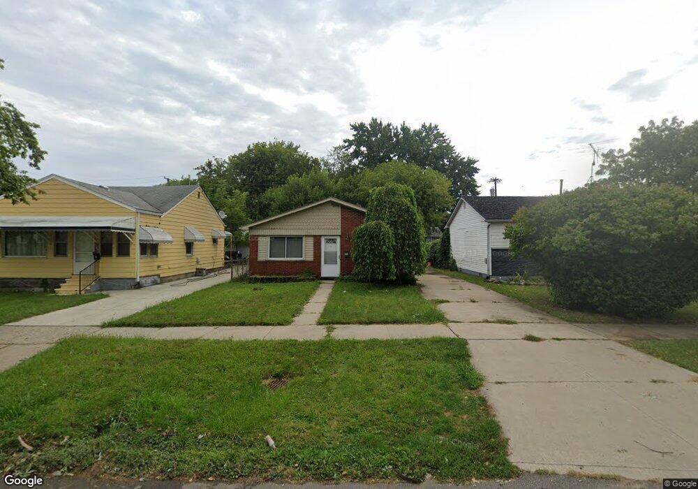
6709 Westpoint St Taylor, MI 48180
Estimated Value: $146,000 - $154,599
3
Beds
1
Bath
976
Sq Ft
$154/Sq Ft
Est. Value
About This Home
This home is located at 6709 Westpoint St, Taylor, MI 48180 and is currently estimated at $150,650, approximately $154 per square foot. 6709 Westpoint St is a home located in Wayne County with nearby schools including Clarence Randall Elementary School, Hoover Middle School, and Quest Charter Academy.
Ownership History
Date
Name
Owned For
Owner Type
Purchase Details
Closed on
Sep 17, 2009
Sold by
Donovan Shaun and Secretary Of Housing & Urban D
Bought by
Robinson John
Current Estimated Value
Purchase Details
Closed on
Dec 4, 2008
Sold by
Citimortgage Inc
Bought by
The Secretary Of Housing & Urban Develop
Purchase Details
Closed on
May 29, 2008
Sold by
Glore Keith
Bought by
Citimortgage Inc
Purchase Details
Closed on
May 3, 2006
Sold by
Alford Bill B and Alford Judith A
Bought by
Glore Keith B
Create a Home Valuation Report for This Property
The Home Valuation Report is an in-depth analysis detailing your home's value as well as a comparison with similar homes in the area
Home Values in the Area
Average Home Value in this Area
Purchase History
| Date | Buyer | Sale Price | Title Company |
|---|---|---|---|
| Robinson John | $28,511 | None Available | |
| The Secretary Of Housing & Urban Develop | -- | None Available | |
| Citimortgage Inc | $113,003 | None Available | |
| Glore Keith B | $105,900 | Multiple |
Source: Public Records
Tax History Compared to Growth
Tax History
| Year | Tax Paid | Tax Assessment Tax Assessment Total Assessment is a certain percentage of the fair market value that is determined by local assessors to be the total taxable value of land and additions on the property. | Land | Improvement |
|---|---|---|---|---|
| 2025 | $1,301 | $70,400 | $0 | $0 |
| 2024 | $1,301 | $62,000 | $0 | $0 |
| 2023 | $2,322 | $54,900 | $0 | $0 |
| 2022 | $1,242 | $49,700 | $0 | $0 |
| 2021 | $1,598 | $45,800 | $0 | $0 |
| 2020 | $1,597 | $42,000 | $0 | $0 |
| 2019 | $150,559 | $34,600 | $0 | $0 |
| 2018 | $1,067 | $26,700 | $0 | $0 |
| 2017 | $587 | $27,200 | $0 | $0 |
| 2016 | $1,592 | $26,400 | $0 | $0 |
| 2015 | $2,410 | $24,100 | $0 | $0 |
| 2013 | $2,450 | $25,400 | $0 | $0 |
| 2012 | $1,088 | $24,800 | $6,900 | $17,900 |
Source: Public Records
Map
Nearby Homes
- 6717 Westpoint St
- 6677 Westpoint St
- 6725 Westpoint St
- 6665 Westpoint St
- 6716 Cornell St
- 6733 Westpoint St
- 6724 Cornell St
- 6657 Westpoint St Unit Bldg-Unit
- 6657 Westpoint St
- 6708 Cornell St
- 6732 Cornell St
- 6647 Westpoint St
- 6674 Westpoint St
- 6740 Cornell St
- 6749 Westpoint St
- 6664 Westpoint St
- 6648 Cornell St
- 6641 Westpoint St
- 6658 Westpoint St
- 6748 Cornell St