Estimated Value: $264,932 - $346,000
Studio
2
Baths
2,191
Sq Ft
$144/Sq Ft
Est. Value
About This Home
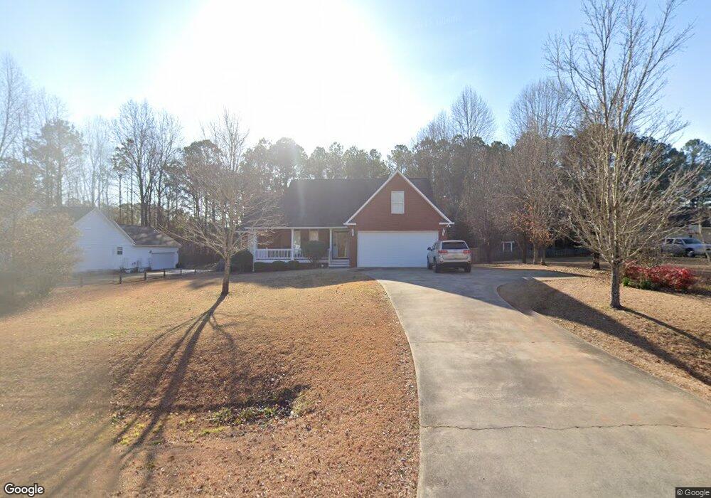
This home is located at 671 Aarons Cir, Gray, GA 31032 and is currently estimated at $316,233, approximately $144 per square foot. 671 Aarons Cir is a home located in Jones County with nearby schools including Turner Woods Elementary School, Gray Station Middle School, and Jones County High School.
Ownership History
Date
Name
Owned For
Owner Type
Purchase Details
Closed on
May 9, 2014
Sold by
Moore Newman L
Bought by
Sheffield David S and Sheffield Lauren
Current Estimated Value
Home Financials for this Owner
Home Financials are based on the most recent Mortgage that was taken out on this home.
Original Mortgage
$164,957
Outstanding Balance
$124,233
Interest Rate
4.25%
Mortgage Type
FHA
Estimated Equity
$192,000
Purchase Details
Closed on
Jul 24, 2003
Sold by
Flanders Michael A and Flanders Maureen H
Bought by
Moore Newman L
Purchase Details
Closed on
Aug 30, 2002
Sold by
Bob Hamilton
Bought by
Flanders Michael A and Flanders Maureen H
Create a Home Valuation Report for This Property
The Home Valuation Report is an in-depth analysis detailing your home's value as well as a comparison with similar homes in the area
Home Values in the Area
Average Home Value in this Area
Purchase History
| Date | Buyer | Sale Price | Title Company |
|---|---|---|---|
| Sheffield David S | $168,000 | -- | |
| Moore Newman L | $159,500 | -- | |
| Flanders Michael A | $160,000 | -- |
Source: Public Records
Mortgage History
| Date | Status | Borrower | Loan Amount |
|---|---|---|---|
| Open | Sheffield David S | $164,957 |
Source: Public Records
Tax History
| Year | Tax Paid | Tax Assessment Tax Assessment Total Assessment is a certain percentage of the fair market value that is determined by local assessors to be the total taxable value of land and additions on the property. | Land | Improvement |
|---|---|---|---|---|
| 2025 | $3,557 | $112,135 | $14,040 | $98,095 |
| 2023 | $1,836 | $72,470 | $10,800 | $61,670 |
| 2022 | $2,463 | $72,254 | $10,584 | $61,670 |
| 2021 | $2,465 | $72,254 | $10,584 | $61,670 |
| 2020 | $2,467 | $72,254 | $10,584 | $61,670 |
| 2019 | $2,419 | $70,928 | $10,584 | $60,344 |
| 2018 | $2,419 | $70,928 | $10,584 | $60,344 |
| 2017 | $2,419 | $70,928 | $10,584 | $60,344 |
| 2016 | $2,419 | $70,928 | $10,584 | $60,344 |
| 2015 | $2,158 | $70,928 | $10,584 | $60,344 |
| 2014 | $1,663 | $70,928 | $10,584 | $60,344 |
Source: Public Records
Map
Nearby Homes
- 354 Lite N Tie Rd
- 140 Lite-N-tie Rd
- 000 Walnut Grove Rd
- 0 Walnut Grove Rd Unit 10697101
- 00 Walnut Grove Rd
- 314 Walnut Grove Rd
- 0 Walnut Grove Rd Unit 10697107
- 0 Walnut Grove Rd Unit 183246
- 229 Lite N Tie Rd
- 146 Overland Way
- 203 Hidden Lakes Dr
- 134 Royal Ln
- 0 Clinton Crossing Dr Unit M181966
- 320 Amanda Dr
- 1104 Boulder Dr
- 146 Lite N Tie Rd
- 041 Hickory Ln
- 250 Stone Brooke Dr Unit LOT 133
- 250 Stone Brooke Dr
- 250 Stone Brooke Lot 133 Dr
- 665 Aarons Cir
- 675 Aarons Cir
- 387 Lite N Tie Rd
- 672 Aarons Cir
- 658 Aarons Cir
- 657 Aaron Cir
- 657 Aarons Cir
- 318 Overland Way
- 658 Aarons Cir
- 314 Overland Way
- 651 Aarons Cir
- 652 Aaron Cir
- 652 Aarons Cir
- 355 Lite N Tie Rd
- 621 Homer Roberts Rd
- 310 Overland Way
- 645 Aarons Cir
- 646 Aarons Cir
- 309 Caitlyn Ct
- 325 Overland Way
Your Personal Tour Guide
Ask me questions while you tour the home.