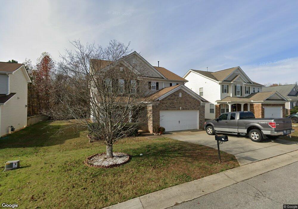
671 Averasboro Dr Clayton, NC 27520
Little Creek NeighborhoodEstimated Value: $332,000 - $359,223
3
Beds
3
Baths
2,500
Sq Ft
$140/Sq Ft
Est. Value
About This Home
This home is located at 671 Averasboro Dr, Clayton, NC 27520 and is currently estimated at $349,306, approximately $139 per square foot. 671 Averasboro Dr is a home located in Johnston County with nearby schools including East Clayton Elementary School, Clayton Middle School, and Clayton High.
Ownership History
Date
Name
Owned For
Owner Type
Purchase Details
Closed on
Jan 18, 2022
Sold by
True Homes Llc
Bought by
Vice Arlene J and Vice Jeffrey A
Current Estimated Value
Purchase Details
Closed on
Sep 4, 2012
Sold by
Federal National Mortgage Association
Bought by
Sims Michael E and Sims Deborah D
Home Financials for this Owner
Home Financials are based on the most recent Mortgage that was taken out on this home.
Original Mortgage
$146,900
Interest Rate
3.63%
Mortgage Type
VA
Purchase Details
Closed on
May 29, 2008
Sold by
Kb Home Raleigh Durham Inc
Bought by
Gathers James
Purchase Details
Closed on
Dec 28, 2007
Sold by
Kb Home Raleigh Durham Inc
Bought by
Tatis Carlos M and Mateo Tatis Maria C
Home Financials for this Owner
Home Financials are based on the most recent Mortgage that was taken out on this home.
Original Mortgage
$177,593
Interest Rate
6.05%
Mortgage Type
Purchase Money Mortgage
Create a Home Valuation Report for This Property
The Home Valuation Report is an in-depth analysis detailing your home's value as well as a comparison with similar homes in the area
Home Values in the Area
Average Home Value in this Area
Purchase History
| Date | Buyer | Sale Price | Title Company |
|---|---|---|---|
| Vice Arlene J | $869 | New Title Company Name | |
| Sims Michael E | -- | None Available | |
| Gathers James | $149,000 | None Available | |
| Tatis Carlos M | $197,500 | None Available |
Source: Public Records
Mortgage History
| Date | Status | Borrower | Loan Amount |
|---|---|---|---|
| Previous Owner | Sims Michael E | $146,900 | |
| Previous Owner | Tatis Carlos M | $177,593 |
Source: Public Records
Tax History Compared to Growth
Tax History
| Year | Tax Paid | Tax Assessment Tax Assessment Total Assessment is a certain percentage of the fair market value that is determined by local assessors to be the total taxable value of land and additions on the property. | Land | Improvement |
|---|---|---|---|---|
| 2025 | $3,791 | $375,390 | $70,000 | $305,390 |
| 2024 | $3,138 | $237,720 | $38,500 | $199,220 |
| 2023 | $3,067 | $237,720 | $38,500 | $199,220 |
| 2022 | $3,162 | $237,720 | $38,500 | $199,220 |
| 2021 | $3,114 | $237,720 | $38,500 | $199,220 |
| 2020 | $3,224 | $237,720 | $38,500 | $199,220 |
| 2019 | $3,224 | $237,720 | $38,500 | $199,220 |
| 2018 | $2,618 | $189,580 | $30,000 | $159,580 |
| 2017 | $2,561 | $189,580 | $30,000 | $159,580 |
| 2016 | $2,576 | $189,580 | $30,000 | $159,580 |
| 2015 | $2,579 | $189,580 | $30,000 | $159,580 |
| 2014 | $2,474 | $189,580 | $30,000 | $159,580 |
Source: Public Records
Map
Nearby Homes
- 776 Averasboro Dr
- 418 Averasboro Dr
- 128 Plymouth Dr
- 16 Averasboro Dr
- 507 Westminster Dr
- 187 Pamlico Dr
- 612 Champion St
- 94 Cheyenne Dr
- 400 Westminster Dr
- BELHAVEN Plan at Lawson Glen
- ARIA Plan at Lawson Glen
- ROBIE Plan at Lawson Glen
- DARWIN Plan at Lawson Glen
- 629 Avondale Dr
- 797 Ranch Rd
- 421 Champion St
- 737 Lakemont Dr
- 2001 Mckinnon Dr
- 2008 Mckinnon Dr
- 882 John St
- 677 Averasboro Dr
- 659 Averasboro Dr
- 687 Averasboro Dr
- 647 Averasboro Dr
- 668 Averasboro Dr
- 674 Averasboro Dr
- 639 Averasboro Dr
- 654 Averasboro Dr
- 686 Averasboro Dr
- 642 Averasboro Dr
- 709 Averasboro Dr
- 698 Averasboro Dr
- 625 Averasboro Dr
- 634 Averasboro Dr
- 267 Plymouth Dr
- 289 Plymouth Dr
- 255 Plymouth Dr
- 279 Plymouth Dr
- 723 Averasboro Dr
- 615 Averasboro Dr