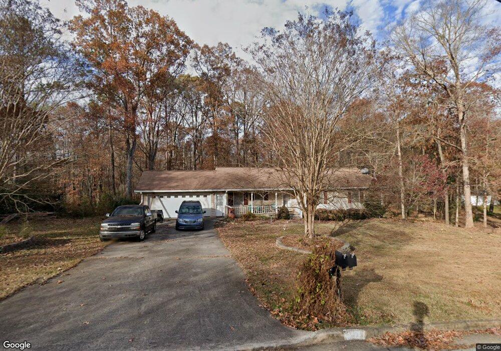
671 Kirkus Dr SE Conyers, GA 30094
Estimated Value: $252,022 - $352,000
4
Beds
3
Baths
1,588
Sq Ft
$195/Sq Ft
Est. Value
About This Home
This home is located at 671 Kirkus Dr SE, Conyers, GA 30094 and is currently estimated at $309,756, approximately $195 per square foot. 671 Kirkus Dr SE is a home located in Rockdale County with nearby schools including Sims Elementary School, Edwards Middle School, and Rockdale County High School.
Ownership History
Date
Name
Owned For
Owner Type
Purchase Details
Closed on
Aug 15, 2012
Sold by
Shaver John E
Bought by
Smith Dempsey B and Smith Kathryn A
Current Estimated Value
Home Financials for this Owner
Home Financials are based on the most recent Mortgage that was taken out on this home.
Original Mortgage
$114,500
Outstanding Balance
$78,984
Interest Rate
3.58%
Mortgage Type
VA
Estimated Equity
$230,772
Create a Home Valuation Report for This Property
The Home Valuation Report is an in-depth analysis detailing your home's value as well as a comparison with similar homes in the area
Home Values in the Area
Average Home Value in this Area
Purchase History
| Date | Buyer | Sale Price | Title Company |
|---|---|---|---|
| Smith Dempsey B | $114,500 | -- |
Source: Public Records
Mortgage History
| Date | Status | Borrower | Loan Amount |
|---|---|---|---|
| Open | Smith Dempsey B | $114,500 |
Source: Public Records
Tax History Compared to Growth
Tax History
| Year | Tax Paid | Tax Assessment Tax Assessment Total Assessment is a certain percentage of the fair market value that is determined by local assessors to be the total taxable value of land and additions on the property. | Land | Improvement |
|---|---|---|---|---|
| 2024 | $1,179 | $81,400 | $24,160 | $57,240 |
| 2023 | $274 | $49,160 | $6,920 | $42,240 |
| 2022 | $491 | $46,040 | $6,920 | $39,120 |
| 2021 | $505 | $45,920 | $6,800 | $39,120 |
| 2020 | $436 | $45,920 | $6,800 | $39,120 |
| 2019 | $457 | $47,920 | $6,800 | $41,120 |
| 2018 | $469 | $46,240 | $6,800 | $39,440 |
| 2017 | $361 | $42,640 | $6,800 | $35,840 |
| 2016 | $294 | $42,640 | $6,800 | $35,840 |
| 2015 | $296 | $42,640 | $6,800 | $35,840 |
| 2014 | $211 | $42,640 | $6,800 | $35,840 |
| 2013 | -- | $46,920 | $8,800 | $38,120 |
Source: Public Records
Map
Nearby Homes
- 660 Kirkus Dr SE
- 1870 Parker Rd SE
- 1911 Victoria Way Unit 117
- 1701 Silver Summit Dr SE
- 1502 Silver Summit Dr SE
- 1503 Silver Summit Dr SE Unit 1503
- 2862 Flat Shoals Rd SW
- 1000 Silver Summit Dr SE
- Astrid Plan at Alder Park
- Harrison Plan at Alder Park
- Baker Plan at Alder Park
- Oliver Plan at Alder Park
- 1736 Almand Creek Dr SW
- 1415 Almand Creek Dr SW
- 1423 Almand Creek Dr SW
- 0 Georgia 20 Unit 10439576
- 1432 Almand Creek Dr SW
- 1444 Meadowind Ct SW
- 2197 Boxwood Cir
- 2850 Flat Shoals Rd SW
- 691 Kirkus Dr SE
- 681 Kirkus Dr SE
- 1175 Highway 138 SW
- 661 Kirkus Dr SE
- 1895 Parker Rd SE
- 1891 Parker Rd SE
- 1899 Parker Rd SE
- 680 Kirkus Dr SE
- 1871 Parker Rd SE
- 670 Kirkus Dr SE
- 670 Kirkus Dr SE Unit 670 KIRKUS DR.
- 0 Kirkus Dr SE Unit 3161872
- 690 Kirkus Dr SE
- 1861 Parker Rd SE
- 700 Kirkus Dr SE
- 1967 Old Parker Rd SE
- 650 Kirkus Dr SE
- 1886 Parker Rd SE
- 1944 Parker Rd SE
- 1966 Old Parker Rd SE