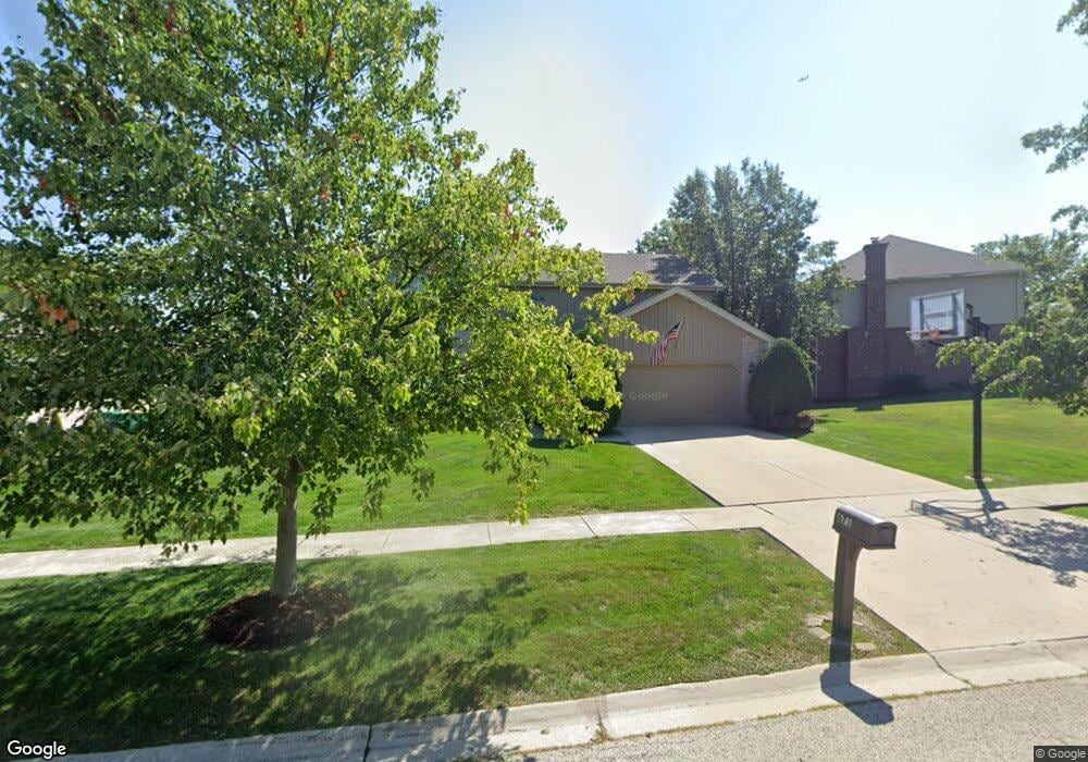
671 Kromray Rd Lemont, IL 60439
Northeast Lemont NeighborhoodEstimated Value: $644,000 - $698,000
4
Beds
3
Baths
2,787
Sq Ft
$240/Sq Ft
Est. Value
About This Home
This home is located at 671 Kromray Rd, Lemont, IL 60439 and is currently estimated at $667,998, approximately $239 per square foot. 671 Kromray Rd is a home located in Cook County with nearby schools including Oakwood School, River Valley School, and Old Quarry Middle School.
Ownership History
Date
Name
Owned For
Owner Type
Purchase Details
Closed on
Apr 10, 2018
Sold by
Statkus Kevin F and Statkus Frances A
Bought by
Statkus Kevin F and Statkus Frances A
Current Estimated Value
Purchase Details
Closed on
Nov 12, 1997
Sold by
State Bank Of Countryside
Bought by
Statkus Kevin F and Statkus Frances A
Home Financials for this Owner
Home Financials are based on the most recent Mortgage that was taken out on this home.
Original Mortgage
$145,000
Outstanding Balance
$24,155
Interest Rate
7.45%
Estimated Equity
$643,843
Create a Home Valuation Report for This Property
The Home Valuation Report is an in-depth analysis detailing your home's value as well as a comparison with similar homes in the area
Home Values in the Area
Average Home Value in this Area
Purchase History
| Date | Buyer | Sale Price | Title Company |
|---|---|---|---|
| Statkus Kevin F | -- | Attorney | |
| Statkus Kevin F | $264,000 | -- |
Source: Public Records
Mortgage History
| Date | Status | Borrower | Loan Amount |
|---|---|---|---|
| Open | Statkus Kevin F | $145,000 |
Source: Public Records
Tax History Compared to Growth
Tax History
| Year | Tax Paid | Tax Assessment Tax Assessment Total Assessment is a certain percentage of the fair market value that is determined by local assessors to be the total taxable value of land and additions on the property. | Land | Improvement |
|---|---|---|---|---|
| 2024 | $9,718 | $52,728 | $7,280 | $45,448 |
| 2023 | $7,505 | $52,728 | $7,280 | $45,448 |
| 2022 | $7,505 | $37,069 | $6,440 | $30,629 |
| 2021 | $7,940 | $37,069 | $6,440 | $30,629 |
| 2020 | $8,734 | $39,828 | $6,440 | $33,388 |
| 2019 | $7,807 | $37,181 | $6,440 | $30,741 |
| 2018 | $7,677 | $37,181 | $6,440 | $30,741 |
| 2017 | $7,576 | $37,181 | $6,440 | $30,741 |
| 2016 | $7,246 | $33,190 | $5,320 | $27,870 |
| 2015 | $7,325 | $33,190 | $5,320 | $27,870 |
| 2014 | $7,408 | $33,190 | $5,320 | $27,870 |
| 2013 | $7,777 | $36,841 | $5,320 | $31,521 |
Source: Public Records
Map
Nearby Homes
- 1170 Mccarthy Rd
- 1216 Country Ln
- 14517 Albany Ave
- 11716 Center Dr
- 1297 Mccarthy Rd
- 611 Houston St
- 1156 Covington Dr
- 11174 Tuscany Ln
- 1078 Amber Dr
- 614 Czacki St
- 700 Czacki St
- 1249 Cronin Ct
- Fremont Plan at Covington Knolls
- Briarcliffe Plan at Covington Knolls
- Eden Plan at Covington Knolls
- Amberwood Plan at Covington Knolls
- Calysta Plan at Covington Knolls
- Danbury Plan at Covington Knolls
- 8 Division Ct
- 1382 Overton Dr
- 661 Kromray Rd
- 681 Kromray Rd
- 651 Kromray Rd
- 608 Carriage Ridge Ln
- 660 Kromray Rd
- 670 Kromray Rd
- 610 Carriage Ridge Ln
- 650 Kromray Rd
- 641 Kromray Rd
- 680 Kromray Rd
- 690 Kromray Rd
- 640 Kromray Rd
- 606 Carriage Ridge Ln
- 710 Kromray Rd
- 631 Kromray Rd
- 612 Carriage Ridge Ln
- 630 Kromray Rd
- 604 Carriage Ridge Ln
- 1189 Mccarthy Rd
- 1163 Mccarthy Rd