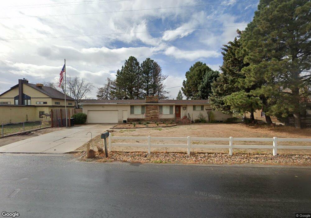
671 N Flint St Kaysville, UT 84037
West Kaysville NeighborhoodEstimated Value: $601,000 - $795,000
5
Beds
3
Baths
1,596
Sq Ft
$437/Sq Ft
Est. Value
About This Home
This home is located at 671 N Flint St, Kaysville, UT 84037 and is currently estimated at $698,139, approximately $437 per square foot. 671 N Flint St is a home located in Davis County with nearby schools including Kay's Creek Elementary School, Shoreline Junior High School, and Davis High School.
Ownership History
Date
Name
Owned For
Owner Type
Purchase Details
Closed on
Mar 8, 2024
Sold by
Smith Michael G and Smith Noni G
Bought by
Smith Family Trust and Smith
Current Estimated Value
Purchase Details
Closed on
Oct 20, 2020
Sold by
Macfarlane Michael and Macfarlane Judy
Bought by
Smith Michael G and Smith Noni G
Home Financials for this Owner
Home Financials are based on the most recent Mortgage that was taken out on this home.
Original Mortgage
$428,000
Interest Rate
2.8%
Mortgage Type
New Conventional
Purchase Details
Closed on
Aug 17, 2011
Sold by
Macfarlane Michael C and Macfarlane Judy M
Bought by
Macfarlane Michael and Macfarlane Judy
Purchase Details
Closed on
Jul 18, 2011
Sold by
Macfarlane Michael and Macfarlane Judy
Bought by
Macfarlane Michael and Macfarlane Judy
Create a Home Valuation Report for This Property
The Home Valuation Report is an in-depth analysis detailing your home's value as well as a comparison with similar homes in the area
Home Values in the Area
Average Home Value in this Area
Purchase History
| Date | Buyer | Sale Price | Title Company |
|---|---|---|---|
| Smith Family Trust | -- | None Listed On Document | |
| Smith Michael G | -- | First American Title Ins Co | |
| Macfarlane Michael | -- | None Available | |
| Macfarlane Michael | -- | None Available |
Source: Public Records
Mortgage History
| Date | Status | Borrower | Loan Amount |
|---|---|---|---|
| Previous Owner | Smith Michael G | $428,000 |
Source: Public Records
Tax History Compared to Growth
Tax History
| Year | Tax Paid | Tax Assessment Tax Assessment Total Assessment is a certain percentage of the fair market value that is determined by local assessors to be the total taxable value of land and additions on the property. | Land | Improvement |
|---|---|---|---|---|
| 2025 | $3,515 | $365,200 | $238,425 | $126,775 |
| 2024 | $3,317 | $349,800 | $257,185 | $92,615 |
| 2023 | $3,267 | $610,000 | $421,873 | $188,127 |
| 2022 | $3,391 | $355,300 | $228,273 | $127,027 |
| 2021 | $2,942 | $462,000 | $286,010 | $175,990 |
| 2020 | $2,681 | $410,000 | $250,339 | $159,661 |
| 2019 | $2,624 | $394,000 | $226,983 | $167,017 |
| 2018 | $2,445 | $366,000 | $201,019 | $164,981 |
| 2016 | $2,061 | $162,195 | $133,329 | $28,866 |
| 2015 | $2,066 | $154,385 | $133,329 | $21,056 |
| 2014 | $1,957 | $148,865 | $84,472 | $64,393 |
| 2013 | -- | $137,687 | $60,954 | $76,733 |
Source: Public Records
Map
Nearby Homes
- 256 Seemore Dr
- 1429 W Lincoln Way
- 268 E 900 S
- 282 E 925 S
- 71 S Harvs Ln
- 129 N Mountain Vistas Rd
- 774 W Farming Way
- 473 E Alice Way
- 493 E Alice Way
- 267 S Melody St
- 877 S Main St Unit B
- 714 Rose Blossom Dr
- 593 Kimball Dr
- 917 S Main St Unit H
- 895 S Main St Unit E
- 678 E Creekview Dr
- 174 W Dawson St
- 1038 S Old Towne Rd
- 562 S 850 W
- 1845 W Sherri Ln
- 657 N Flint St
- 683 N Flint St
- 10 Phillips St
- 627 N Flint St
- 90 Phillips St
- 64 Phillips St
- 1501 Phillips St
- 16 Phillips St
- 624 N Flint St
- 953 Flint St
- 1501 W Phillips St
- 600 N Flint St
- 30 Phillips St
- 1517 W Phillips St
- 20 Phillips St
- 937 Flint St
- 12 Phillips St
- 593 N Flint St
- 924 S 75 W
- 1533 W Phillips St