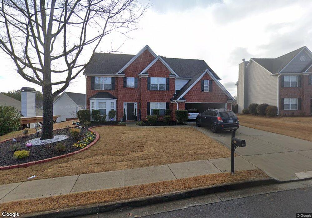
671 Roxtree Ct Unit 1 Buford, GA 30518
Estimated Value: $468,218 - $506,000
4
Beds
3
Baths
2,838
Sq Ft
$173/Sq Ft
Est. Value
About This Home
This home is located at 671 Roxtree Ct Unit 1, Buford, GA 30518 and is currently estimated at $490,305, approximately $172 per square foot. 671 Roxtree Ct Unit 1 is a home located in Gwinnett County with nearby schools including Sugar Hill Elementary School, Lanier Middle School, and Lanier High School.
Ownership History
Date
Name
Owned For
Owner Type
Purchase Details
Closed on
Dec 23, 2019
Sold by
Grant Patricia F
Bought by
Jones Patricia F
Current Estimated Value
Home Financials for this Owner
Home Financials are based on the most recent Mortgage that was taken out on this home.
Original Mortgage
$227,920
Outstanding Balance
$203,024
Interest Rate
4.25%
Mortgage Type
FHA
Estimated Equity
$287,281
Create a Home Valuation Report for This Property
The Home Valuation Report is an in-depth analysis detailing your home's value as well as a comparison with similar homes in the area
Home Values in the Area
Average Home Value in this Area
Purchase History
| Date | Buyer | Sale Price | Title Company |
|---|---|---|---|
| Jones Patricia F | -- | -- |
Source: Public Records
Mortgage History
| Date | Status | Borrower | Loan Amount |
|---|---|---|---|
| Open | Jones Patricia F | $227,920 |
Source: Public Records
Tax History Compared to Growth
Tax History
| Year | Tax Paid | Tax Assessment Tax Assessment Total Assessment is a certain percentage of the fair market value that is determined by local assessors to be the total taxable value of land and additions on the property. | Land | Improvement |
|---|---|---|---|---|
| 2025 | $5,146 | $196,880 | $50,000 | $146,880 |
| 2024 | $4,699 | $167,840 | $35,200 | $132,640 |
| 2023 | $4,699 | $167,840 | $35,200 | $132,640 |
| 2022 | $4,228 | $146,800 | $28,000 | $118,800 |
| 2021 | $3,652 | $116,120 | $24,000 | $92,120 |
| 2020 | $3,416 | $104,000 | $20,000 | $84,000 |
| 2019 | $3,323 | $104,000 | $20,000 | $84,000 |
| 2018 | $3,224 | $99,280 | $20,000 | $79,280 |
| 2016 | $3,041 | $89,840 | $17,360 | $72,480 |
| 2015 | $2,741 | $74,840 | $12,000 | $62,840 |
| 2014 | -- | $74,840 | $12,000 | $62,840 |
Source: Public Records
Map
Nearby Homes
- 3811 Roxfield Dr
- 3725 Roxwood Park Dr Unit 1
- 812 Holly Meadow Dr
- 665 Roxford Ln Unit 3
- 3805 Roxwood Park Dr Unit 1
- 3929 Two Bridge Dr
- 3740 Crescent Walk Ln
- 3720 Crescent Walk Ln
- 3941 Oak Crossing Dr
- 3998 Oak Crossing Dr NE
- 3612 Brookefall Ct
- 870 Creekview Bluff Way
- 3645 Hickory Branch Trail Unit 1
- 3720 Brookefall Landing
- 957 Pont Du Gard Ct
- 1320 Newbridge Cir
- 4071 Woodward Walk Ln
- 3835 Creekview Ridge Dr
- 661 Roxtree Ct Unit 1
- 681 Roxtree Ct
- 3752 Roxfield Dr Unit 2
- 0 Roxtree Ct NE
- 3742 Roxfield Dr Unit 2
- 651 Roxtree Ct
- 662 Roxtree Ct
- 672 Roxtree Ct Unit 1
- 682 Roxtree Ct Unit 1
- 3732 Roxfield Dr
- 652 Roxtree Ct
- 641 Roxtree Ct Unit 1
- 3771 Roxfield Dr Unit 1
- 3741 Roxfield Dr
- 642 Roxtree Ct Unit 1
- 3781 Roxfield Dr Unit 1
- 3722 Roxfield Dr
- 3761 Roxfield Dr
- 631 Roxtree Ct
- 3791 Roxfield Dr