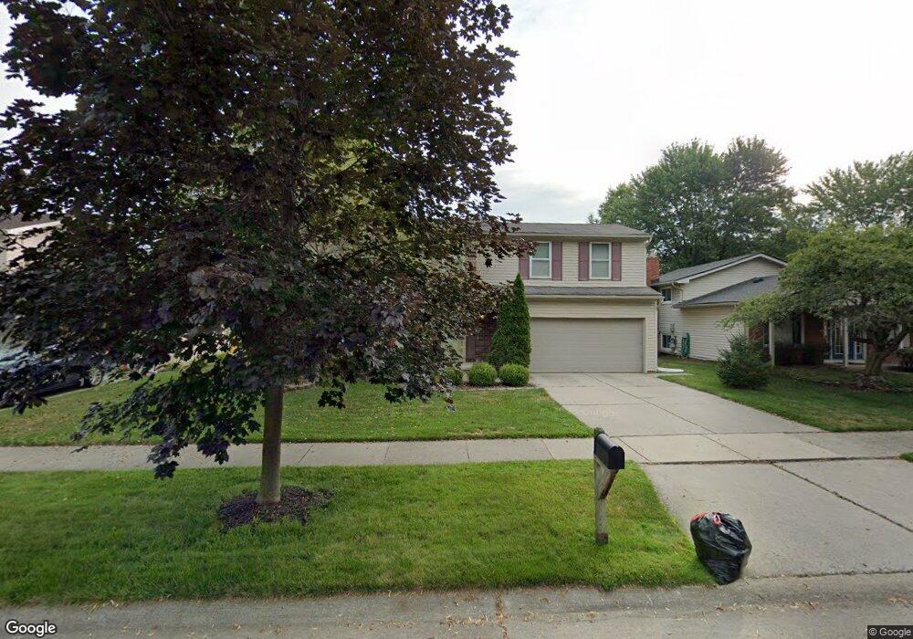
6710 Devonshire Dr Canton, MI 48187
Estimated Value: $379,869 - $431,000
Studio
3
Baths
1,939
Sq Ft
$205/Sq Ft
Est. Value
About This Home
This home is located at 6710 Devonshire Dr, Canton, MI 48187 and is currently estimated at $397,717, approximately $205 per square foot. 6710 Devonshire Dr is a home located in Wayne County with nearby schools including Canton High School, Discovery Middle School, and Salem High School.
Ownership History
Date
Name
Owned For
Owner Type
Purchase Details
Closed on
Apr 21, 2009
Sold by
Rosati Janet and Le Annais Dennis
Bought by
Leannais Dennis
Current Estimated Value
Home Financials for this Owner
Home Financials are based on the most recent Mortgage that was taken out on this home.
Original Mortgage
$100,000
Outstanding Balance
$63,589
Interest Rate
5.05%
Mortgage Type
Stand Alone Refi Refinance Of Original Loan
Estimated Equity
$334,129
Purchase Details
Closed on
Mar 16, 1998
Sold by
Pawlu Karen M and Pawlu Ronald J
Bought by
Dennis Leanna
Create a Home Valuation Report for This Property
The Home Valuation Report is an in-depth analysis detailing your home's value as well as a comparison with similar homes in the area
Home Values in the Area
Average Home Value in this Area
Purchase History
| Date | Buyer | Sale Price | Title Company |
|---|---|---|---|
| Leannais Dennis | -- | Dfcu Title Agency Llc | |
| Dennis Leanna | $167,000 | -- |
Source: Public Records
Mortgage History
| Date | Status | Borrower | Loan Amount |
|---|---|---|---|
| Open | Leannais Dennis | $100,000 |
Source: Public Records
Tax History
| Year | Tax Paid | Tax Assessment Tax Assessment Total Assessment is a certain percentage of the fair market value that is determined by local assessors to be the total taxable value of land and additions on the property. | Land | Improvement |
|---|---|---|---|---|
| 2025 | $1,818 | $167,300 | $0 | $0 |
| 2024 | $1,766 | $159,300 | $0 | $0 |
| 2023 | $1,684 | $140,000 | $0 | $0 |
| 2022 | $3,800 | $129,500 | $0 | $0 |
| 2021 | $3,683 | $125,700 | $0 | $0 |
| 2020 | $3,626 | $119,200 | $0 | $0 |
| 2019 | $3,562 | $113,320 | $0 | $0 |
| 2018 | $1,431 | $103,880 | $0 | $0 |
| 2017 | $3,764 | $102,300 | $0 | $0 |
| 2016 | $3,268 | $98,900 | $0 | $0 |
| 2015 | $7,862 | $90,970 | $0 | $0 |
| 2013 | $7,617 | $81,630 | $0 | $0 |
| 2010 | -- | $79,080 | $34,650 | $44,430 |
Source: Public Records
Map
Nearby Homes
- 6852 New Providence Way Unit 104
- 49772 Shoreline Dr
- 44432 Newburyport Dr
- 45261 Patrick Dr
- 835 Coldrose Way
- 48590 Ford Rd
- 7065 Epping Dr
- 6857 Bridgemont Dr
- 6622 Carriage Hills Dr
- 1995 Peerce Ct Unit 2
- 43607 Ryegate St
- 44447 Savery Dr Unit 126
- 0000 Ford
- 43051 Fernwood St
- 45677 Radnor Rd
- 58560 Stuart Dr
- 1822 N Sheldon Rd
- 7459 Admiralty Dr
- 45900 Gainsborough Dr
- 44089 Candlewood Dr
- 6698 Devonshire Dr
- 6724 Devonshire Dr
- 6736 Devonshire Dr
- 6684 Devonshire Dr
- 6711 Devonshire Dr
- 6750 Devonshire Dr
- 6701 Devonshire Dr
- 6725 Devonshire Dr
- 6817 New Providence Way
- 6687 Devonshire Dr
- 6737 Devonshire Dr
- 6804 New Providence Way
- 6804 New Providence Way Unit 1003
- 6762 Devonshire Dr
- 6658 Devonshire Dr
- 6673 Devonshire Dr
- 6823 New Providence Way Unit 143
- 6751 Devonshire Dr
- 6806 New Providence Way
- 6819 New Providence Way Unit 144
Your Personal Tour Guide
Ask me questions while you tour the home.