Estimated Value: $509,912 - $589,000
4
Beds
3
Baths
2,567
Sq Ft
$212/Sq Ft
Est. Value
About This Home
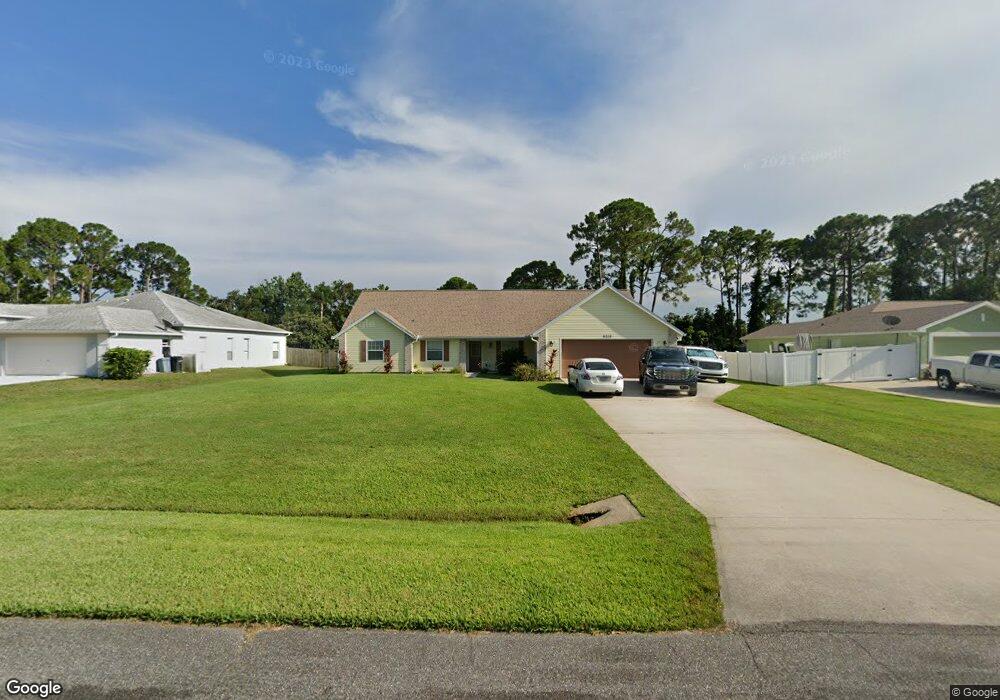
This home is located at 6710 Hundred Acre Dr, Cocoa, FL 32927 and is currently estimated at $544,978, approximately $212 per square foot. 6710 Hundred Acre Dr is a home located in Brevard County with nearby schools including Enterprise Elementary School, Space Coast Junior/Senior High School, and East Atlantic Prep of Brevard County.
Ownership History
Date
Name
Owned For
Owner Type
Purchase Details
Closed on
May 1, 2023
Sold by
Marlow Dale R and Marlow Lisa A
Bought by
Dale R And Lisa Ann Marlow Trust
Current Estimated Value
Purchase Details
Closed on
Nov 18, 2005
Sold by
Branly William and Branly Dana
Bought by
Marlow Dale R and Marlow Lisa A
Home Financials for this Owner
Home Financials are based on the most recent Mortgage that was taken out on this home.
Original Mortgage
$260,000
Interest Rate
6%
Purchase Details
Closed on
Feb 25, 1999
Sold by
Evert Brian A and Evert Karen P
Bought by
E M R Const Inc
Home Financials for this Owner
Home Financials are based on the most recent Mortgage that was taken out on this home.
Original Mortgage
$157,500
Interest Rate
6.84%
Purchase Details
Closed on
Apr 10, 1997
Sold by
Romar Homes Inc
Bought by
Evert Brian A and Evert Karen P
Create a Home Valuation Report for This Property
The Home Valuation Report is an in-depth analysis detailing your home's value as well as a comparison with similar homes in the area
Home Values in the Area
Average Home Value in this Area
Purchase History
| Date | Buyer | Sale Price | Title Company |
|---|---|---|---|
| Dale R And Lisa Ann Marlow Trust | $100 | None Listed On Document | |
| Marlow Dale R | $402,500 | Town & Country Title Inc | |
| E M R Const Inc | $22,000 | -- | |
| Evert Brian A | $19,000 | -- |
Source: Public Records
Mortgage History
| Date | Status | Borrower | Loan Amount |
|---|---|---|---|
| Previous Owner | Marlow Dale R | $260,000 | |
| Previous Owner | E M R Const Inc | $157,500 |
Source: Public Records
Tax History Compared to Growth
Tax History
| Year | Tax Paid | Tax Assessment Tax Assessment Total Assessment is a certain percentage of the fair market value that is determined by local assessors to be the total taxable value of land and additions on the property. | Land | Improvement |
|---|---|---|---|---|
| 2025 | $2,696 | $198,520 | -- | -- |
| 2024 | $2,650 | $192,930 | -- | -- |
| 2023 | $2,650 | $187,320 | $0 | $0 |
| 2022 | $2,485 | $181,870 | $0 | $0 |
| 2021 | $2,527 | $176,580 | $0 | $0 |
| 2020 | $2,449 | $174,150 | $0 | $0 |
| 2019 | $2,394 | $170,240 | $0 | $0 |
| 2018 | $2,398 | $167,070 | $0 | $0 |
| 2017 | $2,414 | $163,640 | $0 | $0 |
| 2016 | $2,443 | $160,280 | $32,000 | $128,280 |
| 2015 | $2,503 | $159,170 | $32,000 | $127,170 |
| 2014 | $2,515 | $157,910 | $32,000 | $125,910 |
Source: Public Records
Map
Nearby Homes
- 6643 Emil Ave
- 6581 Bancroft Ave
- 6615 Dock Ave
- 7065 Hundred Acre Dr
- 5575 Curtis Blvd
- 4650 N Highway 1 Hwy
- 5715 Fairbridge St
- 6665 Addie Ave
- 7230 Venus Ave
- TBD Freeport Rd
- 6545 Addie Ave
- 5155 Mayflower St
- 00 Unknown
- 6105 Banyan St
- 5149 Arlington Rd Unit 104
- 5730 Friendly St
- 5090 Market St
- 23-35-21-JX-B-2 Aruin St
- 6365 Homestead Ave
- 7635 Fringe Place
- 6720 Hundred Acre Dr
- 6700 Hundred Acre Dr
- 6705 Hundred Acre Dr
- 6730 Hundred Acre Dr
- 6690 Hundred Acre Dr
- 5570 Hastings St
- 5600 Hastings St
- 5550 Hastings St
- 6715 Hundred Acre Dr
- 5610 Hastings St
- 6740 Hundred Acre Dr
- 6725 Hundred Acre Dr
- 5540 Hastings St
- 6735 Hundred Acre Dr
- 6695 Hundred Acre Dr
- 5620 Hastings St
- 6750 Hundred Acre Dr Unit 4
- 6745 Hundred Acre Dr
- 6685 Hundred Acre Dr
- 5640 Hastings St