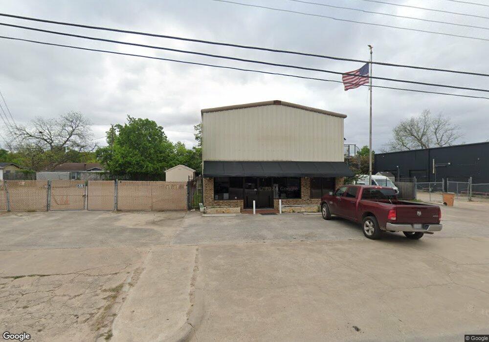
6711 Burnet Ln Austin, TX 78757
Brentwood NeighborhoodEstimated Value: $830,212
--
Bed
--
Bath
3,630
Sq Ft
$229/Sq Ft
Est. Value
About This Home
This home is located at 6711 Burnet Ln, Austin, TX 78757 and is currently priced at $830,212, approximately $228 per square foot. 6711 Burnet Ln is a home located in Travis County with nearby schools including Brentwood Elementary School, Lamar Middle School, and McCallum High School.
Ownership History
Date
Name
Owned For
Owner Type
Purchase Details
Closed on
Nov 13, 2023
Sold by
Timco Eric and Liebes George J
Bought by
Hansen Eric
Current Estimated Value
Purchase Details
Closed on
May 16, 2012
Sold by
Huff Charles H
Bought by
Timeo Eric and Liebes George J
Purchase Details
Closed on
Dec 28, 2001
Sold by
Technical Educational Services Inc
Bought by
Huff Charles H
Home Financials for this Owner
Home Financials are based on the most recent Mortgage that was taken out on this home.
Original Mortgage
$205,875
Interest Rate
6.73%
Mortgage Type
Commercial
Create a Home Valuation Report for This Property
The Home Valuation Report is an in-depth analysis detailing your home's value as well as a comparison with similar homes in the area
Home Values in the Area
Average Home Value in this Area
Purchase History
| Date | Buyer | Sale Price | Title Company |
|---|---|---|---|
| Hansen Eric | -- | None Listed On Document | |
| Timeo Eric | -- | North American Title Company | |
| Huff Charles H | -- | Alamo Title Company |
Source: Public Records
Mortgage History
| Date | Status | Borrower | Loan Amount |
|---|---|---|---|
| Previous Owner | Huff Charles H | $205,875 |
Source: Public Records
Tax History Compared to Growth
Tax History
| Year | Tax Paid | Tax Assessment Tax Assessment Total Assessment is a certain percentage of the fair market value that is determined by local assessors to be the total taxable value of land and additions on the property. | Land | Improvement |
|---|---|---|---|---|
| 2025 | $18,164 | $734,876 | $403,800 | $331,076 |
| 2023 | $13,992 | $773,381 | $403,800 | $369,581 |
| 2022 | $15,276 | $773,482 | $403,800 | $369,682 |
| 2021 | $16,993 | $780,667 | $403,800 | $376,867 |
| 2020 | $15,376 | $716,889 | $403,800 | $313,089 |
| 2018 | $12,730 | $575,000 | $282,660 | $292,340 |
| 2017 | $10,477 | $469,781 | $282,660 | $187,121 |
| 2016 | $9,588 | $429,916 | $242,280 | $187,636 |
| 2015 | $7,937 | $349,051 | $161,520 | $187,531 |
| 2014 | $7,937 | $374,924 | $161,520 | $213,404 |
Source: Public Records
Map
Nearby Homes
- 6602 Laird Dr
- 2019 Brentwood St
- 1900 Burbank St
- 1812 Burbank St
- 6444 Burnet Rd Unit 204
- 6444 Burnet Rd Unit 305
- 1915 Cullen Ave
- 2012 Cullen Ave
- 6905 Daugherty St
- 2009 Payne Ave Unit 2
- 2601 Park View Dr
- 2604 Addison Ave
- 2603 Park View Dr
- 2004 Pequeno St
- 7009 Daugherty St
- 7103 Daugherty St
- 1907 Payne Ave
- 2608 Twin Oaks Dr
- 1711 Brentwood St
- 6403 Nasco Dr
- 6706 Modesto St
- 6708 Modesto St
- 6710 Modesto St
- 6702 Modesto St
- 6712 Modesto St Unit A
- 6712 Modesto St Unit B
- 6714 Modesto St
- 6700 Modesto St
- 6707 Modesto St
- 6709 Modesto St
- 6705 Modesto St
- 6711 Modesto St
- 2007 Vallejo St
- 6703 Modesto St
- 2009 Burbank St
- 2014 Vallejo St
- 6710 Burnet Ln Unit 109
- 6710 Burnet Ln Unit 110
- 6710 Burnet Ln Unit 217
- 6710 Burnet Ln Unit 215